Lêer:Mt Saint Elias NOAA 2102.jpg
Grootte van hierdie voorskou: 800 × 523 piksels. Ander resolusies: 320 × 209 piksels | 640 × 419 piksels | 1 024 × 670 piksels | 1 280 × 837 piksels | 1 792 × 1 172 piksels.
Oorspronklike lêer (1 792 × 1 172 piksels, lêergrootte: 1,08 MG, MIME-tipe: image/jpeg)
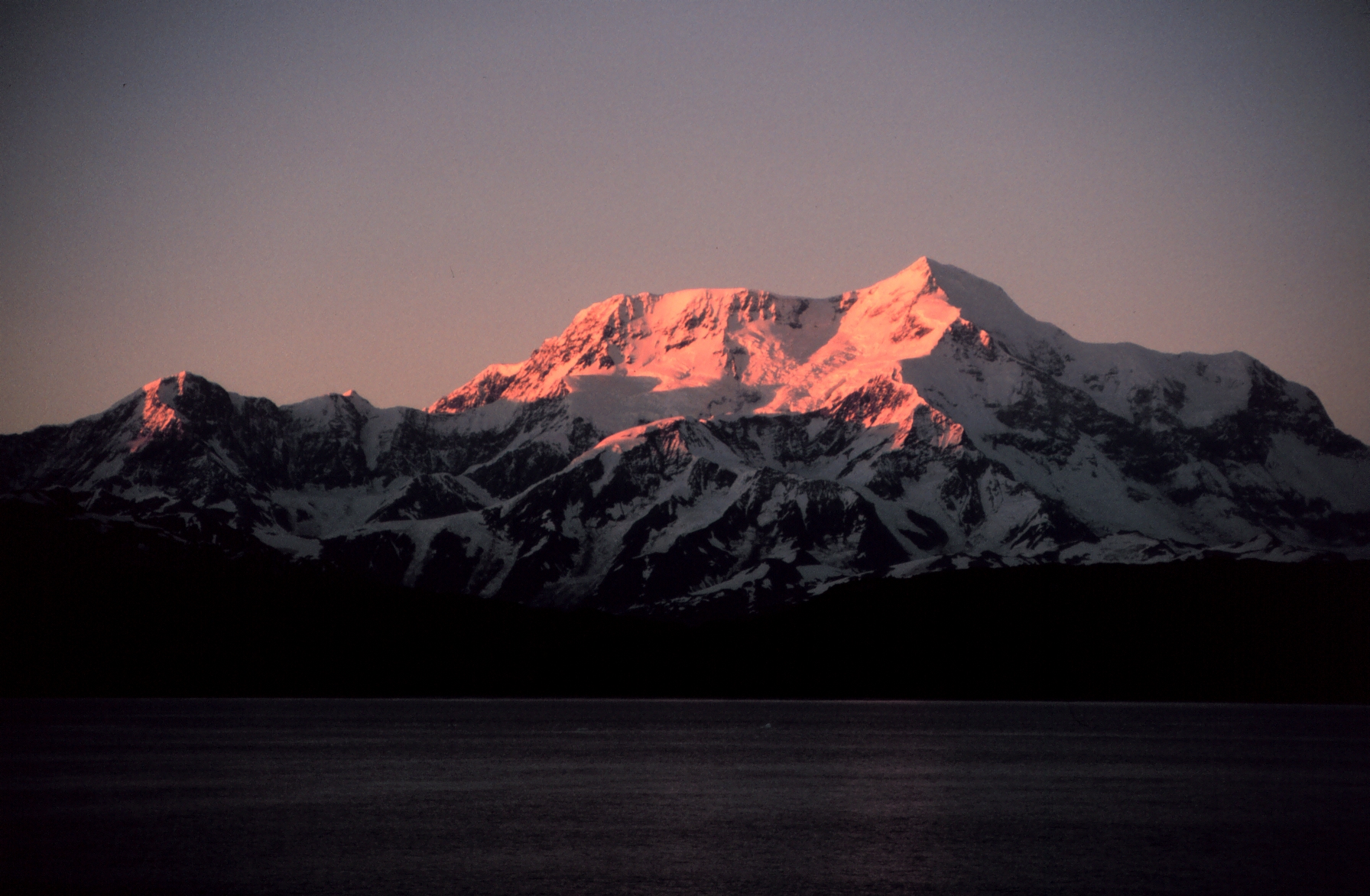
| Beskrywing | Mount Saint Elias, 2nd highest mountain in Canada and the USA. South Central Alaska, Icy Bay | |||
| Bron | line2102, NOAA's America's Coastlines Collection. This is photo #14 of the sequence. To find image description, search website for "line2102". | |||
| Outeur | Mr. David Sinson, NOAA, Office of Coast Survey | |||
| Toestemming (Hergebruik van die lêer) |
|
Lêergeskiedenis
Klik op die datum/tyd om te sien hoe die lêer destyds gelyk het.
| Datum/Tyd | Duimnael | Dimensies | Gebruiker | Opmerking | |
|---|---|---|---|---|---|
| huidig | 08:18, 25 Mei 2008 | | 1 792 × 1 172 (1,08 MG) | RedWolf | {{Information |Description=Mount Saint Elias, 2nd highest mountain in Canada and the USA. South Central Alaska, Icy Bay |Source=http://www.photolib.noaa.gov/700s/line2102.jpg<br> line2102, NOAA's America's Coastlines Collection. |
Lêergebruik
Die volgende bladsy gebruik dié lêer:
Globale lêergebruik
Die volgende ander wiki's gebruik hierdie lêer:
- Gebruik in ar.wikipedia.org
- Gebruik in bn.wikipedia.org
- Gebruik in el.wikipedia.org
- Gebruik in en.wikipedia.org
- Gebruik in eo.wikipedia.org
- Gebruik in eu.wikipedia.org
- Gebruik in fi.wikipedia.org
- Gebruik in fr.wikipedia.org
- Gebruik in ik.wikipedia.org
- Gebruik in lt.wikipedia.org
- Gebruik in no.wikipedia.org
- Gebruik in pl.wikipedia.org
- Gebruik in ru.wikipedia.org
- Gebruik in simple.wikipedia.org
- Gebruik in tr.wikipedia.org
- Gebruik in uk.wikipedia.org
- Gebruik in zh.wikipedia.org
Metadata
🔥 Top keywords: Spesiaal:SoekTuisbladVarkgriepSpesiaal:Onlangse wysigingsKategorie:Artikels met NARA-identifiseerdersCarles PuigdemontGeweldSelfstandige naamwoordAardverwarmingByvoeglike naamwoordTrappe van vergelykingFagotAntoniemSuid-AfrikaWikipedia:GeselshoekieRob HersovPornhubVergelykings (taalkunde)Tropiese sikloonIntensiewe vormNelson MandelaGreen PornoAardbewingMenseregteSeksposisiePeter SnydersGetalSwangerskapSinoniemSeksVoornaamwoordWiki HowAfkortingPlastiekJavaScriptDirekte en Indirekte redeJames SelfeMieliestronkSkoenlapper