Lêer:Guillaume Delisle Senegambia 1707.jpg
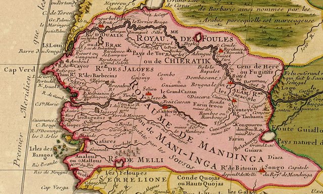
Grootte van hierdie voorskou: 800 × 482 piksels. Ander resolusies: 320 × 193 piksels | 640 × 385 piksels | 1 024 × 617 piksels | 1 280 × 771 piksels | 2 200 × 1 325 piksels.
Oorspronklike lêer (2 200 × 1 325 piksels, lêergrootte: 784 KG, MIME-tipe: image/jpeg)
Opsomming
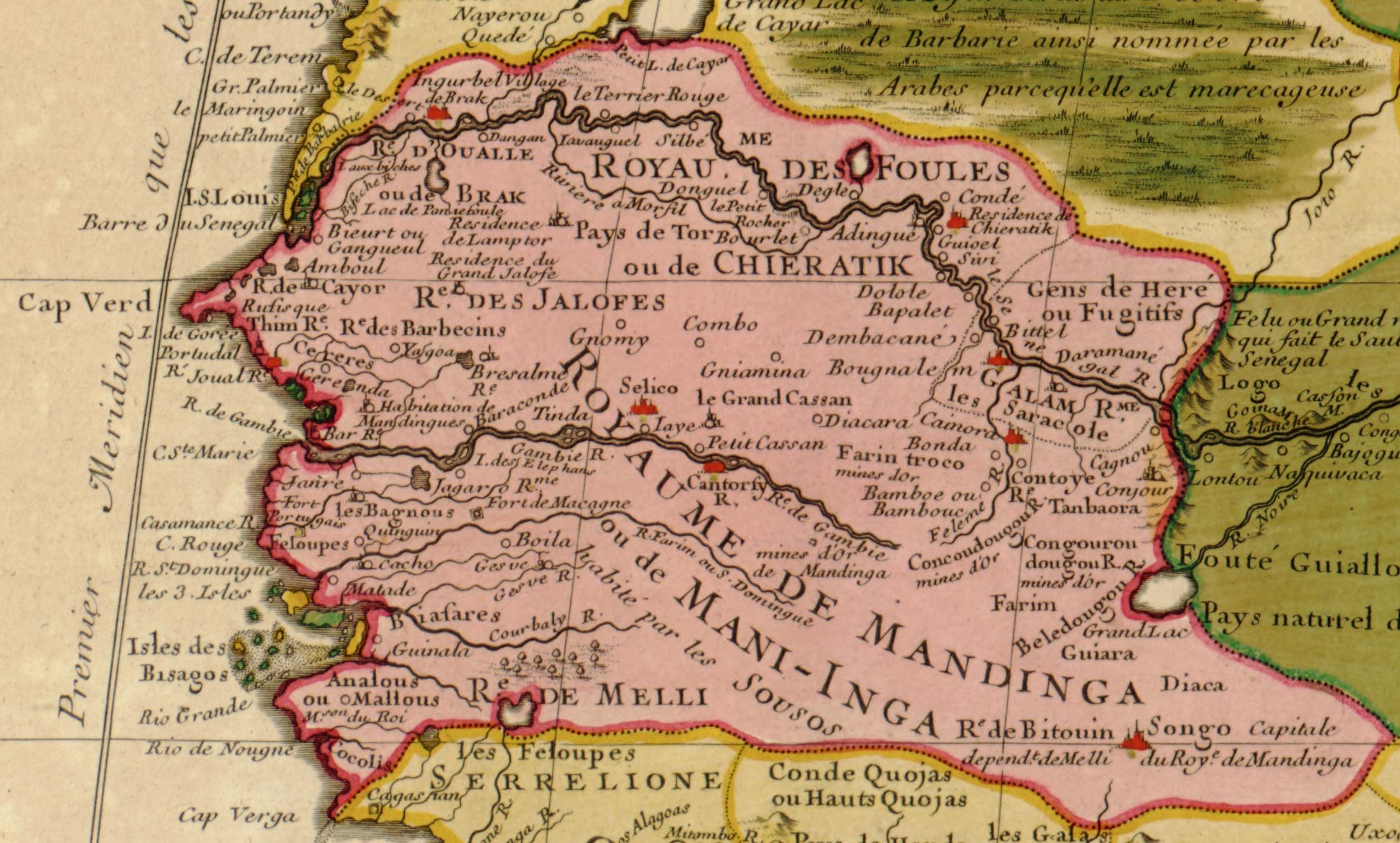
| Beskrywing | English: Part of North West Africa (original title: Carte de la Barbarie de la Nigritie et de La Guinee; it translates: "Map of the Barbary of Nigritie & Guinea") | |||||||||||||||||||||||
| Datum | C.E.1707/H.E.11,707 | |||||||||||||||||||||||
| Bron | Library of Congress Geography & Map Division; Call Number G8220 1707 .L5
| |||||||||||||||||||||||
| Outeur |
| |||||||||||||||||||||||
| Ander weergawes | full map: File:Guillaume_Delisle_North_West_Africa_1707.jpg | |||||||||||||||||||||||


Lisensiëring
This work is in the public domain in its country of origin and other countries and areas where the copyright term is the author's life plus 100 years or fewer. | |
| Hierdie lêer is geïdentifiseer as vry van bekende beperkings onder kopiereg, insluitend alle verwante en naburige regte. | |
Lêergeskiedenis
Klik op die datum/tyd om te sien hoe die lêer destyds gelyk het.
| Datum/Tyd | Duimnael | Dimensies | Gebruiker | Opmerking | |
|---|---|---|---|---|---|
| huidig | 12:42, 3 Junie 2006 | | 2 200 × 1 325 (784 KG) | Ephraim33 | {{Information| |Description=Part of North West Africa (original title: Carte de la Barbarie de la Nigritie et de La Guinee) |Source=http://memory.loc.gov/cgi-bin/map_item.pl?data=/home/www/data/gmd/gmd8/g8220/g8220/ct001447.jp2&itemLink=D?gmd:12:./temp/~a |
Lêergebruik
Die volgende bladsy gebruik dié lêer:
Globale lêergebruik
Die volgende ander wiki's gebruik hierdie lêer:
- Gebruik in als.wikipedia.org
- Gebruik in an.wikipedia.org
- Gebruik in ar.wikipedia.org
- Gebruik in ast.wikipedia.org
- Gebruik in be.wikipedia.org
- Gebruik in ca.wikipedia.org
- Gebruik in de.wikipedia.org
- Gebruik in en.wikipedia.org
- Gebruik in es.wikipedia.org
- Gebruik in eu.wikipedia.org
- Gebruik in fi.wikipedia.org
- Gebruik in frr.wikipedia.org
- Gebruik in fr.wikipedia.org
- Gebruik in gl.wikipedia.org
- Gebruik in ha.wikipedia.org
- Gebruik in io.wikipedia.org
- Gebruik in it.wikipedia.org
- Gebruik in ja.wikipedia.org
- Gebruik in ka.wikipedia.org
Wys meer globale gebruik van die lêer.
Metadata
🔥 Top keywords: TuisbladSpesiaal:SoekJacques LootsSpesiaal:Onlangse wysigingsVarkgriepJan BloukaasCarles PuigdemontAardverwarmingSuid-AfrikaDroogteErfenisLydia WinchesterErfenisdag (Suid-Afrika)Kategorie:Artikels met WorldCat-VIAF-identifiseerdersNazi-DuitslandWiki HowGeweldSwangerskapSeksGordelroosTropiese sikloonMenseregteAardbewingKlimaatsverandering in Suid-AfrikaApartheidPornhubTrappe van vergelykingMieliestronkHemelvaartsdagEkonomiese sektorBek-en-klouseerTweede WêreldoorlogBoelieryRobbeneilandCleopatra VIISkarlakenkoorsHeks van HexrivierSeksposisieOlifant