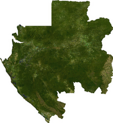
Ficheiro:Gabon sat.png

Tamaño desta vista previa: 553 × 599 píxeles. Outras resolucións: 222 × 240 píxeles | 443 × 480 píxeles | 698 × 756 píxeles.
Ficheiro orixinal (698 × 756 píxeles; tamaño do ficheiro: 615 kB; tipo MIME: image/png)
| Este ficheiro procede de Wikimedia Commons. A continuación móstrase a información da súa páxina de descrición. Commons é un repositorio libre de ficheiros multimedia. Pode contribuír alí cargando as súas imaxes. |
ECW to TIFF to PNG (compression level 9).
| This file is in the public domain, because it was generated by a user, using free sources available at The Map Library. Note that this does not include the maps in the Global Administrative Areas section of the homepage. |
Historial do ficheiro
Prema nunha data/hora para ver o ficheiro tal e como estaba nese momento.
| Data/Hora | Miniatura | Dimensións | Usuario | Comentario | |
|---|---|---|---|---|---|
| actual | 14 de xullo de 2006 ás 01:14 | | 698 × 756 (615 kB) | Unquietwiki | ECW to TIFF to PNG (compression level 9). {{PD-MapLibrary}} |
Uso do ficheiro
A seguinte páxina usa este ficheiro:
Uso global do ficheiro
Os seguintes wikis empregan esta imaxe:
- Uso en af.wikipedia.org
- Uso en arz.wikipedia.org
- Uso en ast.wikipedia.org
- Uso en ca.wikipedia.org
- Uso en ceb.wikipedia.org
- Uso en dag.wikipedia.org
- Uso en de.wikivoyage.org
- Uso en diq.wikipedia.org
- Uso en en.wikipedia.org
- Uso en en.wikinews.org
- Uso en fa.wikipedia.org
- Uso en ff.wikipedia.org
- Uso en fr.wikipedia.org
- Uso en fr.wikinews.org
- Uso en fr.wikivoyage.org
- Uso en ga.wikipedia.org
- Uso en gd.wikipedia.org
- Uso en gpe.wikipedia.org
- Uso en ha.wikipedia.org
- Uso en he.wikivoyage.org
- Uso en hr.wikipedia.org
- Uso en ia.wikipedia.org
- Uso en id.wikipedia.org
- Uso en ig.wikipedia.org
- Uso en is.wikipedia.org
- Uso en kab.wikipedia.org
- Uso en ka.wikipedia.org
- Uso en lt.wikipedia.org
- Uso en pap.wikipedia.org
- Uso en sv.wikipedia.org
- Uso en tum.wikipedia.org
- Uso en ur.wikipedia.org
- Uso en vec.wikipedia.org
- Uso en www.wikidata.org
- Uso en zu.wikipedia.org
🔥 Top keywords: PortadaFrancisco Porto MellaEspecial:ProcurarRosario Porto OrtegaMaría do Socorro Ortega RomeroElvis PresleyLuísa VillaltaCarles PuigdemontCaso Asunta BasterraAlfonso Basterra CamporroEspecial:Cambios recentesDía da NaiDeportivo da CoruñaSerpinaEva Iglesias MiguénsTereixa NavazaPili PampínQatarJason StathamXaxún no islamMatsuo BashoWikipedia:Entradas de Gallegos. Quién es quien en la Galicia del siglo XXIJoseph VacherShinovaSegunda guerra mundialGaliciaAnne HathawayJosé Manuel Rodríguez PuenteMaría JamardoHindemburg Melão Jr.José Antonio Vázquez TaínRoko (actriz)Xosé Manuel PiñeiroPosicións sexuaisAxuda:Cambios relacionadosRefraneiro galego sobre o mes de maioWikipedia:Acerca deAWStatsÁreas lingüísticas do galego