Archivo:Surrey UK location map.svg

Tamaño de esta previsualización PNG del archivo SVG: 790 × 599 píxeles. Otras resoluciones: 317 × 240 píxeles · 633 × 480 píxeles · 1013 × 768 píxeles · 1280 × 971 píxeles · 2560 × 1942 píxeles · 1425 × 1081 píxeles.
Ver la imagen en su resolución original ((Imagen SVG, nominalmente 1425 × 1081 pixels, tamaño de archivo: 1,93 MB))
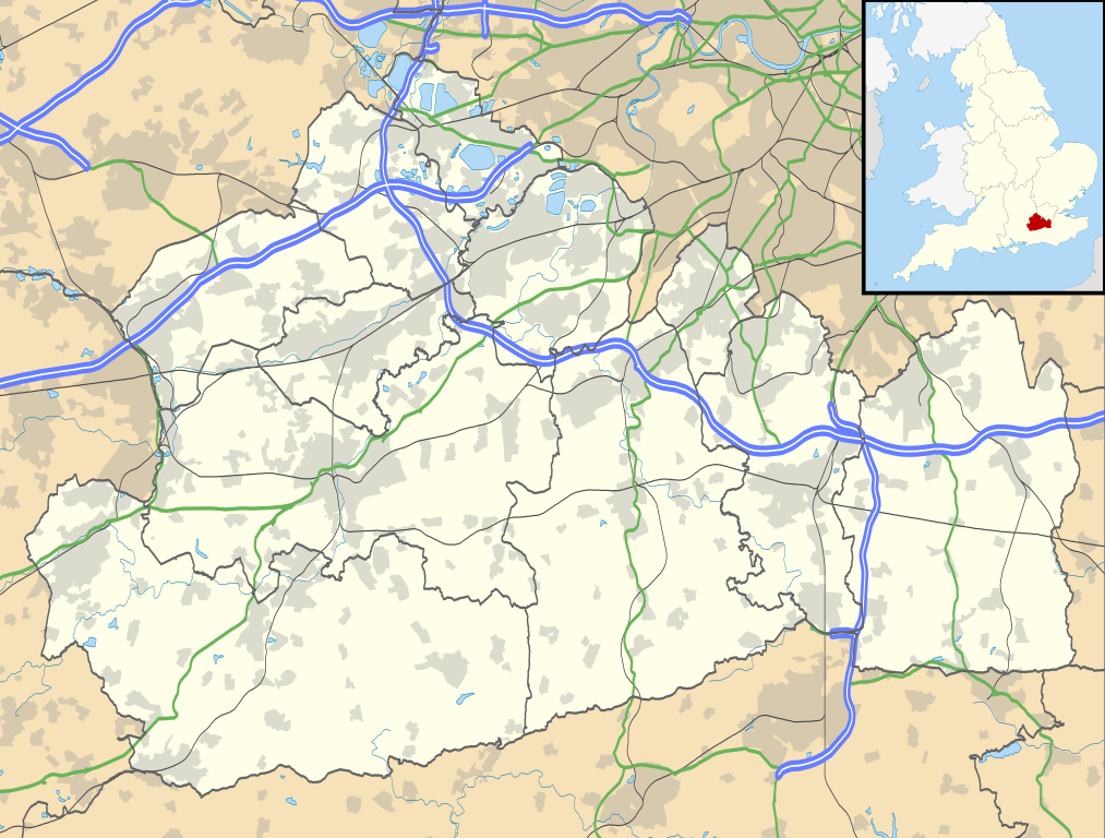
| Descripción | Map of Surrey, UK with the following information shown:
Equirectangular map projection on WGS 84 datum, with N/S stretched 160% Geographic limits:
|
| Fecha | |
| Fuente |
|
| Autor | Nilfanion, created using Ordnance Survey data |
| Permiso (Reutilización de este archivo) | Este archivo se encuentra bajo la licencia Creative Commons Genérica de Atribución/Compartir-Igual 3.0. Atribución: Contains Ordnance Survey data © Crown copyright and database right
|
| Otras versiones | File:Surrey UK district map (blank).svg - Blank map |
.svg)
Historial del archivo
Haz clic sobre una fecha y hora para ver elarchivo tal como apareció en ese momento.
| Fecha y hora | Miniatura | Dimensiones | Usuario | Comentario | |
|---|---|---|---|---|---|
| actual | 19:15 26 sep 2010 | | 1425 × 1081 (1,93 MB) | Nilfanion | {{Information |Description=Map of Surrey, UK with the following information shown: *Administrative borders *Coastline, lakes and rivers *Roads and railways *Urban areas Equirectangular map projection on WGS 84 datum, with N/S stretched 160% |
Usos del archivo
Las siguientes páginas usan este archivo:
- Addlestone
- Albury (Surrey)
- Alfold Crossways
- Ash (Surrey)
- Ashford (Surrey)
- Ashtead
- Badshot Lea
- Bagshot
- Banstead
- Biggin Hill
- Bletchingley
- Box Hill
- Bramley (Surrey)
- Brockham
- Brookwood (Surrey)
- Byfleet
- Camberley
- Capel (Surrey)
- Caterham (Surrey)
- Chaldon
- Charlwood
- Chertsey
- Chiddingfold
- Chilworth
- Chobham (Surrey)
- Churt
- Claygate
- Cobham (Surrey)
- Cranleigh
- Deepcut
- Dorking
- Dormans Park
- Dormansland
- East Clandon
- East Horsley
- Egham
- Elstead
- Epsom
- Esher
- Ewell
- Ewhurst
- Fairlands
- Farncombe
- Flexford
- Frimley
- Godalming
- Godstone
- Grayshott
- Grayswood
- Guildford
- Haslemere
- Headley (Surrey)
- Holmwood
- Hooley
- Horley
- Langley Vale
- Leatherhead
- Lingfield
- Lower Kingswood
- Lyne
- Mickleham
- Netherne On-The-Hill
- Newdigate
- Ockley
- Oxted
- Peaslake
- Pirbright
- Pirbright Camp
- Puttenham
- Redhill
- Reigate
- Ripley (Surrey)
- Rowly
- Salfords
- Salfords and Sidlow
- Shamley Green
- Shere
- South Earlswood
- South Godstone
- South Nutfield
- Staines-upon-Thames
- Sunbury-on-Thames
- Tandridge
- The Wells
- Warlingham
- West Clandon
- West Horsley
- Westcott (Surrey)
- Westhumble
- Witley
- Woking
- Woldingham
- Wood Street Village
- Wormley
- Worplesdon
- Plantilla:Mapa de localización de Surrey
Uso global del archivo
Las wikis siguientes utilizan este archivo:
- Uso en ar.wikipedia.org
- Uso en bg.wikipedia.org
- Uso en ceb.wikipedia.org
- Uso en en.wikipedia.org
- Staines-upon-Thames
- Dorking
- Guildford
- Effingham, Surrey
- Farnham
- Ashtead
- Leatherhead
- Epsom
- Wisley
- Cobham, Surrey
- Hindhead
- Fetcham
- Great Bookham
- East Horsley
- Cranleigh
- Oatlands, Surrey
- Little Bookham
- Godalming
- Reigate
- Camberley
- Milford, Surrey
- Dunsfold
- Winkworth Arboretum
- Weybridge
- Haslemere
- Redhill, Surrey
- Bramley, Surrey
- Haxted Watermill
- Ockham, Surrey
- Egham
- Esher
- Virginia Water
- Sunbury-on-Thames
- Pirbright
- Abinger Hammer
- Epsom railway station
- Send, Surrey
- Lingfield, Surrey
- Shalford, Surrey
- Waverley Abbey
- Ashford, Surrey
- Tadworth
- Church of St Peter & St Paul, Godalming
- Wormley, Surrey
- Guildford Cathedral
- Witley
- Hambledon, Surrey
Ver más uso global de este archivo.
Metadatos
🔥 Top keywords: Wikipedia:PortadaOmar GelesEspecial:BuscarCleopatra I de EgiptoAdemola LookmanAtalanta Bergamasca CalcioCrimen de Los GalindosToni KroosCaso de Nahir GalarzaChatGPTBatalla de PichinchaGian Piero GasperiniAdria ArjonaLiga Europa de la UEFARita de CasiaHansi FlickBayer LeverkusenCaso Asunta BasterraMyke TowersClub Atlético TemperleyLos DiablitosEstadio AvivaXabi AlonsoTabla periódica de los elementosBridgertonJavier MileiClaudia SheinbaumEstado de PalestinaLiga de Campeones de la UEFABaloncestoJuan MussoCleopatraJason MomoaSegunda Guerra MundialEl planeta de los simios (franquicia)Primera Guerra MundialYouTubeBérgamoLiga Europa de la UEFA 2023-24