This is a list of schools in the North Queensland region of Queensland, Australia, and includes schools in North West Queensland. The region is centred on the coastal cities of Townsville and Mackay, and the inland city of Mount Isa. It includes the following local government areas:
- Shire of Burdekin
- Charters Towers Region
- Shire of Cloncurry
- Shire of Flinders
- Shire of Hinchinbrook
- Mackay Region
- Shire of Mckinlay
- City of Mount Isa
- Aboriginal Shire of Palm Island
- Shire of Richmond
- City of Townsville
- Whitsunday Region
Prior to 2015, the Queensland education system consisted of primary schools, which accommodated students from Kindergarten to Year 7 (ages 5–13), and high schools, which accommodate students from Years 8 to 12 (ages 12–18). However, as of 2015, Year 7 became the first year of high school, leaving Year 6 as the last year or primary.[1]
State schools edit
State primary schools edit
| Name | Suburb | LGA | Opened | Coords | Notes |
|---|---|---|---|---|---|
| Abergowrie State School | Abergowrie | Hinchinbrook | 1953 | 18°28′29″S 145°53′01″E / 18.4746°S 145.8835°E | 5 Venables Road.[2][3] |
| Airville State School | Airville | Burdekin | 1890 | ||
| Aitkenvale State School | Aitkenvale | Townsville | 1924 | ||
| Alligator Creek State School | Alligator Creek | Mackay | 1896 | ||
| Andergrove State School | Andergrove | Mackay | 1939 | ||
| Annandale State School | Annandale | Townsville | 1998 | ||
| Ayr State School | Ayr | Burdekin | 1886 | Central school 1928–1936 | |
| Ayr East State School | Ayr | Burdekin | 1952 | ||
| Barkly Highway State School | Mount Isa | Mount Isa | 1959 | ||
| Beaconsfield State School | Beaconsfield | Mackay | 1999 | ||
| Belgian Gardens State School | Belgian Gardens | Townsville | 1887 | ||
| Bloomsbury State School | Bloomsbury | Mackay | 1927 | ||
| Bluewater State School | Bluewater | Townsville | 1957 | 19°10′29″S 146°33′20″E / 19.1748°S 146.5556°E | Provisional until Feb 1960. At 1–3 Ditton Street with its entrance on Buckby Street.[4] |
| Bohlevale State School | Bohle | Townsville | 20 November 1911 | [5] | |
| Bowen State School | Bowen | Whitsunday | 1865 | ||
| Brandon State School | Brandon | Burdekin | 1888 | ||
| Bucasia State School | Bucasia | Mackay | 1985 | ||
| Bwgcolman Community School | Palm Island | Palm Island | 1964 | P–10. Formerly Palm Island CS until 1994 | |
| Cameron Downs State School | via Hughenden | Flinders | 1967 | ||
| Camooweal State School | Camooweal | Mount Isa | 1893 | ||
| Cannonvale State School | Cannonvale | Whitsunday | 1892-1908 | Cannon Vale Provisional School opened on 8 February 1892. It closed in 1908.[6] | |
| 1910-1968 | 20°17′20″S 148°40′42″E / 20.2890°S 148.6784°E | In 1910 the school reopened as Cannon Valley State School on a new site on the north-eastern corner of Shute Harbour Road and Abell Road.[6][7][8] The 1910 site is now within the boundaries of Cannonvale rather than Cannon Valley.[9] | |||
| 1968 | 20°16′29″S 148°41′59″E / 20.2747°S 148.6996°E | In 1968, it was decided to relocate the school back into Cannonvale and the school was then renamed Cannonvale State School.[10][11] At 56 Coral Esplanade.[12] | |||
| Charters Towers Central State School | Charters Towers | Charters Towers | 1875 | Split sex until 1965 | |
| Chelona State School | Chelona | Mackay | 1893 | ||
| Clare State School | Clare | Burdekin | 1921 | ||
| Collinsville State School | Collinsville | Whitsunday | 1921 | ||
| Coningsby State School | Farleigh | Mackay | 1884 | ||
| Cranbrook State School | Cranbrook | Townsville | 1981 | ||
| Currajong State School | Currajong | Townsville | 1954 | ||
| Dajarra State School | Dajarra | Cloncurry | 1920 | 21°41′41″S 139°30′44″E / 21.6946°S 139.5122°E | Matheson Street[13] |
| Dundula State School | Bakers Creek | Mackay | 1922 | ||
| Eimeo Road State School | Rural View | Mackay | 1934 | ||
| Eton State School | Eton | Mackay | 1883 | ||
| Eungella State School | Eungella | Mackay | 1928 | 21°08′04″S 148°29′28″E / 21.1344°S 148.4912°E | Located at 36 Eungella Dam Road.[14] |
| Farleigh State School | Farleigh | Mackay | 1909 | ||
| Finch Hatton State School | Finch Hatton | Mackay | 1909 | ||
| Fitzgerald State School | North Mackay | Mackay | 1979 | ||
| Forrest Beach State School | Forrest Beach | Hinchinbrook | 1980 | ||
| Garbutt State School | Garbutt | Townsville | 1932 | ||
| Gargett State School | Gargett | Mackay | 1914 | ||
| Giru State School | Giru | Burdekin | 1924 | 19°30′46″S 147°06′35″E / 19.5129°S 147.1096°E | At 45–51 Luxton Street.[15] |
| Glenella State School | Glenella | Mackay | 1912 | ||
| Greenvale State School | Greenvale | Charters Towers | 1972 | Previous provisional school 1919–1926 | |
| Gumlu State School | Gumlu | Whitsunday | 1913 | ||
| Halifax State School | Halifax | Hinchinbrook | 1883 | ||
| Hamilton Island State School | Hamilton Island | Whitsunday | 1986 | ||
| Hampden State School | Kuttabul | Mackay | 1887 | Provisional until Aug 1926 | |
| Happy Valley State School | Happy Valley | Mount Isa | 1942 | ||
| Hayman Island State School | Hayman Island | Whitsunday | 1956 | ||
| Healy State School | Healy | Mount Isa | 1972 | ||
| Heatley State School | Heatley | Townsville | 1971 | ||
| Hermit Park State School | Hyde Park | Townsville | 1924 | ||
| Home Hill State School | Home Hill | Burdekin | 1914 | ||
| Homebush State School | Homebush | Mackay | 1889 | ||
| Homestead State School | Homestead | Charters Towers | 1893 | ||
| Ingham State School | Ingham | Hinchinbrook | 1885 | ||
| Jarvisfield State School | Jarvisfield | Burdekin | 1915 | ||
| Julia Creek State School | Julia Creek | McKinlay | 1911 | ||
| Kalamia State School | Brandon | Burdekin | 1928 | ||
| Kelso State School | Kelso | Townsville | 1986 | ||
| Kirwan State School | Kirwan | Townsville | 1977 | ||
| Koumala State School | Koumala | Mackay | 1922 | ||
| Mackay Central State School | Mackay | Mackay | 1871 | ||
| Mackay North State School | North Mackay | Mackay | 1915 | ||
| Mackay West State School | West Mackay | Mackay | 1924 | ||
| Macknade State School | Macknade | Hinchinbrook | 1893 | ||
| Magnetic Island State School | Nelly Bay | Townsville (Offshore) | 1924 | Formerly Nelly Bay SS until 1973 | |
| Maidavale State School | Airville | Burdekin | 1910 | ||
| Marian State School | Marian | Mackay | 1886 | ||
| Merinda State School | Merinda | Whitsunday | 1898 | ||
| Millaroo State School | Millaroo | Burdekin | 1954 | 20°03′29″S 147°16′50″E / 20.0581°S 147.2806°E | At 1–13 Cunningham Street.[16] |
| Millchester State School | Millchester | Charters Towers | 1874 | ||
| Mirani State School | Mirani | Mackay | 1892 | 21°09′41″S 148°51′43″E / 21.1614°S 148.8619°E | At 12 Maud Street.[17] |
| Mount Fox State School | Mount Fox | Hinchinbrook | 1938 | ||
| Mount Isa Central State School | Mount Isa | Mount Isa | 1924 | ||
| Mundingburra State School | Mundingburra | Townsville | 1884 | ||
| Mutarnee State School | Mutarnee | Townsville (Rural) | 1920 | ||
| Northview State School | Mount Pleasant | Mackay | 1986 | ||
| North Eton State School | North Eton | Mackay | 1895 | Also known as Eton North State School | |
| North Shore State School | Burdell | Townsville | 2018 | ||
| Oakenden State School | Oakenden | Mackay | 1910 | ||
| Oonoonba State School | Idalia | Townsville | 1920 | ||
| Osborne State School | Osborne | Burdekin | 1914 | ||
| Pentland State School | Pentland | Charters Towers | 1885 | 21°15′57″S 143°48′30″E / 21.2658°S 143.8083°E | At 18 Mill Street (corner of Gilmore Street).[18] |
| Pindi Pindi State School | Pindi Pindi | Mackay | 1928 | ||
| Pinnacle State School | Pinnacle | Mackay | 1908 | ||
| Prairie State School | Prairie | Flinders | 1894 | ||
| Proserpine State School | Proserpine | Whitsunday | 1897 | ||
| Queens Beach State School | Bowen | Whitsunday | 1940 | ||
| Railway Estate State School | Railway Estate | Townsville | 1916 | ||
| Rasmussen State School | Rasmussen | Townsville | 1978 | ||
| Ravenswood State School | Ravenswood | Charters Towers | 1873 | ||
| Richmond State School | Richmond | Richmond | 1889 | P–10 | |
| Richmond Hill State School | Richmond Hill | Charters Towers | 1895 | ||
| Rollingstone State School | Rollingstone | Townsville (Rural) | 1916 | ||
| Sarina State School | Sarina | Mackay | 1897 | Formerly Plane Creek until 1912. | |
| Scottville State School | Scottville | Whitsunday | 1924 | ||
| Seaforth State School | Seaforth | Mackay | 1935 | ||
| Slade Point State School | Slade Point | Mackay | 1939 | ||
| Sunset State School | Sunset | Mount Isa | 1968 | ||
| Swayneville State School | Sarina | Mackay | 1935 | ||
| The Willows State School | Kirwan | Townsville | 1997 | ||
| Toobanna State School | Toobanna | Hinchinbrook | 1922 | ||
| Townsville Central State School | North Ward | Townsville | 1869 | ||
| Townsville South State School | South Townsville | Townsville | 1884 | ||
| Townsville West State School | West End | Townsville | 1887 | ||
| Townview State School | Townview | Mount Isa | 1965 | ||
| Trebonne State School | Trebonne | Hinchinbrook | 1906 | ||
| Victoria Park State School | East Mackay | Mackay | 1926 | ||
| Victoria Plantation State School | Victoria Plantation | Hinchinbrook | 1894 | ||
| Vincent State School | Vincent | Townsville | 30 January 1968 | [5] | |
| Walkerston State School | Walkerston | Mackay | 1880 | ||
| Weir State School | Kirwan | Townsville | 1881 | ||
| Woodstock State School | Woodstock | Townsville (Rural) | 1890 | ||
| Wulguru State School | Wulguru | Townsville | 30 January 1962 | [5] |
State high schools and colleges edit
Other state schools edit
This includes special schools (schools for disabled children) and schools for specific purposes.
| Name | Suburb | LGA | Opened | Notes |
|---|---|---|---|---|
| Burdekin School | Ayr | Burdekin | 1972 | |
| Charters Towers School of Distance Education | Charters Towers | Charters Towers | 1987 | |
| Cleveland Education and Training Centre | Belgian Gardens | Townsville | 1994 | For juvenile inmates. Formerly Cleveland School until Feb 2006 |
| Mackay District Special School | Beaconsfield | Mackay | 1987 | Formerly Kewarra until Aug 2002 |
| Townsville Community Learning Centre | Mundingburra | Townsville | 2002 |
Defunct state schools edit
| Name | Suburb | LGA | Opened | Closed | Coords | Notes |
|---|---|---|---|---|---|---|
| Airdmillan State School | Airdmillan | Burdekin | 1912 | 1986 | ||
| Aitkenvale Special School | Aitkenvale | Townsville | 1972 | 2001 | Merged into Townsville Community Learning Centre | |
| Ana Branch State School | Jarvisfield | Charters Towers | 1919 | 1964 | Described as "via Ayr" and "in the parish of Morrill" so referring to the anabranch of the Burdekin River. Ana Branch Road is in Jarvisfield.[22][23][24] | |
| Balfe's Creek State School | Balfes Creek (Campaspe) | Charters Towers | 1905 | 1967 | ||
| Ballara State School | Kuridala | Cloncurry | 1918 | 1926 | Ballara (20°56′45″S 139°57′48″E / 20.9458°S 139.9633°E) is the now abandoned ruins of a settlement that supported the Wee MacGregor Mine.[25][26][27] | |
| Balnagowan State School | Balnagowan | Mackay | 1950 | 1973 | ||
| Bambaroo State School | Bambaroo | Hinchinbrook | 1924 | 2016 | 18°52′04″S 146°11′20″E / 18.8679°S 146.1889°E | Located at 10 Bambaroo School Road.[28][29] The school's website has been archived.[30] |
| Beatrice Creek State School | via Pinnacle | Mackay | 1936 | c. 1971 | [31][32] | |
| Black Jack State School | Black Jack | Charters Towers | 1887 | 1948 | Provisional until July 1891 | |
| Blue Mountain State School | Blue Mountain | Mackay | 1943 | 1963 | approx 21°34′25″S 149°01′31″E / 21.5736°S 149.0254°E | Located on Blue Mountain Road.[33] |
| Bogie Range Provisional School | Bogie | Whitsunday Region | 1919 | 1922 | Originally known as Twenty-five Mile Camp Provisional School and Aberdeen Provisional School | |
| Bona Vista State School | Proserpine | Whitsunday | 1906 | 1964 | ||
| Bora Creek State School | 1916 | 1920 | Ravenswood area? Or possibly Captains Mountain near Milmerran?[34] | |||
| Braemeadows State School | Braemeadows | Hinchinbrook | 1928 | 1969 | ||
| Brightly State School | Brightly | Mackay | 1925 | 1988 | ||
| Brookville State School | via Ravenswood | 1901 | 1926 | |||
| Broughton State School | Broughton near Charters Towers | Charters Towers | 1905 | 1930 | Opened as a provisional school in 1905,[35][36] becoming a state school in 1909. Closed due to low attendances in 1930.[37] The buildings were sold for removal in 1934.[38] | |
| Burdekin Bridge Tent State School | near Ayr | Burdekin | 1912 | 1913 | In June 1912, approval was given for a tent school provided the Railway Department supplied the tent.[39] In November 1913, the teacher Miss Dean was reassigned to Gumlu State School.[40] The Railway Department were constructing a rail bridge over the Burdekin River near Ayr in 1912–1913; the tent school was presumably for the children of the railway workers living in a temporary camp by the bridge site. | |
| Burdekin Falls State School | Mount Wyatt | Whitsunday | 1984 | 1988 | ||
| Cameron's Pocket State School | Camerons Pocket (Calen) | Mackay | 1930 | 1958 | 20°55′13″S 148°43′40″E / 20.9202°S 148.7278°E | Located at 375 Calen Mount Charlton Road.[41][42] |
| Cannon Vale Provisional School | Cannonvale | Whitsunday | 1892 | circa 1908 | Replaced by Cannon Valley State School at a different location.[43] | |
| Cannon Valley State School | Cannonvale | Whitsunday | 1910 | 1969 | Located on the north-eastern corner of Shute Harbour Road and Abell Road (20°17′20″S 148°40′42″E / 20.2890°S 148.6784°E).[44][45] Despite its name, it was not in present-day Cannon Valley. Replaced by Cannonvale State School at a different location. | |
| Cape River State School | Pentland | Charters Towers | 1915 | 1938 | [46] | |
| Capeville State School | Capeville near Pentland | Charters Towers | circa 1895 | 1912 | Opened circa 1895 as Deep Lead Provision School near the Capeville pastoral run on the Cape River near Pentland.[37] Deep Lead was a gold mining area along the Cape River.[47] Became Deep Lead State School in September 1909.[48] Renamed Capeville State School in 1909 and then closed in 1912.[49] | |
| Charters Towers School of the Air | Charters Towers | Charters Towers | 1964 | 1973 | ||
| Cootharinga Special School | Castle Hill | Townsville | 1964 | 1986 | ||
| Cordelia State School | Cordelia | Hinchinbrook | 1918 | 1993 | 18°35′47″S 146°15′33″E / 18.5964°S 146.2591°E | Located at 15 Cordelia School Road.[50] |
| Crediton State School | Crediton | Mackay | 1943 | 1968 | Crediton Provisional School opened on 18 October 1943. It became a State School in 1956 and closed in 1968. | |
| Crediton West State School | Crediton | Mackay | 1951 | 1961 | ||
| Crystal Creek State School | Crystal Creek | Whitsunday | 1916 | 1967 | Provisional until 1921; closed 1948, 1951–1956 | |
| Dalbeg State School | Dalbeg | Burdekin | 1955 | 1999 | 20°16′15″S 147°17′43″E / 20.2708°S 147.2952°E | Located at 45–63 Delpratt Street.[51] |
| Dalrymple Heights State School | Dalrymple Heights | Mackay | 1937 | 1959 | 21°05′54″S 148°31′18″E / 21.0983°S 148.5216°E | 686 Dalrymple Road[52][53] |
| Devereaux Creek State School | Devereaux Creek | Mackay | 1903 | 1970 | ||
| Dittmer State School | Dittmer | Whitsunday | 1938 | 1965 | approx 20°27′01″S 148°24′11″E / 20.4504°S 148.4031°E | Located at approx 11 Thorogood Street.[54] |
| Dobbyn State School | Three Rivers | Cloncurry | 1918 | 1954 | ||
| Dows Creek State School | Dows Creek | Mackay | 1895 | 2009 | 21°06′15″S 148°46′25″E / 21.1041°S 148.7735°E | Located at 1081 Mount Ossa Road.[55] The school's website was archived.[56] |
| Duchess State School | Duchess | Cloncurry | 1911 | 1983 | ||
| Dumbleton State School | Dumbleton | Mackay | 1926 | 1949 | ||
| Dutton River State School | Dutton River | Flinders | 1972 | 1977 | ||
| Elaroo State School | Elaroo (now Bloomsbury) | Whitsunday | 1936 | 1969 | ||
| Etowri State School | Habana | Mackay | 1926 | 1953 | Located at 108 Barcoo Road (21°02′52″S 149°06′53″E / 21.04789°S 149.11483°E).[57][58][59][53] | |
| Evlinton State School | Ravenswood | Charters Towers | 1885 | 1921 | Originally known as Sandy Creek State School. | |
| Ewan State School | Ewan (now Paluma) | Townsville | 1907 | circa 1931 | Very little information available about this school. | |
| Foresthome State School | Foresthome | Hinchinbrook | 1935 | 1993 | ||
| Foxdale State School | Foxdale | Whitsunday | 1904 | 1972 | ||
| Gainsford Homestead School | (now Basalt) | Charters Towers | 1942 | 1942 | Very little known about this school, which operated for a year in the Gainsford Homestead building at the old Dalrymple township site. It may have been a private school. | |
| Gilliat State School | Gilliat | Mckinlay | 1931 | 1942? | ||
| Grass Tree Provisional School | Grasstree Beach | Mackay | circa 1892 | 1905 | 21°21′40″S 149°17′45″E / 21.36105°S 149.29597°E | Located on the north-eastern side of Haden Street.[60][61] |
| Greenvale Project No. 1 State School | Greenvale | Charters Towers | 1974 | 1974 | Opened 18 Feb 1974 and closed on 29 Mar 1974 | |
| Greenvale Project No. 2 State School | Greenvale | Charters Towers | 1972 | 1974 | ||
| Gunpowder State School | Gunpowder | Mount Isa | 1970 | 1999 | Closed 1982–1991 | |
| Guthalungra State School | Guthalungra | Whitsunday | 1948 | 1988 | 19°50′00″S 147°42′00″E / 19.8333°S 147.7000°E | Provisional until 28 February 1957.[32] Located on the north side of the Bruce Highway in the town.[62][53] |
| Habana State School | Habana | Mackay | 1917 | 1960 | 21°01′54″S 149°04′07″E / 21.03168°S 149.06852°E | Located at 863 Yakapari Road.[57][58][59]19°50′00″S 147°42′00″E / 19.8333°S 147.7000°E |
| Hawkins Creek State School | Hawkins Creek | Hinchinbrook | 1912 | 2003 | 18°36′44″S 146°05′40″E / 18.6122°S 146.0945°E | Sometimes written as Hawkin's Creek State School. Located at 18 Gortons Road.[63] |
| Helens Hill State School | Helens Hill | Hinchinbrook | 1931 | 2016 | 18°46′08″S 146°08′07″E / 18.7690°S 146.1352°E | Located at 48388 Bruce Highway[64][53] The school's website was archived.[65] |
| Hermit Park Special School | Hermit Park | Townsville | 1979 | 1980 | ||
| Hermit Park State Infants' School | Hermit Park | Townsville | 1955 | 1993 | Merged into Hermit Park SS | |
| Hightville State School | Hightville (now Kuridala) | Cloncurry | 1915 | 1920 | ||
| Horseshoe Bay State School | Horseshoe Bay | Townsville (Offshore) | 1949 | 1972 | ||
| Idalia Provisional School | Idalia | Townsville | 1931 | 1939 | ||
| Ingham Special School | Ingham | Hinchinbrook | 1971 | 1992 | ||
| Inkerman State School | Inkerman | Burdekin | 1915 | 1974 | 19°45′05″S 147°29′37″E / 19.7513°S 147.4935°E | Located at 22 Wallace Road.[66] |
| Inverdon Road State School | Bowen | Whitsunday | 1922 | 1955 | 19°59′23″S 148°12′43″E / 19.9896°S 148.2119°E | Located at 174 Inverdon Road.[67][68][53] |
| Iona State School | Osborne | Burdekin | 1928 | 1963 | approx | Located on the north-west corner of Iona Road and Bapty Road.[69] |
| Iyah State School | Fredericksfield | Burdekin | 1920 | 1963 | 19°42′37″S 147°26′57″E / 19.7102°S 147.4491°E | Located approximately at 13 Charlies Hill Road.[70][71] |
| Jaggan State School | Jaggan | Tablelands | 1918 | 1965 | [37] | |
| Kajabbi State School | Kajabbi | Cloncurry | 1919 | 1975 | ||
| Kalkadoon State High School | Pioneer | Mount Isa | 1977 | 2002 | 20°43′20″S 139°30′36″E / 20.7223°S 139.5099°E | Located at 145–163 Abel Smith Parade. Merged with Mount Isa State High School to create Spinifex State College. The senior campus of the new college occupies the former Kalkadoon State High School site. Kalkadoon State High School's website has been archived.[72] |
| Kelsey Creek State School | Kelsey Creek | Whitsunday | 1895 | 1963 | Provisional until 1909 | |
| King's Gully State School | Broughton | Charters Towers | 1911 | 1932 | Kings Gully and Kings Gully Road are both in Broughton.[73][53] | |
| Kirk River State School | in western Ravenswood | Charters Towers | 1890 | 1944 | Kirk River and Kirk River Road are both in Ravenswood.[74][53] | |
| Koolamarra State School | Koolamarra (now Cloncurry) | Cloncurry | 1915 | 1971 | [75] | |
| Kungurri State School | Kungurri (now Dows Creek) | Mackay | 1932 | 1963 | [76] | |
| Kuridala State School | Kuridala | Cloncurry | 1901 | 1932 | formerly Friezland SS until 1920 | |
| Kynuna State School | Kynuna | McKinlay | 1899 | 1992 | ||
| Lake Julius State School | Lake Julius | Mount Isa | 1973 | 1976 | ||
| Lannercost State School | Lannercost | Hinchinbrook | 1929 | 1962 | 18°38′28″S 146°01′48″E / 18.6410°S 146.0299°E | Located on Lannercost Extension Road near the junction with Venables Crossing Road.[77][78] |
| Lethebrook State School | Lethebrook | Whitsunday | 1922 | 1964 | ||
| Liontown State School | Liontown (now Campaspe) | Charters Towers | 1906 | 1914 | [79][37] | |
| Long Pocket State School | Long Pocket (now in Lannercost) | Hinchinbrook | 1915 | 1994 | 18°32′31″S 146°01′10″E / 18.5419°S 146.0194°E | Located at 2062 Abergowrie Road, now in Lannercost.[80] |
| Lower Gregory State School | in southern Gregory River | Whitsunday | 1922 | 1962 | [53] | |
| Lucinda Point State School | Lucinda | Hinchinbrook | 1896 | 2008 | 18°31′50″S 146°20′02″E / 18.5306°S 146.3339°E | Originally opened Dungeness Provisional School in 1896, relocated to Lucinda Point in 1897 and renamed Lucinda Point Provisional School in 1898. Located at 20 Patterson Parade (corner Waring Street).[81] The school's website was archived.[82] |
| McDesme State School | McDesme | Burdekin | 1905 | 1965 | ||
| Mackay Central State Infants School | Mackay | Mackay | 1960 | 1968 | Merged with Mackay Central SS | |
| Mackay Special School | Mackay | Mackay | 1981 | 1997 | Merged with Kewarra Special | |
| Mackay West State Infants School | West Mackay | Mackay | 1956 | 1994 | 21°09′06″S 149°09′51″E / 21.1517°S 149.1643°E | Split from and then merged back in Mackay West State School. Located at 364 Bridge Road.[83] |
| Macrossan State School | Macrossan (now Dotswood) | Charters Towers | 1884 | 1948 | Originally called Macrossan Bridge Provisional School from 1884–1903 then changed name to Burdekin Provisional School. In 1917 it took on its final name. | |
| Majors Creek State School | Majors Creek | Burdekin | 1933 | 2009 | 19°35′55″S 146°54′05″E / 19.5985°S 146.9015°E | Located at 54 Majors Creek Road.[84] |
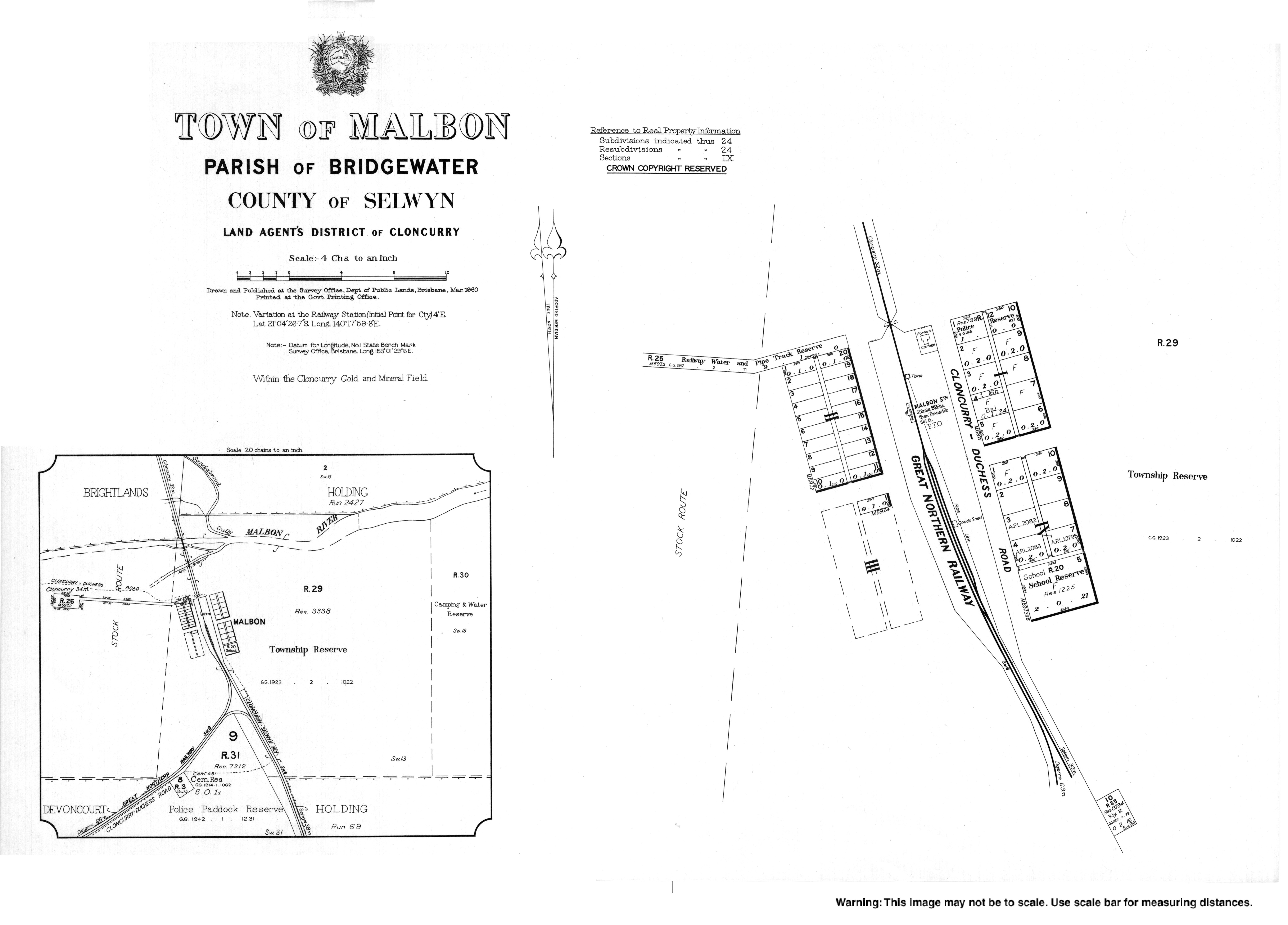
| Malbon State School | Malbon | Cloncurry | 1911 | 1969 | 21°04′31″S 140°18′07″E / 21.0754°S 140.3019°E | The school was located at the southern end of town on the Malbon Selwyn Road.[85] |
| Mary Kathleen State School | Mary Kathleen | Cloncurry | 1956 | 1983 | ||
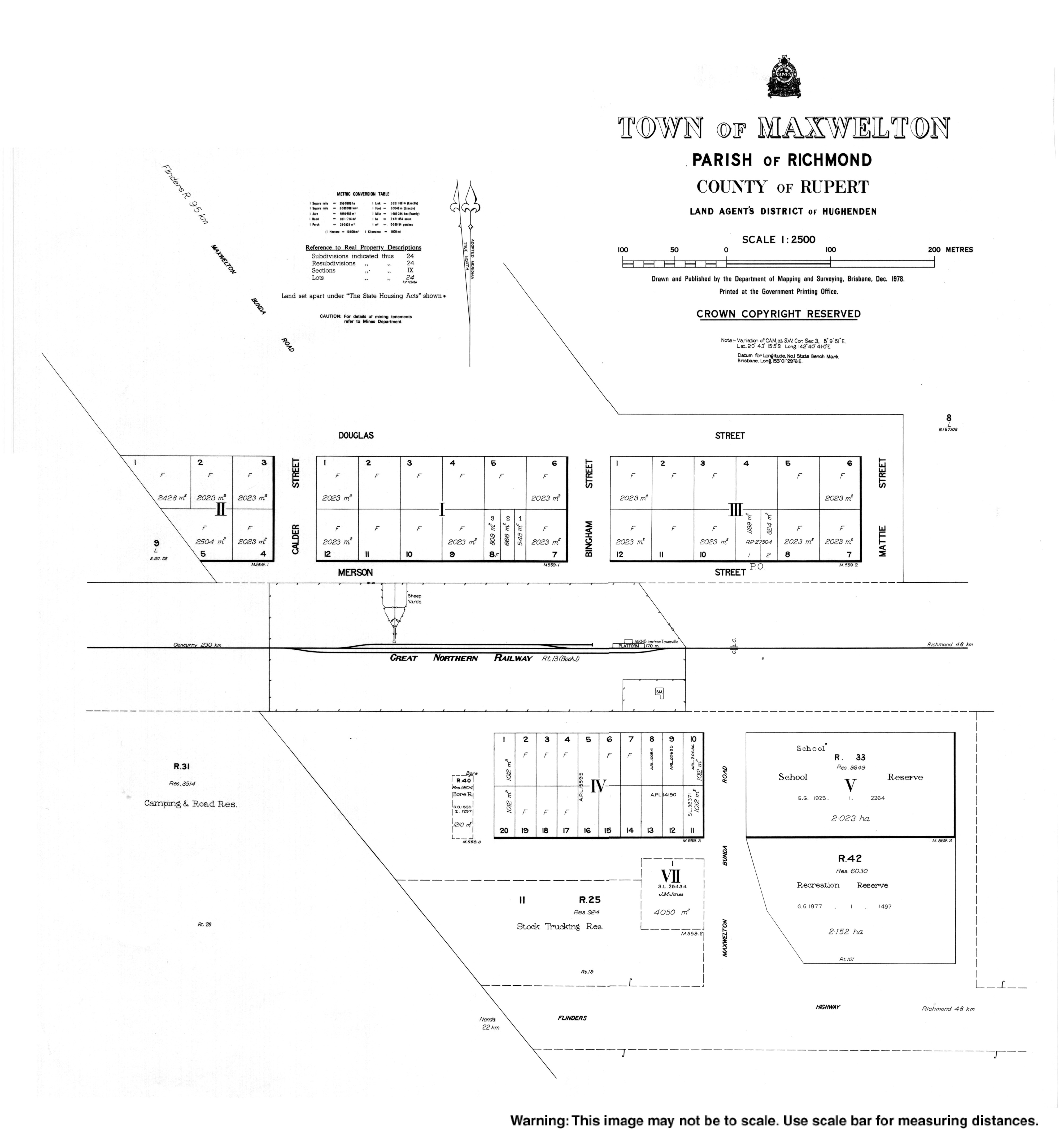
| Maxwelton State School | Maxwelton | Richmond | 1923 | 1989 | 20°43′18″S 142°40′54″E / 20.7217°S 142.6816°E | Located in School Road.[86][53] The school building is now used as a house. |
| McKinlay State School | McKinlay | McKinlay | 1897 | 1986 | ||
| Melrose Provisional School | near Bowen | c.1877 | c.1896 | This school was located on the property of the same name, owned and operated by Sidney Yeates. It was a rough bark and slab structure with bark for a roof. | ||
| Mia Mia State School | Mia Mia | Mackay | 1899 | 1967 | ||
| Mingela State School | Mingela | Charters Towers | 1882 | 2002 | 19°52′52″S 146°38′01″E / 19.8812°S 146.6336°E | Known as Ravenswood Junction until 1931.[32] Located at 33 Burdekin Street.[87][53] The school's website was archived.[88] |
| Mount Charlton State School | Mount Charlton | Mackay | 1931 | 2009 | 21°01′20″S 148°43′47″E / 21.0222°S 148.7296°E | Located at 2342 Mirani-Mount Ossa Road.[89][90] The school's website was archived.[91] |
| Mount Christian State School | Mount Christian (now Koumala) | Mackay | 1925 | 1968 | [92][93] | |
| Mount Cobalt State School | Selwyn | Cloncurry | 1924 | 1926 | Mount Cobalt was a mine in Selwyn.[94] | |
| Mount Coolon State School | Mount Coolon | Whitsunday | 1921 | 1967 | Provisional until May 1963 | |
| Mount Dalrymple State School | Dalrymple Heights | Mackay | 1904 | 1963 | ||
| Mount Isa State High School | Parkside | Mount Isa | 1953 | 2002 | 20°44′05″S 139°29′14″E / 20.7348°S 139.4871°E | Located at 6–16 Fifth Avenue. Merged with Kalkadoon State High School to create Spinifex State College. The junior campus of the new college occupies the former Mount Isa State High School site. Mount Isa State High School's website has been archived.[95] |
| Mount Jukes State School | Mount Jukes | Mackay | 1926 | 1967 | ||
| Mount Leyshon State School | Mount Leyshon (now Seventy Mile) | Charters Towers | 1890 | c.1940? | [96] | |
| Mount Marlow State School | Mount Marlow | Whitsunday | 1900 | 1954 | ||
| Mount Martin State School | Mount Martin | Mackay | 1906 | 1961 | ||
| Mount Ossa State School | Mount Ossa | Mackay | 1938 | 1970 | 20°57′30″S 148°50′04″E / 20.9582°S 148.8344°E | In 1938, the Silent Grove Provisional School closed, being replaced by the Mount Ossa State School. Located on Mount Ossa School Road.[97] |
| Mount Pelion State School | Mount Pelion | Mackay | 1924 | 1970 | 20°55′47″S 148°48′51″E / 20.9298°S 148.8143°E | Provisional until Aug 1926. Located about 19 Bogga Road.[98][99] |
| Mount Proserpine State School | Conway | Whitsunday | 1938 | 1963 | [100] | |
| Mount Surround State School | Mount Surround | Burdekin | 1932 | 1968 | ||
| Munbura State School | Munbura | Mackay | 1920 | 1971 | ||
| Mundingburra Special School | Mundingburra | Townsville | 1981 | 2001 | Formerly Mundingburra South until Jan 1987. Merged into Townsville Community Learning Centre | |
| Narpi State School | Narpi (now Kuttabul) | Mackay | 1926 | 2005 | 20°59′59″S 148°52′31″E / 20.9998°S 148.8753°E | Located at 69 Narpi Road.[101][102][103][104] |
| Nelia State School | Nelia | McKinlay | 1926 | 1960 | ||
| Netherdale State School | Netherdale | Mackay | 1914 | 1963 | ||
| Nindaroo State School | Richmond | Mackay | 1899 | 1963 | 21°04′56″S 149°08′31″E / 21.08220°S 149.14186°E | Located at 1 Boveys Road, corner of Mackay Habana Road, now in Richmond.[59][58][53] |
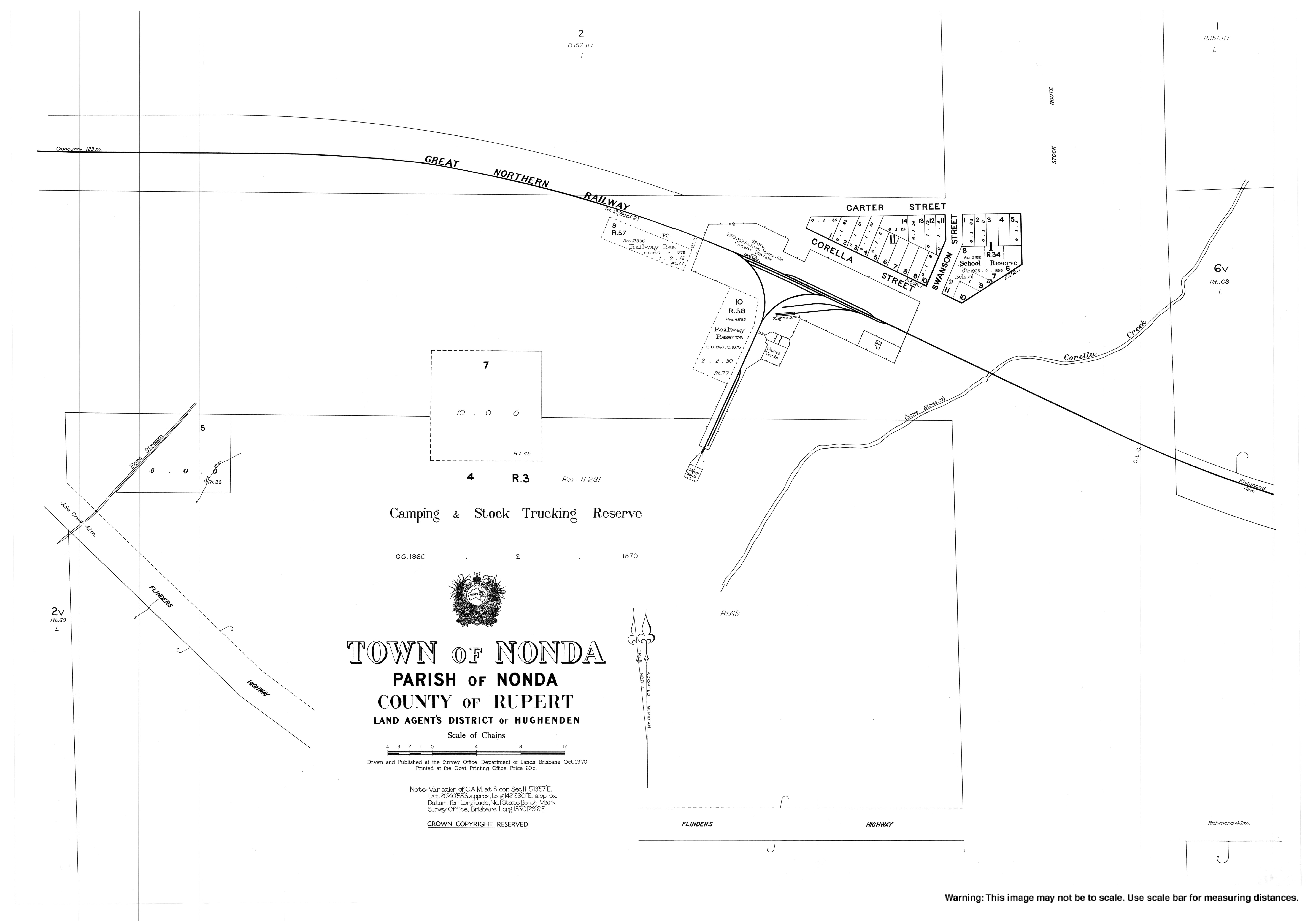
| Nonda State School | Nonda | Richmond | 1925 | 1975 | 20°40′53″S 142°29′09″E / 20.6813°S 142.4857°E | Located in Corella Street.[105][53] |
| Norwood State School | Norwood (now in Pentland) | Charters Towers | 1920 | 1952 | [106] | |
| O'Connell River State School | Yalboroo | Mackay | 1937 | 1960 | 20°51′48″S 148°37′11″E / 20.8632°S 148.6196°E | Located to the west of the junction of Cathu O'Connell Road and Frys Road.[41][42] |
| Oolbun State School | Oolbun (now Nome) | Townsville | 1917 | c.1932 | Very little information available about this school. | |
| Oona State School | Oona (now Three Rivers) | Cloncurry | c.1917 | c.1920 | Very little information available about this school. | |
| Owens Creek State School | Owens Creek | Mackay | 1913 | 1967 | Provisional until 1918 | |
| Palm Grove State School | Palm Grove | Whitsunday | 1916 | 1951 | ||
| Paluma State School | Paluma | Townsville/Charters Towers | 1950 | 1968 | Originally opened as Paluma Temporary School, it became a State School in 1952. Has been confused with Running River State School, but they are separate schools (see Running River State School below) | |
| Pandanus Creek State School | north-western Ravenswood | Charters Towers | 1908 | 1926 | Pandanus Creek is a tributary of the Kirk River in north-western Ravenswood.[107][108][53] | |
| Peacock Siding State School | Peacock Siding | Hinchinbrook | 1929 | 1949 | ||
| Picnic Bay State School | Picnic Bay | Townsville (Offshore) | 1917 | 1970 | Formerly Magnetic Island SS until Sep 1925. | |
| Pleystowe State School | Pleystowe | Mackay | 1896 | 1961 | ||
| Plane Creek West State School | West Plane Creek (now Sarina) | Mackay | 1900 | 1969 | Plane Creek, Upper Provisional School opened 19 February 1900 and became Plane Creek, Upper State school in 1909. In 1928 the school name was changed to Plane Creek, West (later without comma before West) and the school closed in 1969. | |
| Pumping Station State School | Breddan | Charters Towers | 1898 | 1936 | ||
| Quamby State School | Quamby | Cloncurry | 1924 | 1969 | ||
| Queenton State School | Queenton | Charters Towers | 1891 | 1931 | ||
| Rangemore State School | Rangemore | Burdekin | 1913 | 1962 | ||
| Reid River State School | Reid River | Townsville (R) | 1948 | 1966 | ||
| Riordan Vale State School | Riordanvale | Whitsunday | 1939 | 1963 | Provisional until 1955 | |
| Ripple Creek State School | Ripple Creek (now in Bemerside) | Hinchinbrook | 1893 | 1995 | 18°34′47″S 146°12′19″E / 18.5796°S 146.2053°E | Located on Fulton Drive.[109][110] |
| Rise and Shine State School | Rise and Shine (now Yalboroo) | Mackay | 1936 | 1963 | 20°53′20″S 148°39′46″E / 20.8888°S 148.6628°E | Located at 2 Watson and Boyds Road (corner Holds Road).[97][111] |
| Rita Island State School | Rita Island | Burdekin | 1920 | 1967 | ||
| Rishton State School | Rishton (now Dotswood) | Charters Towers | 1884 | 1891 | Rishton was the area on the eastern bank of the Burdekin River where it is cross by the Burdekin River Rail Bridge. It was renamed Oombabia in 1890.[112] It is now the south-western corner of Dotswood.[113] | |
| Rochford State School | Rochford (now Ravenswood) | Charters Towers | 1892 | 1921 | [114] | |
| Running River State School | Hidden Valley (now Paluma) | Townsville/Charters Towers | 1946 | 1994 | 18°58′40″S 146°01′34″E / 18.9777°S 146.0262°E | Closed in 1949 and opened again in 1954. Closed in 1963 and opened in 1965. Closed in 1974 and opened in 1978. Finally closed in 1994. Located at 28 Furber Road (also known as Breakaway Road and Ewan Road) in Paluma; it was a 5-acre (2.0 ha) site with a frontage onto Running River.[115][116] |
| Sandiford State School | Sandiford | Mackay | 1908 | 1992 | ||
| Sellheim State School | Sellheim | Charters Towers | 1889 | 1939 | ||
| Septimus State School | Septimus | Mackay | 1904 | 1999 | 21°12′15″S 148°45′51″E / 21.2043°S 148.7642°E | Located at 888–892 Gargett Mia Mia Road.[117][118][119] |
| Silent Grove Provisional School | Mount Charlton | Mackay | 1928 | 1938 | Closed to establish Mount Ossa State School. | |
| Silent Grove Upper State School | Mount Charlton | Mackay | 1936 | circa 1964 | 20°59′21″S 148°46′06″E / 20.9891°S 148.7684°E | Located at 2948 Mirani-Mount Ossa Road (20°59′21″S 148°46′06″E / 20.9891°S 148.7684°E).[41] |
| Shirbourne State School | Shirbourne | Burdekin | 1931 | 1970 | ||
| Stamford State School | Stamford | Flinders | 1984 | 2013 | 21°15′57″S 143°48′30″E / 21.2658°S 143.8083°E | Stamford State School opened on 23 January 1984.[120] It closed on Located at 5 Marathon Stamford Road.[121] The school's website was partially archived.[122] |
| Stone State School | Upper Stone | Hinchinbrook | 1909 | 1993 | ||
| Strathdickie State School | Strathdickie | Whitsunday | 1906 | 1962 | ||
| Stuart State School | Stuart | Townsville | 1901 | 2013 | 19°20′53″S 146°50′30″E / 19.34793°S 146.84179°E | Originally called Stewart's Creek, renamed Stuart in 1939. Located at 10 Dwyer Street. Its website was partially archived.[123] |
| Sunnyside State School | Sunnyside | Mackay | 1937 | 1960 | ||
| Sybil Creek State School | Owens Creek | Mackay | 1921 | 1965 | Sybil Creek runs north of Cattle Creek in Owens Creek.[124] | |
| Te Kowai State School | Te Kowai | Mackay | 1883 | 1968 | 21°09′57″S 149°07′38″E / 21.1659°S 149.1273°E | Located at 5 Te Kowai Foulden Road.[125][126][53] |
| The Leap State School | The Leap | Mackay | 1893 | 1969 | 21°04′12″S 149°00′30″E / 21.0700°S 149.00847°E | Located at 2105 Maraju Yakapari Road.[127][128] |
| The Monument State School | The Monument | Cloncurry | 1976 | 1994 | ||
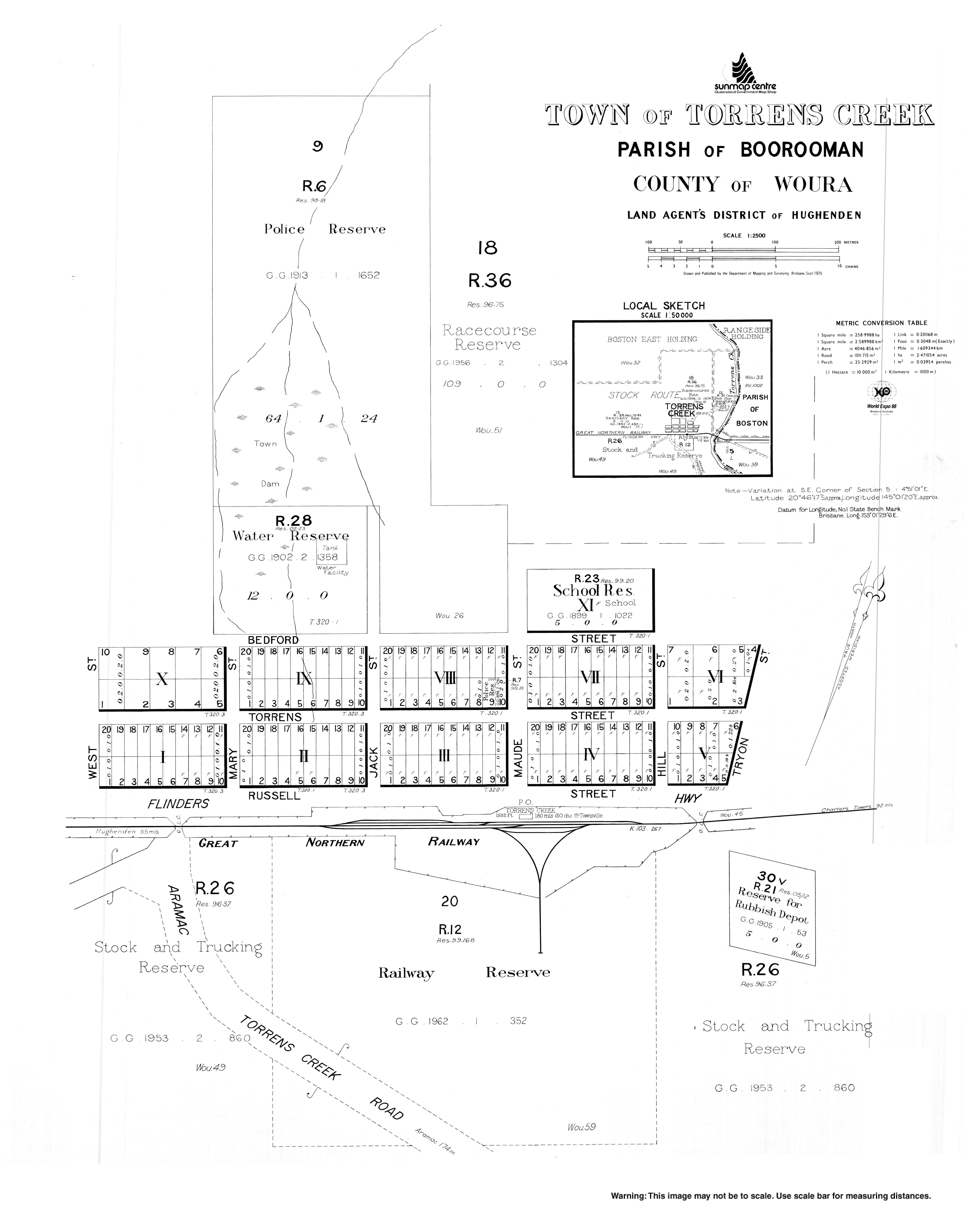
| Torrens Creek State School | Torrens Creek | Flinders | 1891 | 1991 | 20°46′02″S 145°01′11″E / 20.7673°S 145.0198°E | Located at 2 Bedford Street.[129][53] |
| Torsdale Farm Provisional School | near Mackay | 1919 | 1920 | Was a half-time school in conjunction with Torsdale Station Provisional School. Should not be confused with Torsdale Farm Provisional School, later known as Torsdale Farm State School, near Biloela, which opened in 1935 and changed name in 1944 to Prospect Creek State School. | ||
| Torsdale Station Provisional School | near Mackay | 1919 | 1920 | Was a half-time school in conjunction with Torsdale Farm Provisional School. | ||
| Townsville Hospital Special School | North Ward | Townsville | 1974 | 1994 | Townsville Hospital is located in North Ward. | |
| Townsville West Special School | West End | Townsville | 1958 | 1992 | ||
| Ukalunda State School | Mount Wyatt | Whitsunday | 1903 | 1924 | [130] | |
| Victoria Park State Infants School | Mackay | Mackay | 1970 | 1994 | Merged with Victoria Park State School | |
| Wagoora State School | Wagoora (now Pindi Pindi) | Mackay | 1949 | 1963 | Wagoora is now in Pindi Pindi.[131] | |
| Walluma State School | 1900 | 1912 | Originally known as Gregory State School. There is a Gregory parish and a Wallum Creek in Farnsfield.[132][133] | |||
| Whitewood State School | Whitewood (now Stamford) | Flinders | 1961 | 1970 | Whitewood is now in Stamford.[134] | |
| Yalboroo State School | Yalboroo | Mackay | 1927 | 2000 | 20°50′11″S 148°38′59″E / 20.8365°S 148.6498°E | Originally opened as Yalboroo Siding Provisional School.[135] Located at 6885 Bruce Highway.[136] |
| Yuruga State School | Yuruga | Hinchinbrook | 1919 | 1994 | 18°50′07″S 146°09′19″E / 18.8353°S 146.1552°E | Opened as Waterview State School, renamed Yuruga State School in 1930. Located at 20 Yuruga School Road.[137][138] |
Private schools edit
Catholic schools edit
In Queensland, Catholic primary schools are usually (but not always) linked to a parish. Prior to the 1970s, most schools were founded by religious institutes, but with the decrease in membership of these institutes, together with major reforms inside the church, lay teachers and administrators began to take over the schools, a process which completed by approximately 1990.
Within the region, schools in the Mackay Region are administered by Catholic Education Office, Diocese of Rockhampton, which was established in 1966 and was the first Catholic Education Office (CEO) in Queensland. All others are administered by the Catholic Education Office, Diocese of Townsville. Both are supported by the Queensland Catholic Education Commission, which is responsible for coordinating administration, curriculum and policy across the Catholic school system. Preference for enrolment is given to Catholic students from the parish or local area, although non-Catholic students are admitted if room is available.
| Name | Suburb | LGA | M/F/Co-ed | Years | Opened | Notes |
|---|---|---|---|---|---|---|
| Burdekin Catholic High School | Ayr | Burdekin | Co-ed | 7–12 | 1974 | |
| Catherine McAuley College | Mackay | Mackay | Co-ed | 7–12 | 2022 | |
| Columba Catholic College | Charters Towers | Charters Towers | Co-ed | P–12 | 1998 | |
| Emmanuel Catholic Primary School | Mount Pleasant | Mackay | Co-ed | P–6 | 1983 | P–10 until 1994 |
| Gilroy Santa Maria College | Ingham | Hinchinbrook | Co-ed | 7–12 | 1973 | Merger of Gilroy (boys) and Santa Maria (girls) |
| Good Shepherd Catholic College | Mount Isa | Mount Isa | Co-ed | 7–12 | 1985 | Merger of St Kieran's (boys) and San Jose (girls) |
| Good Shepherd Catholic Community School | Rasmussen | Townsville | Co-ed | P–6 | 1996 | |
| Holy Spirit Catholic School | Cranbrook | Townsville | Co-ed | P–6 | 1969 | |
| Holy Spirit College | Mount Pleasant | Mackay | Co-ed | 7–12 | 1995 | Formerly part of Emmanuel College |
| Ignatius Park College | Cranbrook | Townsville | M | 7–12 | 1969 | |
| MacKillop Catholic Primary School | Andergrove | Mackay | Co-ed | P–6 | 1995 | |
| Marian Catholic School | Currajong | Townsville | Co-ed | P–6 | 1988 | |
| Mount Isa Flexible Learning Centre | Mount Isa | Mount Isa | Co-ed | 7–12 | Operated by Edmund Rice Foundation. | |
| Our Lady of Lourdes Catholic School | Ingham | Hinchinbrook | Co-ed | P–6 | 1914 | |
| Ryan Catholic College | Kirwan | Townsville | Co-ed | P–12 | 1979 | |
| Southern Cross Catholic College | Annandale | Townsville | Co-ed | P–12 | 1998 | |
| St Anne's Catholic Primary School | Sarina | Mackay | Co-ed | P–6 | 1925 | |
| St Anthony's Catholic College | Deeragun | Townsville | Co-ed | P–12 | 1992 | |
| St Benedict's Catholic School | Shaw | Townsville | Co-ed | P–6 | ||
| St Brendan's Catholic Primary School | Rural View | Mackay | Co-ed | P–6 | ||
| St Catherine's College | Proserpine | Whitsunday | Co-ed | P–12 | 1925 | |
| St Clare's Catholic School | Burdell | Townsville | Co-ed | P–6 | ||
| St Colman's School | Home Hill | Burdekin | Co-ed | P–6 | 1927 | |
| St Francis's School | Ayr | Burdekin | Co-ed | P–6 | 1912 | |
| St Francis's School | Hughenden | Flinders | Co-ed | P–6 | 1900 | |
| St Francis Xavier Catholic Primary School | West Mackay | Mackay | Co-ed | P–6 | 1935 | |
| St John Bosco's School | Collinsville | Whitsunday | Co-ed | P–6 | 1936 | |
| St John's Catholic School | Walkerston | Mackay | Co-ed | P–6 | 1924 | |
| St Joseph's Catholic Primary School | North Mackay | Mackay | Co-ed | P–6 | 1936 | |
| St Joseph's Catholic School | Mundingburra | Townsville | Co-ed | P–6 | 1924 | |
| St Joseph's Catholic School | Cloncurry | Cloncurry | Co-ed | P–6 | 1908 | |
| St Joseph's Primary School | Parkside | Mount Isa | Co-ed | P–6 | 1932 | |
| St Joseph's School | North Ward | Townsville | Co-ed | P–6 | 1873 | |
| St Kieran's Primary School | Pioneer | Mount Isa | Co-ed | P–6 | 1985 | Merger of two earlier schools |
| St Margaret Mary's College | Hyde Park | Townsville | F | 7–12 | 1963 | |
| St Mary's Catholic Primary School | South Mackay | Mackay | Co-ed | P–6 | 1924 | |
| St Mary's Catholic School | Bowen | Whitsunday | Co-ed | P–6 | 1872 | |
| St Michael's Catholic School | Palm Island | Palm Island | Co-ed | P–6 | 1945 | |
| St Patrick's College | Mackay | Mackay | Co-ed | 7–12 | 1929 | Formerly St Patrick's CBC until 1986 |
| St Patrick's College | North Ward | Townsville | F | 7–12 | 1904 | |
| St Peter's Catholic School | Halifax | Hinchinbrook | Co-ed | P–6 | 1927 | Formerly St Theresa's Convent until 1969 |
| St Teresa's College | Abergowrie | Hinchinbrook | M | 7–12 | 1933 | |
| Townsville Flexible Learning Centre | West End | Townsville | Co-ed | 7–12 | 2006 | Alternative, Operated by Edmund Rice Foundation. |
Independent schools edit
| Name | Suburb | LG | M/F/Co-ed | Years | Category | Opened | Coordinates | Notes |
|---|---|---|---|---|---|---|---|---|
| All Souls St Gabriel's School | Richmond Hill | Charters Towers | Co-ed | P–12 | Anglican | 1990 | Merger of All Souls School and St Gabriel's School | |
| Annandale Christian College | Annandale | Townsville | Co-ed | P–12 | Christian | 1982 | ||
| Blackheath & Thornburgh College | Richmond Hill | Charters Towers | Co-ed | P–12 | Uniting | 1978 | Merger of Blackheath College and Thornburgh College | |
| Burdekin Christian College | Ayr | Burdekin | Co-ed | P–12 | Christian | 1982 | ||
| Calvary Christian College | Mount Louisa | Townsville | Co-ed | P–12 | Assembly of God | 1978 | ||
| Carinity Education | Condon | Townsville | Co-ed | P–12 | Christian Aboriginal | 1992 | Alternative, Formerly Shalom Christian College | |
| Carlisle Christian College | Beaconsfield | Mackay | Co-ed | P–12 | Adventist | 1950 | ||
| Eaton College | Mount Louisa | Townsville | Co-ed | P–6 | Assembly of God | 2023 | Special School. | |
| Enkindle Village School | Douglas | Townsville | Co-ed | P–6 | Independent | |||
| Hinchinbrook Christian School | Ingham | Hinchinbrook | Co-ed | P–10 | Baptist | 1984 | ||
| Kutta Mulla Gorinna Special Assistance School | Mackay | Mackay | Co-ed | 7–12 | Special School. | |||
| Mackay Christian College | North Mackay | Mackay | Co-ed | P–12 | Christian | 1984 | ||
| Mungalla Silver Lining School | Cluden | Townsville | Co-ed | Aboriginal | ||||
| Riverside Adventist Christian School | Aitkenvale | Townsville | Co-ed | P–6 | Adventist | 1967 | ||
| Silver Lining School | Co-ed | Aboriginal | ||||||
| Tec-NQ | Douglas | Townsville | Co-ed | 10–12 | Independent | 2007 | Formerly Australian Technical College – North Queensland. | |
| The Cathedral School of St Anne and St James | Mundingburra | Townsville | Co-ed | P–12 | Anglican | 1917 | Opened as St Anne's Church of England School for Girls in Walker Street on the site of the current Townsville City Council building until 1958.[139] Relocated to Mundingburra where it expanded into a full co-educational school and was renamed The Cadredral School of St Anne and St James.[139] | |
| Townsville Christian College | Garbutt | Townsville | Co-ed | P–12 | Christian | 2007 | Affiliated with Life Church Townsville | |
| Townsville Grammar School | North Ward | Townsville | Co-ed | P–12 | Independent | 1888 | ||
| Whitsunday Anglican School | Beaconsfield | Mackay | Co-ed | P–12 | Anglican | 1988 | ||
| Whitsunday Christian College | Cannonvale | Whitsunday | Co-ed | P–12 | Christian | 1997 | 20°17′20″S 148°40′29″E / 20.2889°S 148.6747°E | At 26 Paluma Road.[140] |
Defunct private schools edit
| Name | Suburb | LGA | Category | Years | Opened | Closed | Notes |
|---|---|---|---|---|---|---|---|
| All Souls' School | Charters Towers | Charters Towers | Anglican Boys | P–12 | 1920 | 1990 | Merged into All Souls St Gabriel's School. |
| Blackheath College | Charters Towers | Charters Towers | Methodist/Presbyterian Girls | P–12 | 1920 | 1978 | Merged into Blackheath and Thornburgh College. |
| Blessed Edmund Campion College | Ayr | Burdekin | Catholic | high | 1953 | 1974 | Merged into St Francis Xavier High School. |
| Canossa Primary School | Trebonne | Hinchinbrook | Catholic | Primary | 1951 | 2013 | |
| Gilroy College | Ingham | Hinchinbrook | Catholic boys | High | 1949 | 1972 | Merged into Gilroy Santa Maria College |
| Heritage High School | Townsville | Townsville | ? | High | 1978 | 1989 | |
| Holy Family Primary School | Gulliver | Townsville | Catholic | Primary | 1952 | 1987 | Merged into The Marian School |
| Immaculate Heart of Mary School | Marian | Mackay | Catholic | Primary | 1924 | 1989 | |
| Mercy College | Mackay | Mackay | Catholic Girls/Co-ed | High | 1930 | 2022 | Formerly Our Lady of Mercy College until 1986. Merged into St Patrick's College, Mackay |
| Mount Carmel College | Charters Towers | Charters Towers | Catholic boys | High | 1902 | 1997 | Merged into Columba Catholic College |
| Mount Isa Christian College | Mount Isa | Mount Isa | Independent | High | 1981 | 2008 | |
| Our Lady's Mount College | Townsville | Townsville | Catholic boys | High | 1911 | 1970 | Moved and became Ignatius Park College |
| San Jose Secondary School | Mount Isa | Mount Isa | Catholic girls | Secondary | 1964 | 1984 | Merged into Good Shepherd Catholic College |
| St Columba's Primary School | Charters Towers | Charters Towers | Catholic | Primary | 1876 | 1997 | Merged into Columba Catholic College |
| St Gabriel’s School | Charters Towers | Charters Towers | Anglican Girls | P–12 | 1921 | 1990 | Merged into All Souls St Gabriel's School. |
| St John Fisher Christian Brothers College | Currajong | Townsville | Catholic boys | Primary | 1952 | 1987 | Merged into The Marian School |
| St Joseph's School | Giru | Burdekin | Catholic | Primary | 1944 | 1998 | |
| St Joseph's School | Julia Creek | McKinlay | Catholic | Primary | 1955 | 1995 | |
| St Kieran's Christian Brothers College | Mount Isa | Mount Isa | Catholic boys | Secondary | 1960 | 1984 | Merged into Good Shepherd Catholic College |
| St Margaret Mary's Primary School | Hermit Park | Townsville | Catholic girls | Primary | 1936 | 1987 | Merged into The Marian School |
| St Mary's College | Charters Towers | Charters Towers | Catholic girls | High | 1882 | 1997 | Merged into Columba Catholic College |
| St Mary's School | West End | Townsville | Catholic | Primary | 1888 | 1995 | Merged into The Marian School |
| Santa Maria College | Ingham | Hinchinbrook | Catholic girls | High | 1949 | 1972 | Merged into Gilroy Santa Maria College |
| Stella Maris College | Bowen | Whitsunday | Catholic girls | High | 1885 | 1971 | |
| Townsville Christian Academy | Townsville | Townsville | Ind. Christian | Primary | 1983 | 1991 | |
| Thornburgh College | Charters Towers | Charters Towers | Methodist/Presbyterian Boys | P–12 | 1919 | 1978 | Merged into Blackheath and Thornburgh College. |
See also edit
References edit
- ^ "Year 7 is moving to high school | Education and training | Queensland Government". www.qld.gov.au. Archived from the original on 13 July 2015. Retrieved 1 July 2015.
- ^ "State and non-state school details". Queensland Government. 9 July 2018. Archived from the original on 21 November 2018. Retrieved 21 November 2018.
- ^ "Abergowrie State School". Archived from the original on 20 April 2013. Retrieved 21 November 2018.
- ^ "Bluewater State School". Archived from the original on 3 March 2021. Retrieved 4 April 2021.
- ^ a b c d "Opening and closing dates of Queensland Schools". Queensland Government. Retrieved 20 April 2019.
- ^ a b "History". Cannonvale State School. 18 November 2019. Archived from the original on 4 March 2021. Retrieved 31 August 2021.
- ^ "Proserpine Points". The Evening Telegraph. Vol. 8, no. 2341. Queensland, Australia. 17 December 1908. p. 5. Archived from the original on 31 August 2021. Retrieved 31 August 2021 – via National Library of Australia.
- ^ "8657-III-North Cannon Valley" (Map). Queensland Government. 1968. Archived from the original on 31 August 2021. Retrieved 31 August 2021.
- ^ "Queensland Globe". State of Queensland. Retrieved 28 August 2023.
- ^ "History". Cannonvale State School. Archived from the original on 10 November 2018. Retrieved 10 November 2018.
- ^ Queensland Family History Society (2010), Queensland schools past and present (Version 1.01 ed.), Queensland Family History Society, ISBN 978-1-921171-26-0
- ^ "Cannonvale State School". Cannonvale State School. 24 August 2022. Archived from the original on 31 August 2021. Retrieved 5 January 2024.
- ^ "Dajarra State School". Archived from the original on 28 July 2012. Retrieved 21 November 2018.
- ^ "Eungella State School". Eungella State School. 29 November 2020. Archived from the original on 22 February 2023. Retrieved 7 September 2023.
- ^ "Giru State School". Giru State School. 29 November 2020. Archived from the original on 25 September 2023. Retrieved 25 September 2023.
- ^ "Millaroo State School". Archived from the original on 26 February 2021. Retrieved 21 November 2018.
- ^ "Mirani State School". Mirani State School. 10 February 2020. Archived from the original on 9 March 2021. Retrieved 31 December 2021.
- ^ Google (16 August 2023). "Pentland State School" (Map). Google Maps. Google. Retrieved 16 August 2023.
- ^ "Ayr State High School". Ayr State High School. 29 November 2020. Archived from the original on 5 April 2021. Retrieved 25 September 2023.
- ^ "Ayr State High School (entry 601574)". Queensland Heritage Register. Queensland Heritage Council. Retrieved 1 August 2014.
- ^ "Mirani State High School". Mirani State High School. 2 November 2018. Archived from the original on 9 June 2021. Retrieved 31 December 2021.
- ^ "State School Expenditure". The Brisbane Courier. No. 18, 949. Queensland, Australia. 11 October 1918. p. 5. Archived from the original on 10 January 2021. Retrieved 17 January 2018 – via National Library of Australia.
- ^ "PUBLIC RESERVES". The Telegraph. No. 14, 667. Queensland, Australia. 28 November 1919. p. 5 (SECOND EDITION). Archived from the original on 10 January 2021. Retrieved 17 January 2018 – via National Library of Australia.
- ^ "Morrill – parish in Shire of Burdekin (entry 22851)". Queensland Place Names. Queensland Government. Retrieved 17 January 2018.
- ^ "Ballara (entry 1382)". Queensland Place Names. Queensland Government. Retrieved 19 February 2021.
- ^ "Wee Macgregor Mine". Mindat. Archived from the original on 29 December 2016. Retrieved 29 December 2016.
- ^ "Queensland Four Mile First series sheet 16A" (Map). Queensland Government. 1921. Archived from the original on 18 February 2021. Retrieved 19 February 2021.
- ^ "Town of Bambaroo" (Map). Queensland Government. 1969. Archived from the original on 7 May 2022. Retrieved 7 May 2022.
- ^ "8160 Ingham" (Map). Queensland Government. 1974. Retrieved 7 May 2022.
- ^ "Bambaroo State School". Internet Archive. 10 March 2016. Archived from the original on 10 March 2016. Retrieved 16 August 2023.
{{cite web}}: CS1 maint: bot: original URL status unknown (link) - ^ "Agency ID 6478, Beatrice Creek State School". Queensland State Archives. Retrieved 1 November 2019.
- ^ a b c Queensland Family History Society (2010), Queensland schools past and present (Version 1.01 ed.), Queensland Family History Society, ISBN 978-1-921171-26-0
- ^ "Queensland Two Mile series sheet 2m279" (Map). Queensland Government. 1961. Archived from the original on 6 September 2023. Retrieved 20 June 2023.
- ^ "Agency ID 6104, Captain's Mountain State School". Queensland State Archives. Retrieved 5 January 2018.
- ^ "Advertising". The Northern Miner. Queensland, Australia. 30 January 1905. p. 1. Archived from the original on 10 January 2021. Retrieved 29 December 2016 – via National Library of Australia.
- ^ "Broughton Provisional School". The Northern Miner. Queensland, Australia. 29 December 1905. p. 3. Archived from the original on 10 January 2021. Retrieved 29 December 2016 – via National Library of Australia.
- ^ a b c d Queensland Family History Society (2010), Queensland schools past and present (Version 1.01 ed.), Queensland Family History Society, ISBN 978-1-921171-26-0
- ^ "Advertising". The Northern Miner. Queensland, Australia. 11 August 1934. p. 1. Archived from the original on 10 January 2021. Retrieved 29 December 2016 – via National Library of Australia.
- ^ "TENT SCHOOL AT BURDEKIN BRIDGE". Bowen Independent. Vol. 9, no. 470. Queensland, Australia. 4 June 1912. p. 2. Archived from the original on 10 January 2021. Retrieved 29 December 2016 – via National Library of Australia.
- ^ "SOCIAL". Bowen Independent. Vol. 10, no. 609. Queensland, Australia. 8 November 1913. p. 2. Archived from the original on 10 January 2021. Retrieved 29 December 2016 – via National Library of Australia.
- ^ a b c "St Helens" (Map). Queensland Government. 1944. Archived from the original on 27 January 2021. Retrieved 28 April 2022.
- ^ a b "Queensland Two Mile series sheet 2m310" (Map). Queensland Government. 1950. Archived from the original on 28 April 2022. Retrieved 28 April 2022.
- ^ "Proserpine Points". The Evening Telegraph. Vol. 8, no. 2341. Queensland, Australia. 17 December 1908. p. 5. Archived from the original on 31 August 2021. Retrieved 31 August 2021 – via National Library of Australia.
- ^ "History". Cannonvale State School. 18 November 2019. Archived from the original on 4 March 2021. Retrieved 31 August 2021.
- ^ "8657-III-North Cannon Valley" (Map). Queensland Government. 1958. Archived from the original on 31 August 2021. Retrieved 31 August 2021.
- ^ "Cape River – railway station in Charters Towers Region (entry 6130)". Queensland Place Names. Queensland Government. Retrieved 17 January 2018.
- ^ "Gold Occurrences in North Queensland". Treasure Enterprises of Australia. Archived from the original on 11 December 2016. Retrieved 29 December 2016.
- ^ "EDUCATION DEPARTMENT". The Telegraph. No. 11, 499. Queensland, Australia. 24 September 1909. p. 2. Archived from the original on 10 January 2021. Retrieved 29 December 2016 – via National Library of Australia.
- ^ "Item ID11105, Capeville State School - returns". Queensland State Archives. Retrieved 29 December 2016.
- ^ "Parish of Cordelia" (Map). Queensland Government. 1977. Archived from the original on 29 December 2020. Retrieved 29 December 2020.
- ^ Queensland. Department of Mapping and Surveying (1976), Queensland 1:25 000 series cadastral map. 8357 II NW, Dalbeg (Standard ed.), Dept. of Mapping and Surveying, archived from the original on 29 April 2022, retrieved 28 April 2022
- ^ "Mirani" (Map). Queensland Government. 1942. Archived from the original on 27 October 2020. Retrieved 30 December 2020.
- ^ a b c d e f g h i j k l m n o "Queensland Globe". State of Queensland. Retrieved 30 December 2021.
- ^ "Monte Christo" (Map). Queensland Government. 1944. Archived from the original on 13 June 2022. Retrieved 13 June 2022.
- ^ "Mirani" (Map). Queensland Government. 1942. Archived from the original on 27 October 2020. Retrieved 12 April 2022.
- ^ "Dows Creek State School". 16 October 2008. Archived from the original on 16 October 2008. Retrieved 12 April 2022.
- ^ a b "Queensland Two Mile series sheet 2m309 Mackay" (Map). Queensland Government. 1935. Archived from the original on 29 January 2021. Retrieved 23 January 2021.
- ^ a b c "Queensland Two Mile series sheet 2m309" (Map). Queensland Government. 1952. Archived from the original on 18 February 2021. Retrieved 23 January 2021.
- ^ a b c "Mackay (western half)" (Map). Queensland Government. 1942. Archived from the original on 29 January 2021.
- ^ Queensland Surveyor General's Office. (1892). "Plan of section 1 to 4, Grass-Tree Township (on Grass-Tree Goldfield) Parish of Hector, County of Carlisle, Mackay Land Agent's District". Town maps of Queensland. Brisbane: Printed & published at the Surveyor-General's Office. Archived from the original on 15 September 2023. Retrieved 15 September 2023 – via Trove.
- ^ "Queensland Globe". State of Queensland. Retrieved 14 September 2023.
- ^ "Town map of Guthalungra" (Map). Queensland Government. 1983. Archived from the original on 29 July 2017. Retrieved 17 December 2021.
- ^ "Parish of Marathon County of Cardwell" (Map). Queensland Government. 1976. Archived from the original on 24 April 2022. Retrieved 23 April 2022.
- ^ "Parish of Trebonne Sheet 2" (Map). Queensland Government. 1978. Archived from the original on 2 January 2021. Retrieved 2 January 2021.
- ^ "Helens Hill State School". Helens Hill State School. 27 July 2012. Archived from the original on 27 July 2012. Retrieved 16 August 2023.
- ^ "Town of Inkerman" (Map). Queensland Government. 1968. Archived from the original on 18 February 2021. Retrieved 19 February 2021.
- ^ "Abbot Point" (Map). Queensland Government. 1942. Archived from the original on 24 August 2021. Retrieved 5 April 2021.
- ^ "Queensland Two Mile series sheet 2m342" (Map). Queensland Government. 1948. Archived from the original on 24 August 2021. Retrieved 5 April 2021.
- ^ "Ayr (Eastern)" (Map). Queensland Government. 1942. Archived from the original on 13 January 2021. Retrieved 19 February 2021.
- ^ "Agency ID 6177, Iyah State School". Queensland State Archives. Retrieved 19 February 2021.
- ^ "Ayr (eastern)" (Map). Queensland Government. 1942. Archived from the original on 13 January 2021. Retrieved 19 February 2021.
- ^ "Kalkadoon State High School". 10 February 2003. Archived from the original on 10 February 2003. Retrieved 24 April 2022.
- ^ "Kings Gully – Gully in Charters Towers Region (entry 18230)". Queensland Place Names. Queensland Government. Retrieved 17 January 2018.
- ^ "Kirk River – river in the Charters Towers Region (entry 18290)". Queensland Place Names. Queensland Government. Retrieved 17 January 2018.
- ^ "Koolamarra – unbounded locality in the Shire of Cloncurry (entry 18437)". Queensland Place Names. Queensland Government. Retrieved 17 January 2018.
- ^ "Kungurri – unbounded locality in Mackay Region (entry 18615)". Queensland Place Names. Queensland Government. Retrieved 17 January 2018.
- ^ "Ingham" (Map). Queensland Government. 1944. Archived from the original on 11 May 2022. Retrieved 11 May 2022.
- ^ "Queensland Two Mile series sheet 2m379". Queensland Government (Map). Queensland Government. 1950. Archived from the original on 10 January 2021.
- ^ "Liontown – unbounded locality in the Charters Towers Region (entry 19480)". Queensland Place Names. Queensland Government. Retrieved 17 January 2018.
- ^ "Parish of Lannercost" (Map). Queensland Government. 1978. Archived from the original on 23 July 2022. Retrieved 10 May 2022.
- ^ "Town of Lucinda" (Map). Queensland Government. 1979. Archived from the original on 14 April 2022. Retrieved 14 April 2022.
- ^ "Lucinda Point State School". 17 July 2005. Archived from the original on 17 July 2005. Retrieved 14 April 2022.
- ^ "City of Mackay" (Map). Queensland Government. 1974. Archived from the original on 13 March 2022. Retrieved 2 May 2022.
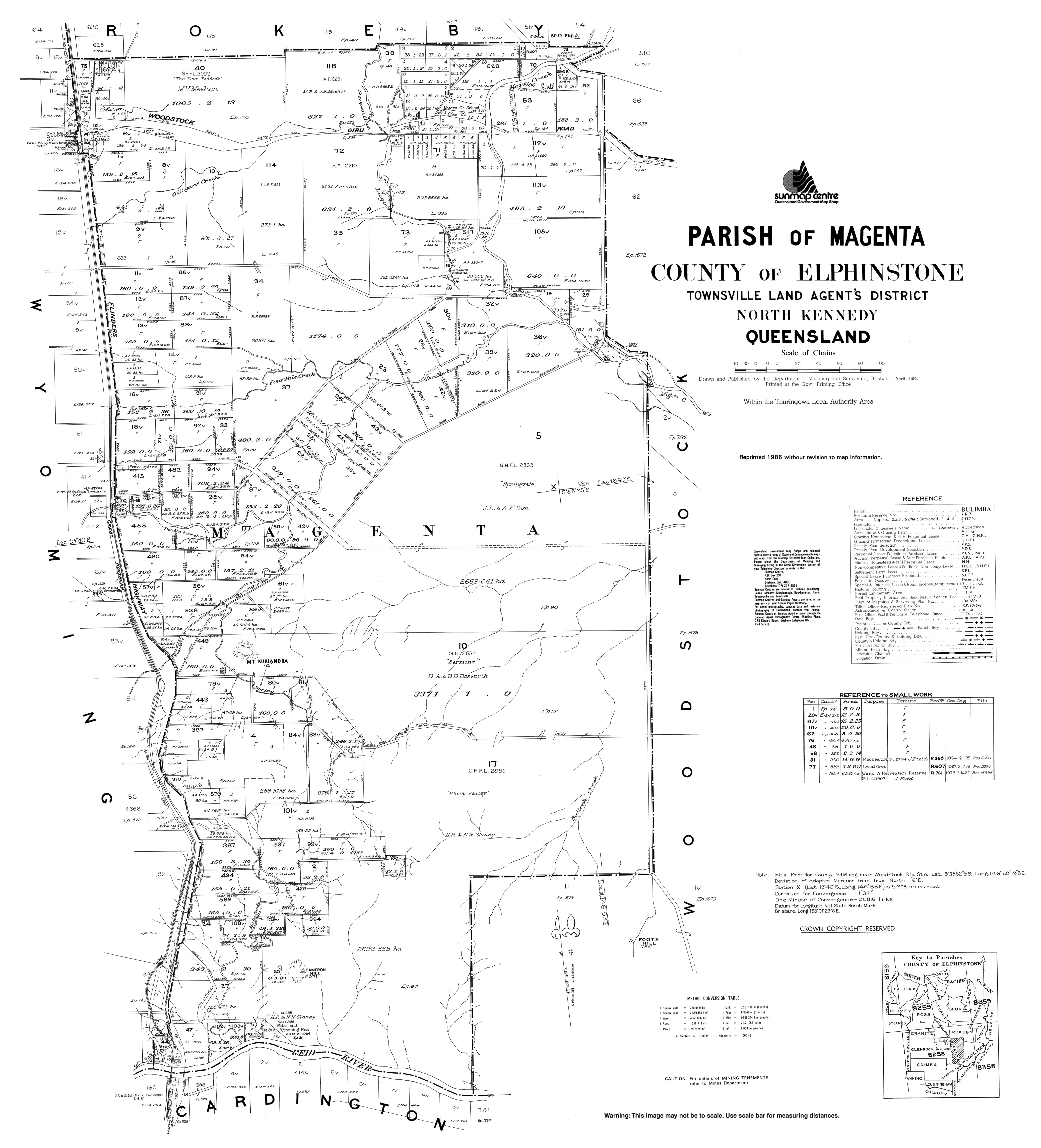
- ^ "Parish of Magenta" (Map). Queensland Government. 1980. Archived from the original on 13 April 2022. Retrieved 13 April 2022.
- ^ "Town map of Malbon". Queensland Government. 1960. Archived from the original on 6 January 2018. Retrieved 6 January 2018.
- ^ "Town map of Maxwelton" (Map). Queensland Government. 1978. Retrieved 30 December 2021.
- ^ "Town of Mingela" (Map). Queensland Government. 1976. Archived from the original on 6 January 2018. Retrieved 14 January 2021.
- ^ "Mingela State School". 24 May 2003. Archived from the original on 24 May 2003. Retrieved 24 April 2022.
- ^ "Mirani" (Map). Queensland Government. 1942. Archived from the original on 27 October 2020. Retrieved 9 April 2022.
- ^ "Parish of Pelion" (Map). Queensland Government. 1975. Archived from the original on 8 April 2022. Retrieved 9 April 2022.
- ^ "Home page". Mount Charlton State School. 30 October 2009. Archived from the original on 30 October 2009. Retrieved 8 April 2022.
- ^ "Mount Christian – mountain in Mackay Region (entry 7170)". Queensland Place Names. Queensland Government. Retrieved 17 January 2018.
- ^ "Mount Christian – railway station in Mackay Region (entry 22993)". Queensland Place Names. Queensland Government. Retrieved 17 January 2018.
- ^ "Mount Cobalt Mine". mindat.org. Hudson Institute of Mineralogy. Archived from the original on 17 January 2018. Retrieved 17 January 2018.
21° 44' 13'' South, 140° 29' 34'' East
- ^ "Home". Mount Isa State High School. 29 November 2002. Archived from the original on 29 November 2002. Retrieved 24 April 2022.
- ^ "Mount Leyshon – unbounded locality in Charters Towers Region (entry 23072)". Queensland Place Names. Queensland Government. Retrieved 17 January 2018.
- ^ a b "St Helens" (Map). Queensland Government. 1944. Archived from the original on 27 January 2021. Retrieved 28 April 2022.
- ^ "Queensland Two Mile series sheet 2m309" (Map). Queensland Government. 1952. Archived from the original on 18 February 2021. Retrieved 19 January 2021.
- ^ "St Helens" (Map). Queensland Government. 1944. Archived from the original on 27 January 2021. Retrieved 19 January 2021.
- ^ "Mount Proserpine – mountain in the Whitsunday Region (entry 27554)". Queensland Place Names. Queensland Government. Retrieved 17 January 2018.
- ^ "Parish of Ossa Sheet 2" (Map). Queensland Government. 1980. Archived from the original on 24 April 2022. Retrieved 22 April 2022.
- ^ "Mirani" (Map). Queensland Government. 1942. Archived from the original on 27 October 2020. Retrieved 22 April 2022.
- ^ Google (22 April 2022). "Narpi State School (former)" (Map). Google Maps. Google. Retrieved 22 April 2022.
- ^ "Narpi – unbounded locality in Mackay Region (entry 23882)". Queensland Place Names. Queensland Government. Retrieved 17 January 2018.
- ^ "Town map of Nonda" (Map). Queensland Government. 1970. Archived from the original on 7 January 2018. Retrieved 30 December 2021.
- ^ "Norwood – unbounded locality in Charters Towers Region (entry 24776)". Queensland Place Names. Queensland Government. Retrieved 17 January 2018.
- ^ "RAISING STATUS OF SCHOOL". The Telegraph. No. 12, 322. Queensland, Australia. 16 May 1912. p. 2 (SECOND EDITION). Archived from the original on 10 January 2021. Retrieved 17 January 2018 – via National Library of Australia.
- ^ "Pandanus Creek – creek in Charters Towers Region (entry 25989)". Queensland Place Names. Queensland Government. Retrieved 17 January 2018.
- ^ "Parish of Cordelia". 1977. Archived from the original on 29 December 2020. Retrieved 29 December 2020.
- ^ "Parish of Marathon, County of Cardwell" (Map). Queensland Government. 1976. Archived from the original on 24 April 2022. Retrieved 6 May 2022.
- ^ "Queensland Two Mile series sheet 2m310" (Map). Queensland Government. 1939. Archived from the original on 28 April 2022. Retrieved 28 April 2022.
- ^ "Untitled". Queensland Government Gazette. 28 March 1900. p. 49:1092.
- ^ "Oombabia – unbounded locality in Charters Towers Region (entry 25466)". Queensland Place Names. Queensland Government. Retrieved 8 January 2017.
- ^ "Rochford – unbounded locality in Charters Towers Region (entry 28617)". Queensland Place Names. Queensland Government. Retrieved 17 January 2018.
- ^ "8160 Ingham" (Map). Queensland Government. 1977. Retrieved 7 May 2022.
- ^ "Lot 2 Ewan Road, Hidden Valley via, Paluma". Felix Reitano Real Estate. Archived from the original on 19 February 2017. Retrieved 6 May 2022.
- ^ Plane, Melanie (3 January 2018). "Historic Mackay region property hits the market: School house property dating back to early 1900s for sale". The Courier-Mail. Archived from the original on 29 April 2022. Retrieved 29 April 2022.
- ^ "8655-I-South Mirani D" (Map). Queensland Government. 1962. Archived from the original on 31 December 2021. Retrieved 29 April 2022.
- ^ "8655-1334 Mia Mia 4" (Map). Queensland Government. 1988. Archived from the original on 29 April 2022. Retrieved 29 April 2022.
- ^ Queensland Family History Society (2010), Queensland schools past and present (Version 1.01 ed.), Queensland Family History Society, ISBN 978-1-921171-26-0
- ^ Google (14 March 2021). "Stamford State School (former)" (Map). Google Maps. Google. Retrieved 14 March 2021.
- ^ "Home". Stamford State School. 19 April 2013. Archived from the original on 19 April 2013. Retrieved 16 August 2023.
- ^ "Stuart State School". Stuart State School. 20 March 2012. Archived from the original on 20 March 2012. Retrieved 16 August 2023.
- ^ "Sybil Creek – creek in the Mackay Region (entry 33014)". Queensland Place Names. Queensland Government. Retrieved 17 January 2018.
- ^ "Queensland Two Mile series sheet 2m309 Mackay" (Map). Queensland Government. 1935. Archived from the original on 18 March 2021. Retrieved 18 March 2021.
- ^ "Queensland Two Mile series sheet 2m309" (Map). Queensland Government. 1952. Archived from the original on 18 February 2021. Retrieved 18 March 2021.
- ^ "Mackay (western half)" (Map). Queensland Government. 1942. Archived from the original on 29 January 2021. Retrieved 20 March 2021.
- ^ "Queensland Two Mile series sheet 2m309" (Map). Queensland Government. 1952. Archived from the original on 18 February 2021. Retrieved 20 March 2021.
- ^ "Town of Torrens Creek" (Map). Queensland Government. 1975. Retrieved 21 March 2021.
- ^ "Ukalunda – unbounded locality in the Whitsunday Region (entry 35725)". Queensland Place Names. Queensland Government. Retrieved 17 January 2018.
- ^ "Wagoora – unbounded locality in Mackay Region (entry 36146)". Queensland Place Names. Queensland Government. Retrieved 17 January 2018.
- ^ "Gregory – parish in the Bundaberg Region (entry 14830)". Queensland Place Names. Queensland Government. Retrieved 8 January 2017.
- ^ "Wallum Creek – creek in the Bundaberg Region (entry 36357)". Queensland Place Names. Queensland Government. Retrieved 8 January 2017.
- ^ "Whitewood – unbounded locality in the Flinders Shire (entry 37355)". Queensland Place Names. Queensland Government. Retrieved 17 January 2018.
- ^ Queensland Family History Society (2010), Queensland schools past and present (Version 1.01 ed.), Queensland Family History Society, ISBN 978-1-921171-26-0
- ^ "Town of Yalboroo" (Map). Queensland Government. 1961. Archived from the original on 24 April 2017. Retrieved 28 April 2022.
- ^ "Parish of Waterview" (Map). Queensland Government. 1977. Archived from the original on 7 May 2022. Retrieved 7 May 2022.
- ^ "Halifax" (Map). Queensland Government. 1944. Archived from the original on 7 May 2022. Retrieved 7 May 2022.
- ^ a b "Our Story". The Cathedral School. Archived from the original on 8 March 2022. Retrieved 27 April 2022.
- ^ "Whitsunday Christian College". Archived from the original on 27 November 2018. Retrieved 21 November 2018.
External links edit
- "Opening and closing dates of Queensland Schools". Queensland Government., a directory of Government schools in Queensland. (Department of Education – Queensland Government)