ID | Name | Coordinates | Image |
---|
ES0000018 | Prepirineu Central català (official name: Prepirineu Central català) Other names: n/a | 42°15′18″N 1°41′18″E / 42.255°N 1.6883°E / 42.255; 1.6883 (Prepirineu Central català) | ![Looks like this Site of Community Interest has an image. Don't worry, you can take one of your own, and upload it too!](//upload.wikimedia.org/wikipedia/commons/thumb/b/b0/Port_del_Comte_i_serra_del_Verd_des_dels_Rasos_de_Peguera_P1220501.JPG/120px-Port_del_Comte_i_serra_del_Verd_des_dels_Rasos_de_Peguera_P1220501.JPG) |
ES0000019 | Aiguamolls de l'Alt Empordà (official name: Aiguamolls de l'Alt Empordà) Other names: n/a | 42°11′45″N 3°08′11″E / 42.1959°N 3.1364°E / 42.1959; 3.1364 (Aiguamolls de l'Alt Empordà) | ![Looks like this Site of Community Interest has an image. Don't worry, you can take one of your own, and upload it too!](//upload.wikimedia.org/wikipedia/commons/thumb/7/77/Aiguamolls_de_l%27Empord%C3%A0.jpg/135px-Aiguamolls_de_l%27Empord%C3%A0.jpg) |
ES0000020 | Delta de l'Ebre (official name: Delta de l'Ebre) Other names: n/a | 40°36′44″N 0°46′18″E / 40.6121°N 0.7717°E / 40.6121; 0.7717 (Delta de l'Ebre) | ![Looks like this Site of Community Interest has an image. Don't worry, you can take one of your own, and upload it too!](//upload.wikimedia.org/wikipedia/commons/thumb/b/b3/EbroRiverDelta_ISS009-E-09985.jpg/90px-EbroRiverDelta_ISS009-E-09985.jpg) |
ES0000022 | Aigüestortes (official name: Aigüestortes) Other names: n/a | 42°33′13″N 0°56′43″E / 42.5536°N 0.9454°E / 42.5536; 0.9454 (Aigüestortes) | ![Looks like this Site of Community Interest has an image. Don't worry, you can take one of your own, and upload it too!](//upload.wikimedia.org/wikipedia/commons/thumb/7/73/Encantats.jpg/75px-Encantats.jpg) |
ES0000146 | Delta del Llobregat (official name: Delta del Llobregat) Other names: n/a | 41°16′37″N 0°59′09″E / 41.2769°N 0.9858°E / 41.2769; 0.9858 (Delta del Llobregat) | ![Looks like this Site of Community Interest has an image. Don't worry, you can take one of your own, and upload it too!](//upload.wikimedia.org/wikipedia/commons/thumb/0/03/Cal_Felip_i_camps_del_delta_del_Llobregat.jpg/120px-Cal_Felip_i_camps_del_delta_del_Llobregat.jpg) |
ES5110001 | Massís del Montseny (official name: Massís del Montseny) Other names: n/a | 41°46′33″N 2°20′45″E / 41.7757°N 2.3458°E / 41.7757; 2.3458 (Massís del Montseny) | ![Looks like this Site of Community Interest has an image. Don't worry, you can take one of your own, and upload it too!](//upload.wikimedia.org/wikipedia/commons/thumb/a/a1/Mass%C3%ADs_del_Montseny_01664.jpg/120px-Mass%C3%ADs_del_Montseny_01664.jpg) |
ES5110004 | Serra de Catllaràs (official name: Serra de Catllaràs) Other names: n/a | 42°12′09″N 1°56′40″E / 42.2025°N 1.9444°E / 42.2025; 1.9444 (Serra de Catllaràs) | ![Looks like this Site of Community Interest has an image. Don't worry, you can take one of your own, and upload it too!](//upload.wikimedia.org/wikipedia/commons/thumb/e/eb/Berga_i_el_Catllar%C3%A0s.jpg/175px-Berga_i_el_Catllar%C3%A0s.jpg) |
ES5110005 | Sistema Transversal català (official name: Sistema Transversal català) Other names: n/a | 42°07′49″N 2°20′16″E / 42.1304°N 2.3379°E / 42.1304; 2.3379 (Sistema Transversal català) | ![Looks like this Site of Community Interest has an image. Don't worry, you can take one of your own, and upload it too!](//upload.wikimedia.org/wikipedia/commons/thumb/7/72/Tavertet_02.jpg/135px-Tavertet_02.jpg) |
ES5110007 | Riu i Estanys de Tordera (official name: Riu i Estanys de Tordera) Other names: n/a | 41°42′17″N 2°42′39″E / 41.7048°N 2.7108°E / 41.7048; 2.7108 (Riu i Estanys de Tordera) | ![Looks like this Site of Community Interest has an image. Don't worry, you can take one of your own, and upload it too!](//upload.wikimedia.org/wikipedia/commons/thumb/c/c9/Montseny_-_Rio_Tordera.jpg/120px-Montseny_-_Rio_Tordera.jpg) |
ES5110008 | Gallifa-Cingles de Bertí (official name: Gallifa-Cingles de Bertí) Other names: n/a | 41°42′56″N 2°13′00″E / 41.7155°N 2.2167°E / 41.7155; 2.2167 (Gallifa-Cingles de Bertí) | ![Looks like this Site of Community Interest has an image. Don't worry, you can take one of your own, and upload it too!](//upload.wikimedia.org/wikipedia/commons/thumb/3/3e/Gallifa-7688.JPG/135px-Gallifa-7688.JPG) |
ES5110009 | Riera de Merlès (official name: Riera de Merlès) Other names: n/a | 41°58′20″N 1°59′05″E / 41.9722°N 1.9847°E / 41.9722; 1.9847 (Riera de Merlès) | ![Looks like this Site of Community Interest has an image. Don't worry, you can take one of your own, and upload it too!](//upload.wikimedia.org/wikipedia/commons/thumb/8/85/Bauma%2C_riera_de_Merl%C3%A8s.jpg/135px-Bauma%2C_riera_de_Merl%C3%A8s.jpg) |
ES5110010 | Sant Llorenç del Munt i l'Obac (official name: Sant Llorenç del Munt i l'Obac) Other names: n/a | 41°39′57″N 1°58′23″E / 41.6659°N 1.973°E / 41.6659; 1.973 (Sant Llorenç del Munt i l'Obac) | ![Looks like this Site of Community Interest has an image. Don't worry, you can take one of your own, and upload it too!](//upload.wikimedia.org/wikipedia/commons/thumb/1/1c/Sant-Llorenc-vegetacio-caracteristica.jpg/67px-Sant-Llorenc-vegetacio-caracteristica.jpg) |
ES5110011 | Serres del Litoral Septentrional (official name: Serres del Litoral Septentrional) Other names: n/a | 41°39′50″N 2°38′11″E / 41.664°N 2.6364°E / 41.664; 2.6364 (Serres del Litoral Septentrional) | ![Looks like this Site of Community Interest has an image. Don't worry, you can take one of your own, and upload it too!](//upload.wikimedia.org/wikipedia/commons/thumb/f/f3/Montnegre_i_el_corredor-2012_%282%29.JPG/136px-Montnegre_i_el_corredor-2012_%282%29.JPG) |
ES5110012 | Montserrat-Roques Blanques-riu Llobregat (official name: Montserrat-Roques Blanques-riu Llobregat) Other names: n/a | 41°35′15″N 1°50′32″E / 41.5876°N 1.8423°E / 41.5876; 1.8423 (Montserrat-Roques Blanques-riu Llobregat) | ![Looks like this Site of Community Interest has an image. Don't worry, you can take one of your own, and upload it too!](//upload.wikimedia.org/wikipedia/commons/thumb/b/b8/Montserrat_Mountains%2C_Catalonia%2C_Spain_-_Jan_2007.jpg/180px-Montserrat_Mountains%2C_Catalonia%2C_Spain_-_Jan_2007.jpg) |
ES5110013 | Serres del Litoral central (official name: Serres del Litoral central) Other names: n/a | 41°17′40″N 1°53′48″E / 41.2944°N 1.8967°E / 41.2944; 1.8967 (Serres del Litoral central) | ![Looks like this Site of Community Interest has an image. Don't worry, you can take one of your own, and upload it too!](//upload.wikimedia.org/wikipedia/commons/thumb/8/89/Panoramica-macizo-garraf.jpg/180px-Panoramica-macizo-garraf.jpg) |
ES5110014 | Serra de Castelltallat (official name: Serra de Castelltallat) Other names: n/a | 41°48′26″N 1°40′07″E / 41.8072°N 1.6686°E / 41.8072; 1.6686 (Serra de Castelltallat) | ![Looks like this Site of Community Interest has an image. Don't worry, you can take one of your own, and upload it too!](//upload.wikimedia.org/wikipedia/commons/thumb/8/8d/Serra_de_Castelltallat_%28Bages%29.jpg/135px-Serra_de_Castelltallat_%28Bages%29.jpg) |
ES5110015 | Sistema Prelitoral Central (official name: Sistema Prelitoral Central) Other names: n/a | 41°27′05″N 1°24′56″E / 41.4514°N 1.4156°E / 41.4514; 1.4156 (Sistema Prelitoral Central) | ![Looks like this Site of Community Interest has an image. Don't worry, you can take one of your own, and upload it too!](//upload.wikimedia.org/wikipedia/commons/thumb/3/35/Sistema_prelitoral_central_-_17.jpg/141px-Sistema_prelitoral_central_-_17.jpg) |
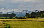
ES5110016 | Riera de Sorreigs (official name: Riera de Sorreigs) Other names: n/a | 42°00′27″N 2°10′37″E / 42.0075°N 2.1769°E / 42.0075; 2.1769 (Riera de Sorreigs) | ![Looks like this Site of Community Interest has an image. Don't worry, you can take one of your own, and upload it too!](//upload.wikimedia.org/wikipedia/commons/thumb/8/85/VorapresaP9210005.jpg/120px-VorapresaP9210005.jpg) |
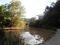
ES5110017 | Costes del Maresme (official name: Costes del Maresme) Other names: n/a | 41°31′41″N 2°29′16″E / 41.5281°N 2.4878°E / 41.5281; 2.4878 (Costes del Maresme) | ![Looks like this Site of Community Interest has an image. Don't worry, you can take one of your own, and upload it too!](//upload.wikimedia.org/wikipedia/commons/thumb/5/54/Mataro_waterfront.jpg/120px-Mataro_waterfront.jpg) |
ES5110018 | Valls de l'Anoia (official name: Valls de l'Anoia) Other names: n/a | 41°29′42″N 1°42′22″E / 41.4951°N 1.7061°E / 41.4951; 1.7061 (Valls de l'Anoia) | ![Looks like this Site of Community Interest has an image. Don't worry, you can take one of your own, and upload it too!](//upload.wikimedia.org/wikipedia/commons/thumb/c/cb/Valls_de_l%27Anoia_-_5.jpg/139px-Valls_de_l%27Anoia_-_5.jpg) |
ES5110019 | Carbassí (official name: Carbassí) Other names: n/a | 41°37′05″N 1°26′01″E / 41.6181°N 1.4336°E / 41.6181; 1.4336 (Carbassí) | ![Looks like this Site of Community Interest has an image. Don't worry, you can take one of your own, and upload it too!](//upload.wikimedia.org/wikipedia/commons/thumb/7/7a/PARC_CARBASI_-_IB-584.JPG/120px-PARC_CARBASI_-_IB-584.JPG) |
ES5110020 | Costes del Garraf (official name: Costes del Garraf) Other names: n/a | 41°11′53″N 1°51′25″E / 41.198°N 1.857°E / 41.198; 1.857 (Costes del Garraf) | ![Looks like this Site of Community Interest has an image. Don't worry, you can take one of your own, and upload it too!](//upload.wikimedia.org/wikipedia/commons/thumb/0/00/Vistas_desde_el_garraf_-_panoramio.jpg/120px-Vistas_desde_el_garraf_-_panoramio.jpg) |
ES5110021 | Riera de la Goda (official name: Riera de la Goda) Other names: n/a | 41°33′46″N 1°27′32″E / 41.5627°N 1.4588°E / 41.5627; 1.4588 (Riera de la Goda) | ![This Site of Community Interest has no photo. Take one and upload it! Thanks!](//upload.wikimedia.org/wikipedia/commons/thumb/3/33/Falta_imagen_r%C3%ADo.svg/90px-Falta_imagen_r%C3%ADo.svg.png) |
ES5110022 | Capçaleres del Foix (official name: Capçaleres del Foix) Other names: n/a | 41°26′26″N 1°35′11″E / 41.4406°N 1.5864°E / 41.4406; 1.5864 (Capçaleres del Foix) | ![Looks like this Site of Community Interest has an image. Don't worry, you can take one of your own, and upload it too!](//upload.wikimedia.org/wikipedia/commons/thumb/3/3d/Parc_del_Foix_-_2.jpg/135px-Parc_del_Foix_-_2.jpg) |
ES5110023 | Riera de Clariana (official name: Riera de Clariana) Other names: n/a | 41°36′20″N 1°29′24″E / 41.6056°N 1.49°E / 41.6056; 1.49 (Riera de Clariana) | ![Looks like this Site of Community Interest has an image. Don't worry, you can take one of your own, and upload it too!](//upload.wikimedia.org/wikipedia/commons/thumb/7/79/PARC_RIERA_DE_CLARIANA_-_IB-659.JPG/120px-PARC_RIERA_DE_CLARIANA_-_IB-659.JPG) |
ES5110024 | Serra de Collserola (official name: Serra de Collserola) Other names: n/a | 41°24′51″N 2°02′51″E / 41.4141°N 2.0476°E / 41.4141; 2.0476 (Serra de Collserola) | ![Looks like this Site of Community Interest has an image. Don't worry, you can take one of your own, and upload it too!](//upload.wikimedia.org/wikipedia/commons/thumb/c/cf/Prop_de_Can_Bosquets_P1240459.JPG/120px-Prop_de_Can_Bosquets_P1240459.JPG) |
ES5110025 | Riu Congost (official name: Riu Congost) Other names: n/a | 41°32′44″N 2°14′25″E / 41.5455°N 2.2403°E / 41.5455; 2.2403 (Riu Congost) | ![Looks like this Site of Community Interest has an image. Don't worry, you can take one of your own, and upload it too!](//upload.wikimedia.org/wikipedia/commons/thumb/e/e9/El_riu_Congost_a_l%27al%C3%A7ada_de_la_Garriga.jpg/67px-El_riu_Congost_a_l%27al%C3%A7ada_de_la_Garriga.jpg) |
ES5120001 | Alta Garrotxa - Massís de les Salines (official name: Alta Garrotxa - Massís de les Salines) Other names: n/a | 42°18′23″N 2°35′44″E / 42.3065°N 2.5956°E / 42.3065; 2.5956 (Alta Garrotxa - Massís de les Salines) | ![Looks like this Site of Community Interest has an image. Don't worry, you can take one of your own, and upload it too!](//upload.wikimedia.org/wikipedia/commons/thumb/8/88/Alta_Garrotxa-_Tossal_Gros.JPG/120px-Alta_Garrotxa-_Tossal_Gros.JPG) |
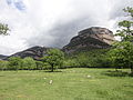
ES5120002 | Capçaleres del Ter i del Freser (official name: Capçaleres del Ter i del Freser) Other names: n/a | 42°23′05″N 2°13′00″E / 42.3846°N 2.2167°E / 42.3846; 2.2167 (Capçaleres del Ter i del Freser) | ![Looks like this Site of Community Interest has an image. Don't worry, you can take one of your own, and upload it too!](//upload.wikimedia.org/wikipedia/commons/thumb/a/a4/Puigmal_des_de_la_vall_de_Noufonts_P1020979.jpg/120px-Puigmal_des_de_la_vall_de_Noufonts_P1020979.jpg) |
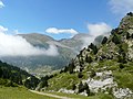
ES5120003 | Serra Cavallera (official name: Serra Cavallera) Other names: n/a | 42°17′25″N 2°14′00″E / 42.2903°N 2.2334°E / 42.2903; 2.2334 (Serra Cavallera) | ![Looks like this Site of Community Interest has an image. Don't worry, you can take one of your own, and upload it too!](//upload.wikimedia.org/wikipedia/commons/thumb/9/9b/Puig_de_Coma_d%27Olla_P1150307.jpg/138px-Puig_de_Coma_d%27Olla_P1150307.jpg) |
ES5120004 | Zona Volcànica de la Garrotxa (official name: Zona Volcànica de la Garrotxa) Other names: n/a | 42°05′28″N 2°29′02″E / 42.0911°N 2.4839°E / 42.0911; 2.4839 (Zona Volcànica de la Garrotxa) | ![Looks like this Site of Community Interest has an image. Don't worry, you can take one of your own, and upload it too!](//upload.wikimedia.org/wikipedia/commons/thumb/3/34/Zona_volc%C3%A0nica_de_la_Garrotxa_-_6.jpg/143px-Zona_volc%C3%A0nica_de_la_Garrotxa_-_6.jpg) |
ES5120005 | Riu Llobregat d'Empordà (official name: Riu Llobregat d'Empordà) Other names: n/a | 42°19′54″N 2°56′50″E / 42.3317°N 2.9473°E / 42.3317; 2.9473 (Riu Llobregat d'Empordà) | ![Looks like this Site of Community Interest has an image. Don't worry, you can take one of your own, and upload it too!](//upload.wikimedia.org/wikipedia/commons/thumb/9/9e/Llobregat_d%27Empord%C3%A0.JPG/135px-Llobregat_d%27Empord%C3%A0.JPG) |
ES5120007 | Cap de Creus (official name: Cap de Creus) Other names: n/a | 42°18′13″N 3°13′47″E / 42.3036°N 3.2296°E / 42.3036; 3.2296 (Cap de Creus) | ![Looks like this Site of Community Interest has an image. Don't worry, you can take one of your own, and upload it too!](//upload.wikimedia.org/wikipedia/commons/thumb/7/73/Paisaje_Cabo_de_Creus.jpg/135px-Paisaje_Cabo_de_Creus.jpg) |
ES5120008 | Estany de Banyoles (official name: Estany de Banyoles) Other names: n/a | 42°07′35″N 2°44′32″E / 42.1264°N 2.7422°E / 42.1264; 2.7422 (Estany de Banyoles) | ![Looks like this Site of Community Interest has an image. Don't worry, you can take one of your own, and upload it too!](//upload.wikimedia.org/wikipedia/commons/thumb/6/61/Aerea_estany_de_banyoles.png/140px-Aerea_estany_de_banyoles.png) |
ES5120009 | Basses de l'Albera (official name: Basses de l'Albera) Other names: n/a | 42°24′00″N 2°55′29″E / 42.4001°N 2.9248°E / 42.4001; 2.9248 (Basses de l'Albera) | ![Looks like this Site of Community Interest has an image. Don't worry, you can take one of your own, and upload it too!](//upload.wikimedia.org/wikipedia/commons/thumb/d/db/La_Jonquera_003.jpg/120px-La_Jonquera_003.jpg) |
ES5120010 | Les Gavarres (official name: Les Gavarres) Other names: n/a | 41°55′27″N 2°58′12″E / 41.9242°N 2.97°E / 41.9242; 2.97 (Les Gavarres) | ![Looks like this Site of Community Interest has an image. Don't worry, you can take one of your own, and upload it too!](//upload.wikimedia.org/wikipedia/commons/thumb/6/6b/Serra_de_Cals.jpg/120px-Serra_de_Cals.jpg) |
ES5120011 | Riberes del Baix Ter (official name: Riberes del Baix Ter) Other names: n/a | 42°00′58″N 2°51′12″E / 42.0161°N 2.8533°E / 42.0161; 2.8533 (Riberes del Baix Ter) | ![Looks like this Site of Community Interest has an image. Don't worry, you can take one of your own, and upload it too!](//upload.wikimedia.org/wikipedia/commons/thumb/b/ba/ARBRES%2C_AIGUA_I_EL_MONTGR%C3%8D.jpg/67px-ARBRES%2C_AIGUA_I_EL_MONTGR%C3%8D.jpg) |
ES5120012 | Les Guilleries (official name: Les Guilleries) Other names: n/a | 41°56′11″N 2°29′54″E / 41.9364°N 2.4983°E / 41.9364; 2.4983 (Les Guilleries) | ![Looks like this Site of Community Interest has an image. Don't worry, you can take one of your own, and upload it too!](//upload.wikimedia.org/wikipedia/commons/thumb/a/a3/Formiga_P8100357.JPG/67px-Formiga_P8100357.JPG) |
ES5120013 | Massís de les Cadiretes (official name: Massís de les Cadiretes) Other names: n/a | 41°46′05″N 2°55′49″E / 41.768°N 2.9303°E / 41.768; 2.9303 (Massís de les Cadiretes) | ![Looks like this Site of Community Interest has an image. Don't worry, you can take one of your own, and upload it too!](//upload.wikimedia.org/wikipedia/commons/thumb/f/fa/Vall_d%27Aro.jpg/135px-Vall_d%27Aro.jpg) |
ES5120014 | L'Albera (official name: L'Albera) Other names: n/a | 42°24′57″N 3°01′58″E / 42.4159°N 3.0329°E / 42.4159; 3.0329 (L'Albera) | ![Looks like this Site of Community Interest has an image. Don't worry, you can take one of your own, and upload it too!](//upload.wikimedia.org/wikipedia/commons/thumb/9/97/Espolla_004.jpg/120px-Espolla_004.jpg) |
ES5120015 | Litoral del Baix Empordà (official name: Litoral del Baix Empordà) Other names: n/a | 41°51′52″N 3°10′08″E / 41.8645°N 3.1689°E / 41.8645; 3.1689 (Litoral del Baix Empordà) | ![Looks like this Site of Community Interest has an image. Don't worry, you can take one of your own, and upload it too!](//upload.wikimedia.org/wikipedia/commons/thumb/9/9d/Cap_de_Planes_i_illes_Formigues.jpg/120px-Cap_de_Planes_i_illes_Formigues.jpg) |
ES5120016 | El Montgrí- Les Medes - El Baix Ter (official name: El Montgrí- Les Medes - El Baix Ter) Other names: n/a | 42°04′55″N 3°10′11″E / 42.082°N 3.1696°E / 42.082; 3.1696 (El Montgrí- Les Medes - El Baix Ter) | ![Looks like this Site of Community Interest has an image. Don't worry, you can take one of your own, and upload it too!](//upload.wikimedia.org/wikipedia/commons/thumb/9/9e/Mass%C3%ADs_del_Montgr%C3%AD%2C_dunes_i_illes_Medes_des_del_Castell.JPG/161px-Mass%C3%ADs_del_Montgr%C3%AD%2C_dunes_i_illes_Medes_des_del_Castell.JPG) |
ES5120017 | Estany de Sils-Ribera de Santa Coloma (official name: Estany de Sils-Ribera de Santa Coloma) Other names: n/a | 41°47′45″N 2°44′02″E / 41.7957°N 2.7338°E / 41.7957; 2.7338 (Estany de Sils-Ribera de Santa Coloma) | ![Looks like this Site of Community Interest has an image. Don't worry, you can take one of your own, and upload it too!](//upload.wikimedia.org/wikipedia/commons/thumb/8/82/Estany_de_Sils.jpg/141px-Estany_de_Sils.jpg) |
ES5120018 | Muntanyes de Rocacorba-Puig de la Banya del Boc (official name: Muntanyes de Rocacorba-Puig de la Banya del Boc) Other names: n/a | 42°03′56″N 2°41′35″E / 42.0656°N 2.6931°E / 42.0656; 2.6931 (Muntanyes de Rocacorba-Puig de la Banya del Boc) | ![Looks like this Site of Community Interest has an image. Don't worry, you can take one of your own, and upload it too!](//upload.wikimedia.org/wikipedia/commons/thumb/b/b7/Vista_Muntanyes_de_Rocacorba%2C_des_de_Rocacorba%2C_sobre_Banyoles.jpg/151px-Vista_Muntanyes_de_Rocacorba%2C_des_de_Rocacorba%2C_sobre_Banyoles.jpg) |
ES5120019 | Riberes de l'Alt Ter (official name: Riberes de l'Alt Ter) Other names: n/a | 42°13′57″N 2°17′38″E / 42.2324°N 2.294°E / 42.2324; 2.294 (Riberes de l'Alt Ter) | ![Looks like this Site of Community Interest has an image. Don't worry, you can take one of your own, and upload it too!](//upload.wikimedia.org/wikipedia/commons/thumb/0/05/Sant_Joan_de_les_Abadesses-PM_25703.jpg/135px-Sant_Joan_de_les_Abadesses-PM_25703.jpg) |
ES5120020 | Riu Llémena (official name: Riu Llémena) Other names: n/a | 42°04′14″N 2°36′21″E / 42.0705°N 2.6057°E / 42.0705; 2.6057 (Riu Llémena) | ![Looks like this Site of Community Interest has an image. Don't worry, you can take one of your own, and upload it too!](//upload.wikimedia.org/wikipedia/commons/thumb/b/bb/Riera_de_la_Ll%C3%A9mena.jpg/135px-Riera_de_la_Ll%C3%A9mena.jpg) |
ES5120021 | Riu Fluvià (official name: Riu Fluvià) Other names: n/a | 42°09′16″N 2°56′13″E / 42.1545°N 2.9369°E / 42.1545; 2.9369 (Riu Fluvià) | ![Looks like this Site of Community Interest has an image. Don't worry, you can take one of your own, and upload it too!](//upload.wikimedia.org/wikipedia/commons/thumb/5/5b/El_FLuvi%C3%A0_a_Sant_Joan_Les_Fonts.jpg/120px-El_FLuvi%C3%A0_a_Sant_Joan_Les_Fonts.jpg) |
ES5120022 | Riu Duran (official name: Riu Duran) Other names: n/a | 42°25′25″N 1°47′44″E / 42.4235°N 1.7955°E / 42.4235; 1.7955 (Riu Duran) | ![This Site of Community Interest has no photo. Take one and upload it! Thanks!](//upload.wikimedia.org/wikipedia/commons/thumb/3/33/Falta_imagen_r%C3%ADo.svg/90px-Falta_imagen_r%C3%ADo.svg.png) |
ES5120023 | Rieres de Xuclà i Riudelleques (official name: Rieres de Xuclà i Riudelleques) Other names: n/a | 42°01′26″N 2°48′08″E / 42.0238°N 2.8021°E / 42.0238; 2.8021 (Rieres de Xuclà i Riudelleques) | ![Looks like this Site of Community Interest has an image. Don't worry, you can take one of your own, and upload it too!](//upload.wikimedia.org/wikipedia/commons/thumb/a/ad/Salt_del_Timbarro.jpg/135px-Salt_del_Timbarro.jpg) |
ES5120024 | Montgrony (official name: Montgrony) Other names: n/a | 42°16′56″N 2°04′59″E / 42.2822°N 2.0831°E / 42.2822; 2.0831 (Montgrony) | ![Looks like this Site of Community Interest has an image. Don't worry, you can take one of your own, and upload it too!](//upload.wikimedia.org/wikipedia/commons/thumb/8/8c/Serra_de_Montgrony.JPG/120px-Serra_de_Montgrony.JPG) |
ES5120025 | Garriga d'Empordà (official name: Garriga d'Empordà) Other names: n/a | 42°16′07″N 2°54′40″E / 42.2686°N 2.9111°E / 42.2686; 2.9111 (Garriga d'Empordà) | ![Looks like this Site of Community Interest has an image. Don't worry, you can take one of your own, and upload it too!](//upload.wikimedia.org/wikipedia/commons/thumb/4/4e/Garriga_Emporda.jpg/120px-Garriga_Emporda.jpg) |
ES5120026 | Tossa Plana de Lles-Puigpedrós (official name: Tossa Plana de Lles-Puigpedrós) Other names: n/a | 42°26′59″N 1°40′10″E / 42.4497°N 1.6695°E / 42.4497; 1.6695 (Tossa Plana de Lles-Puigpedrós) | ![Looks like this Site of Community Interest has an image. Don't worry, you can take one of your own, and upload it too!](//upload.wikimedia.org/wikipedia/commons/thumb/0/02/Tossa_Plana_de_Lles.jpg/120px-Tossa_Plana_de_Lles.jpg) |
ES5120027 | Rasos de Tubau (official name: Rasos de Tubau) Other names: n/a | 42°13′26″N 2°02′50″E / 42.2239°N 2.0472°E / 42.2239; 2.0472 (Rasos de Tubau) | ![This Site of Community Interest has no photo. Take one and upload it! Thanks!](//upload.wikimedia.org/wikipedia/commons/thumb/3/33/Falta_imagen_r%C3%ADo.svg/90px-Falta_imagen_r%C3%ADo.svg.png) |
ES5120028 | Vall del Rigart (official name: Vall del Rigart) Other names: n/a | 42°18′48″N 2°07′13″E / 42.3133°N 2.1203°E / 42.3133; 2.1203 (Vall del Rigart) | ![This Site of Community Interest has no photo. Take one and upload it! Thanks!](//upload.wikimedia.org/wikipedia/commons/thumb/3/33/Falta_imagen_r%C3%ADo.svg/90px-Falta_imagen_r%C3%ADo.svg.png) |
ES5120029 | Riu Brugent (official name: Riu Brugent) Other names: n/a | 42°02′15″N 2°34′20″E / 42.0376°N 2.5723°E / 42.0376; 2.5723 (Riu Brugent) | ![This Site of Community Interest has no photo. Take one and upload it! Thanks!](//upload.wikimedia.org/wikipedia/commons/thumb/3/33/Falta_imagen_r%C3%ADo.svg/90px-Falta_imagen_r%C3%ADo.svg.png) |
ES5130001 | Els Bessons (official name: Els Bessons) Other names: n/a | 41°28′04″N 0°50′52″E / 41.4678°N 0.8478°E / 41.4678; 0.8478 (Els Bessons) | ![This Site of Community Interest has no photo. Take one and upload it! Thanks!](//upload.wikimedia.org/wikipedia/commons/thumb/3/33/Falta_imagen_r%C3%ADo.svg/90px-Falta_imagen_r%C3%ADo.svg.png) |
ES5130002 | Riu Verneda (official name: Riu Verneda) Other names: n/a | 42°23′27″N 1°40′16″E / 42.3908°N 1.6711°E / 42.3908; 1.6711 (Riu Verneda) | ![This Site of Community Interest has no photo. Take one and upload it! Thanks!](//upload.wikimedia.org/wikipedia/commons/thumb/3/33/Falta_imagen_r%C3%ADo.svg/90px-Falta_imagen_r%C3%ADo.svg.png) |
ES5130003 | Alt Pallars (official name: Alt Pallars) Other names: n/a | 42°42′57″N 1°02′02″E / 42.7159°N 1.034°E / 42.7159; 1.034 (Alt Pallars) | ![Looks like this Site of Community Interest has an image. Don't worry, you can take one of your own, and upload it too!](//upload.wikimedia.org/wikipedia/commons/thumb/b/b7/Parc_natural_de_l%27alt_pirineu.jpg/136px-Parc_natural_de_l%27alt_pirineu.jpg) |
ES5130004 | Baish Aran (official name: Baish Aran) Other names: n/a | 42°47′56″N 0°47′17″E / 42.799°N 0.7879999999999999°E / 42.799; 0.7879999999999999 (Baish Aran) | ![Looks like this Site of Community Interest has an image. Don't worry, you can take one of your own, and upload it too!](//upload.wikimedia.org/wikipedia/commons/thumb/4/47/Eth_b%C3%B2sc_de_Carlac.JPG/160px-Eth_b%C3%B2sc_de_Carlac.JPG) |
ES5130005 | Era Artiga de Lin - Eth Portilhon (official name: Era Artiga de Lin - Eth Portilhon) Other names: n/a | 42°40′17″N 0°43′00″E / 42.6713°N 0.7168°E / 42.6713; 0.7168 (Era Artiga de Lin - Eth Portilhon) | ![Looks like this Site of Community Interest has an image. Don't worry, you can take one of your own, and upload it too!](//upload.wikimedia.org/wikipedia/commons/thumb/0/0f/C%C3%B2th_de_Baretja.JPG/160px-C%C3%B2th_de_Baretja.JPG) |
ES5130006 | Estanho de Vielha (official name: Estanho de Vielha) Other names: n/a | 42°42′34″N 0°48′52″E / 42.7095°N 0.8144°E / 42.7095; 0.8144 (Estanho de Vielha) | ![Looks like this Site of Community Interest has an image. Don't worry, you can take one of your own, and upload it too!](//upload.wikimedia.org/wikipedia/commons/thumb/7/7a/Estanho_de_Vielha_amb_Luronium_natans.JPG/160px-Estanho_de_Vielha_amb_Luronium_natans.JPG) |
ES5130007 | Riberes de l'Alt Segre (official name: Riberes de l'Alt Segre) Other names: n/a | 42°23′29″N 1°51′00″E / 42.3915°N 1.8499°E / 42.3915; 1.8499 (Riberes de l'Alt Segre) | ![Looks like this Site of Community Interest has an image. Don't worry, you can take one of your own, and upload it too!](//upload.wikimedia.org/wikipedia/commons/thumb/8/83/Riberes_de_l%27Alt_Segre_-_3.jpg/139px-Riberes_de_l%27Alt_Segre_-_3.jpg) |
ES5130008 | Serra d'Aubenç i Roc de Cogul (official name: Serra d'Aubenç i Roc de Cogul) Other names: n/a | 42°05′05″N 1°16′33″E / 42.0847°N 1.2758°E / 42.0847; 1.2758 (Serra d'Aubenç i Roc de Cogul) | ![Looks like this Site of Community Interest has an image. Don't worry, you can take one of your own, and upload it too!](//upload.wikimedia.org/wikipedia/commons/thumb/4/45/Serra_d%27Auben%C3%A7_i_Roc_de_Cogul_-_3.jpg/137px-Serra_d%27Auben%C3%A7_i_Roc_de_Cogul_-_3.jpg) |
ES5130009 | Serra de Turp i Mora Condal-Valldan (official name: Serra de Turp i Mora Condal-Valldan) Other names: n/a | 42°07′04″N 1°21′13″E / 42.1178°N 1.3536°E / 42.1178; 1.3536 (Serra de Turp i Mora Condal-Valldan) | ![Looks like this Site of Community Interest has an image. Don't worry, you can take one of your own, and upload it too!](//upload.wikimedia.org/wikipedia/commons/thumb/3/34/SERRA_DE_TURP_-_ALINY%C3%80_-_IB-_424.JPG/120px-SERRA_DE_TURP_-_ALINY%C3%80_-_IB-_424.JPG) |
ES5130010 | Serra de Boumort-Collegats (official name: Serra de Boumort-Collegats) Other names: n/a | 42°14′12″N 1°06′01″E / 42.2367°N 1.1003°E / 42.2367; 1.1003 (Serra de Boumort-Collegats) | ![Looks like this Site of Community Interest has an image. Don't worry, you can take one of your own, and upload it too!](//upload.wikimedia.org/wikipedia/commons/thumb/8/8f/Conca_de_Dalt._La_Noguera_Pallaresa_sortint_de_Collegats.JPG/120px-Conca_de_Dalt._La_Noguera_Pallaresa_sortint_de_Collegats.JPG) |
ES5130011 | Riu de la Llosa (official name: Riu de la Llosa) Other names: n/a | 42°27′00″N 1°41′57″E / 42.45°N 1.6992°E / 42.45; 1.6992 (Riu de la Llosa) | ![Looks like this Site of Community Interest has an image. Don't worry, you can take one of your own, and upload it too!](//upload.wikimedia.org/wikipedia/commons/thumb/2/20/Salt_del_Mol%C3%AD_riu_La_Llosa.jpg/135px-Salt_del_Mol%C3%AD_riu_La_Llosa.jpg) |
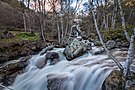
ES5130012 | Vall Alta de Serradell-Serra de Sant Gervàs (official name: Vall Alta de Serradell-Serra de Sant Gervàs) Other names: n/a | 42°13′50″N 0°48′45″E / 42.2305°N 0.8124°E / 42.2305; 0.8124 (Vall Alta de Serradell-Serra de Sant Gervàs) | ![Looks like this Site of Community Interest has an image. Don't worry, you can take one of your own, and upload it too!](//upload.wikimedia.org/wikipedia/commons/thumb/1/18/Conca_de_Dalt._Toralla_i_Serradell._Serradell_1.JPG/120px-Conca_de_Dalt._Toralla_i_Serradell._Serradell_1.JPG) |
ES5130013 | Aiguabarreig Segre-Cinca (official name: Aiguabarreig Segre-Cinca) Other names: n/a | 41°27′52″N 0°24′55″E / 41.4644°N 0.4153°E / 41.4644; 0.4153 (Aiguabarreig Segre-Cinca) | ![Looks like this Site of Community Interest has an image. Don't worry, you can take one of your own, and upload it too!](//upload.wikimedia.org/wikipedia/commons/thumb/8/8d/Cinca_Massalcoreig_1.JPG/120px-Cinca_Massalcoreig_1.JPG) |
ES5130014 | Aiguabarreig Segre-Noguera Pallaresa (official name: Aiguabarreig Segre-Noguera Pallaresa) Other names: n/a | 41°55′46″N 0°50′38″E / 41.9294°N 0.8439°E / 41.9294; 0.8439 (Aiguabarreig Segre-Noguera Pallaresa) | ![Looks like this Site of Community Interest has an image. Don't worry, you can take one of your own, and upload it too!](//upload.wikimedia.org/wikipedia/commons/thumb/d/d0/Aiguabarreig_del_riu_Segre_i_el_Noguera_Pallaresa.JPG/120px-Aiguabarreig_del_riu_Segre_i_el_Noguera_Pallaresa.JPG) |
ES5130015 | Serres del Montsec, Sant Mamet i Mitjana (official name: Serres del Montsec, Sant Mamet i Mitjana) Other names: n/a | 42°01′49″N 0°52′20″E / 42.0303°N 0.8722°E / 42.0303; 0.8722 (Serres del Montsec, Sant Mamet i Mitjana) | ![Looks like this Site of Community Interest has an image. Don't worry, you can take one of your own, and upload it too!](//upload.wikimedia.org/wikipedia/commons/thumb/9/99/SERRA_DE_SANT_MAMET_-_IB-583.JPG/120px-SERRA_DE_SANT_MAMET_-_IB-583.JPG) |
ES5130016 | Valls del Sió-Llobregós (official name: Valls del Sió-Llobregós) Other names: n/a | 41°49′02″N 1°11′52″E / 41.8172°N 1.1978°E / 41.8172; 1.1978 (Valls del Sió-Llobregós) | ![Looks like this Site of Community Interest has an image. Don't worry, you can take one of your own, and upload it too!](//upload.wikimedia.org/wikipedia/commons/thumb/6/67/Valls_del_Si%C3%B3-Llobreg%C3%B3s_-_2.jpg/135px-Valls_del_Si%C3%B3-Llobreg%C3%B3s_-_2.jpg) |
ES5130017 | Basses de Sucs i Alcarràs (official name: Basses de Sucs i Alcarràs) Other names: n/a | 41°38′41″N 0°29′03″E / 41.6447°N 0.4841°E / 41.6447; 0.4841 (Basses de Sucs i Alcarràs) | ![This Site of Community Interest has no photo. Take one and upload it! Thanks!](//upload.wikimedia.org/wikipedia/commons/thumb/3/33/Falta_imagen_r%C3%ADo.svg/90px-Falta_imagen_r%C3%ADo.svg.png) |
ES5130018 | Estany d'Ivars- Vilasana (official name: Estany d'Ivars- Vilasana) Other names: n/a | 41°41′01″N 0°56′59″E / 41.6836°N 0.9497°E / 41.6836; 0.9497 (Estany d'Ivars- Vilasana) | ![Looks like this Site of Community Interest has an image. Don't worry, you can take one of your own, and upload it too!](//upload.wikimedia.org/wikipedia/commons/thumb/d/d0/Estany_d%27Ivars_i_Vila-sana_-_2.jpg/136px-Estany_d%27Ivars_i_Vila-sana_-_2.jpg) |
ES5130019 | Estany de Montcortès (official name: Estany de Montcortès) Other names: n/a | 42°19′55″N 0°59′41″E / 42.3319°N 0.9947°E / 42.3319; 0.9947 (Estany de Montcortès) | ![Looks like this Site of Community Interest has an image. Don't worry, you can take one of your own, and upload it too!](//upload.wikimedia.org/wikipedia/commons/thumb/3/3c/Estany_de_Montcort%C3%A8s_1.JPG/120px-Estany_de_Montcort%C3%A8s_1.JPG) |
ES5130020 | Aiguabarreig Segre-Noguera Ribagorçana (official name: Aiguabarreig Segre-Noguera Ribagorçana) Other names: n/a | 41°40′54″N 0°42′55″E / 41.6818°N 0.7153°E / 41.6818; 0.7153 (Aiguabarreig Segre-Noguera Ribagorçana) | ![Looks like this Site of Community Interest has an image. Don't worry, you can take one of your own, and upload it too!](//upload.wikimedia.org/wikipedia/commons/thumb/8/86/Corb_segre.jpg/135px-Corb_segre.jpg) |
ES5130021 | Secans de la Noguera (official name: Secans de la Noguera) Other names: n/a | 41°49′25″N 0°42′17″E / 41.8236°N 0.7047°E / 41.8236; 0.7047 (Secans de la Noguera) | ![This Site of Community Interest has no photo. Take one and upload it! Thanks!](//upload.wikimedia.org/wikipedia/commons/thumb/3/33/Falta_imagen_r%C3%ADo.svg/90px-Falta_imagen_r%C3%ADo.svg.png) |
ES5130022 | La Torrassa (official name: La Torrassa) Other names: n/a | 42°36′23″N 1°07′59″E / 42.6064°N 1.1331°E / 42.6064; 1.1331 (La Torrassa) | ![Looks like this Site of Community Interest has an image. Don't worry, you can take one of your own, and upload it too!](//upload.wikimedia.org/wikipedia/commons/thumb/3/33/Pant%C3%A0_de_la_Torrassa.JPG/121px-Pant%C3%A0_de_la_Torrassa.JPG) |
ES5130023 | Beneïdor (official name: Beneïdor) Other names: n/a | 42°22′19″N 1°33′55″E / 42.3719°N 1.5653°E / 42.3719; 1.5653 (Beneïdor) | ![Looks like this Site of Community Interest has an image. Don't worry, you can take one of your own, and upload it too!](//upload.wikimedia.org/wikipedia/commons/thumb/b/b3/Roc_Bene%C3%AFdor_des_de_Castellciutat.jpg/120px-Roc_Bene%C3%AFdor_des_de_Castellciutat.jpg) |
ES5130024 | La Faiada de Malpàs i Cambatiri (official name: La Faiada de Malpàs i Cambatiri) Other names: n/a | 42°22′54″N 0°46′26″E / 42.3817°N 0.7739°E / 42.3817; 0.7739 (La Faiada de Malpàs i Cambatiri) | ![Looks like this Site of Community Interest has an image. Don't worry, you can take one of your own, and upload it too!](//upload.wikimedia.org/wikipedia/commons/thumb/6/68/El_Pont_de_Suert._La_Faiada_de_Malp%C3%A0s_1.JPG/120px-El_Pont_de_Suert._La_Faiada_de_Malp%C3%A0s_1.JPG) |
ES5130025 | Bellmunt-Almenara (official name: Bellmunt-Almenara) Other names: n/a | 41°46′52″N 0°57′10″E / 41.7811°N 0.9528°E / 41.7811; 0.9528 (Bellmunt-Almenara) | ![Looks like this Site of Community Interest has an image. Don't worry, you can take one of your own, and upload it too!](//upload.wikimedia.org/wikipedia/commons/thumb/8/84/Bellmunt-Almenara_-_5.jpg/135px-Bellmunt-Almenara_-_5.jpg) |
ES5130026 | Serra de Prada-Castellàs (official name: Serra de Prada-Castellàs) Other names: n/a | 42°16′16″N 1°18′16″E / 42.2711°N 1.3044°E / 42.2711; 1.3044 (Serra de Prada-Castellàs) | ![This Site of Community Interest has no photo. Take one and upload it! Thanks!](//upload.wikimedia.org/wikipedia/commons/thumb/3/33/Falta_imagen_r%C3%ADo.svg/90px-Falta_imagen_r%C3%ADo.svg.png) |
ES5130027 | Obagues de la riera de Madrona (official name: Obagues de la riera de Madrona) Other names: n/a | 41°58′14″N 1°23′06″E / 41.9706°N 1.385°E / 41.9706; 1.385 (Obagues de la riera de Madrona) | ![Looks like this Site of Community Interest has an image. Don't worry, you can take one of your own, and upload it too!](//upload.wikimedia.org/wikipedia/commons/thumb/8/8d/Madrona-PM_30021.jpg/180px-Madrona-PM_30021.jpg) |
ES5130028 | Ribera Salada (official name: Ribera Salada) Other names: n/a | 42°02′31″N 1°25′57″E / 42.0419°N 1.4325°E / 42.0419; 1.4325 (Ribera Salada) | ![Looks like this Site of Community Interest has an image. Don't worry, you can take one of your own, and upload it too!](//upload.wikimedia.org/wikipedia/commons/thumb/e/ec/La_Ribera_Salada_05_-_23072008.JPG/135px-La_Ribera_Salada_05_-_23072008.JPG) |
ES5130029 | Serres de Queralt i Els Tossals-Aigua d'Ora (official name: Serres de Queralt i Els Tossals-Aigua d'Ora) Other names: n/a | 42°03′33″N 1°40′12″E / 42.0592°N 1.67°E / 42.0592; 1.67 (Serres de Queralt i Els Tossals-Aigua d'Ora) | ![Looks like this Site of Community Interest has an image. Don't worry, you can take one of your own, and upload it too!](//upload.wikimedia.org/wikipedia/commons/thumb/2/25/246_Serres_de_Queralt_i_de_la_Petita%2C_des_de_Sant_Quirze_de_Pedret.jpg/165px-246_Serres_de_Queralt_i_de_la_Petita%2C_des_de_Sant_Quirze_de_Pedret.jpg) |
ES5130030 | Estanys de Basturs (official name: Estanys de Basturs) Other names: n/a | 42°08′43″N 1°01′08″E / 42.1453°N 1.0189°E / 42.1453; 1.0189 (Estanys de Basturs) | ![Looks like this Site of Community Interest has an image. Don't worry, you can take one of your own, and upload it too!](//upload.wikimedia.org/wikipedia/commons/thumb/6/6b/Isona_i_Conca_Dell%C3%A0._Orcau._Estanys_de_Basturs_4.JPG/120px-Isona_i_Conca_Dell%C3%A0._Orcau._Estanys_de_Basturs_4.JPG) |
ES5130032 | Vessants de la Noguera Ribagorçana (official name: Vessants de la Noguera Ribagorçana) Other names: n/a | 41°52′57″N 0°38′22″E / 41.8826°N 0.6394°E / 41.8826; 0.6394 (Vessants de la Noguera Ribagorçana) | ![Looks like this Site of Community Interest has an image. Don't worry, you can take one of your own, and upload it too!](//upload.wikimedia.org/wikipedia/commons/thumb/5/52/MONTESSOR_-_OS_DE_BALAGUER_-_IB-821.JPG/120px-MONTESSOR_-_OS_DE_BALAGUER_-_IB-821.JPG) |
ES5130034 | Riu Garona (official name: Riu Garona) Other names: n/a | 42°44′13″N 0°44′29″E / 42.7369°N 0.7414°E / 42.7369; 0.7414 (Riu Garona) | ![Looks like this Site of Community Interest has an image. Don't worry, you can take one of your own, and upload it too!](//upload.wikimedia.org/wikipedia/commons/thumb/7/71/Garonne_Bossost_pont_de_H%C3%A8r_aval.jpg/120px-Garonne_Bossost_pont_de_H%C3%A8r_aval.jpg) |
ES5130035 | Plans de la Unilla (official name: Plans de la Unilla) Other names: n/a | 41°45′59″N 0°33′05″E / 41.7665°N 0.5514°E / 41.7665; 0.5514 (Plans de la Unilla) | ![This Site of Community Interest has no photo. Take one and upload it! Thanks!](//upload.wikimedia.org/wikipedia/commons/thumb/3/33/Falta_imagen_r%C3%ADo.svg/90px-Falta_imagen_r%C3%ADo.svg.png) |
ES5130036 | Plans de Sió (official name: Plans de Sió) Other names: n/a | 41°43′18″N 1°07′37″E / 41.7217°N 1.1269°E / 41.7217; 1.1269 (Plans de Sió) | ![Looks like this Site of Community Interest has an image. Don't worry, you can take one of your own, and upload it too!](//upload.wikimedia.org/wikipedia/commons/thumb/a/af/Plans_de_Si%C3%B3_Segarra_02.jpg/120px-Plans_de_Si%C3%B3_Segarra_02.jpg) |
ES5130037 | Secans de Belianes-Preixana (official name: Secans de Belianes-Preixana) Other names: n/a | 41°35′34″N 1°00′46″E / 41.5928°N 1.0128°E / 41.5928; 1.0128 (Secans de Belianes-Preixana) | ![Looks like this Site of Community Interest has an image. Don't worry, you can take one of your own, and upload it too!](//upload.wikimedia.org/wikipedia/commons/thumb/2/26/Vista_a%C3%A8ria_de_Belianes.JPG/135px-Vista_a%C3%A8ria_de_Belianes.JPG) |
ES5130038 | Secans del Segrià i Utxesa (official name: Secans del Segrià i Utxesa) Other names: n/a | 41°26′38″N 0°27′55″E / 41.4439°N 0.4653°E / 41.4439; 0.4653 (Secans del Segrià i Utxesa) | ![Looks like this Site of Community Interest has an image. Don't worry, you can take one of your own, and upload it too!](//upload.wikimedia.org/wikipedia/commons/thumb/7/7e/Embassament_Utxesa.jpg/180px-Embassament_Utxesa.jpg) |
ES5130039 | Vall de Vinaixa (official name: Vall de Vinaixa) Other names: n/a | 41°26′08″N 0°59′40″E / 41.4356°N 0.9944°E / 41.4356; 0.9944 (Vall de Vinaixa) | ![This Site of Community Interest has no photo. Take one and upload it! Thanks!](//upload.wikimedia.org/wikipedia/commons/thumb/3/33/Falta_imagen_r%C3%ADo.svg/90px-Falta_imagen_r%C3%ADo.svg.png) |
ES5130040 | Secans de Mas de Melons-Alfés (official name: Secans de Mas de Melons-Alfés) Other names: n/a | 41°31′22″N 0°41′25″E / 41.5228°N 0.6903°E / 41.5228; 0.6903 (Secans de Mas de Melons-Alfés) | ![Looks like this Site of Community Interest has an image. Don't worry, you can take one of your own, and upload it too!](//upload.wikimedia.org/wikipedia/commons/thumb/6/6e/Bassa_de_mas_de_Melons.jpg/120px-Bassa_de_mas_de_Melons.jpg) |
ES5140001 | Litoral meridional tarragoní (official name: Litoral meridional tarragoní) Other names: n/a | 40°53′12″N 0°49′32″E / 40.8868°N 0.8256°E / 40.8868; 0.8256 (Litoral meridional tarragoní) | ![Looks like this Site of Community Interest has an image. Don't worry, you can take one of your own, and upload it too!](//upload.wikimedia.org/wikipedia/commons/thumb/5/54/GranRecorregut-92.jpg/120px-GranRecorregut-92.jpg) |
ES5140002 | Serra de Godall (official name: Serra de Godall) Other names: n/a | 40°37′58″N 0°27′40″E / 40.6327°N 0.4611°E / 40.6327; 0.4611 (Serra de Godall) | ![Looks like this Site of Community Interest has an image. Don't worry, you can take one of your own, and upload it too!](//upload.wikimedia.org/wikipedia/commons/thumb/7/79/Godall_0901_L_0028.JPG/120px-Godall_0901_L_0028.JPG) |
ES5140003 | Ribera de l'Algars (official name: Ribera de l'Algars) Other names: n/a | 41°07′02″N 0°13′45″E / 41.1172°N 0.2291°E / 41.1172; 0.2291 (Ribera de l'Algars) | ![This Site of Community Interest has no photo. Take one and upload it! Thanks!](//upload.wikimedia.org/wikipedia/commons/thumb/3/33/Falta_imagen_r%C3%ADo.svg/90px-Falta_imagen_r%C3%ADo.svg.png) |
ES5140004 | Sèquia Major (official name: Sèquia Major) Other names: n/a | 41°05′19″N 1°11′18″E / 41.0887°N 1.1882°E / 41.0887; 1.1882 (Sèquia Major) | ![Looks like this Site of Community Interest has an image. Don't worry, you can take one of your own, and upload it too!](//upload.wikimedia.org/wikipedia/commons/thumb/6/62/Un_canal_lleno_de_vida.jpg/135px-Un_canal_lleno_de_vida.jpg) |
ES5140005 | Serra de Montsià (official name: Serra de Montsià) Other names: n/a | 40°37′09″N 0°31′44″E / 40.6192°N 0.5289°E / 40.6192; 0.5289 (Serra de Montsià) | ![Looks like this Site of Community Interest has an image. Don't worry, you can take one of your own, and upload it too!](//upload.wikimedia.org/wikipedia/commons/thumb/1/12/Serra_del_Montsi%C3%A0_des_del_pla_de_Vinar%C3%B2s_P1170048.JPG/120px-Serra_del_Montsi%C3%A0_des_del_pla_de_Vinar%C3%B2s_P1170048.JPG) |
ES5140006 | Serres de Cardó- El Boix (official name: Serres de Cardó- El Boix) Other names: n/a | 40°54′29″N 0°34′55″E / 40.9081°N 0.5819°E / 40.9081; 0.5819 (Serres de Cardó- El Boix) | ![Looks like this Site of Community Interest has an image. Don't worry, you can take one of your own, and upload it too!](//upload.wikimedia.org/wikipedia/commons/thumb/d/d2/MassisdeCardo-montaspre2p.JPG/171px-MassisdeCardo-montaspre2p.JPG) |
ES5140007 | Costes del Tarragonès (official name: Costes del Tarragonès) Other names: n/a | 41°07′36″N 1°23′06″E / 41.1267°N 1.3851°E / 41.1267; 1.3851 (Costes del Tarragonès) | ![Looks like this Site of Community Interest has an image. Don't worry, you can take one of your own, and upload it too!](//upload.wikimedia.org/wikipedia/commons/thumb/c/c9/Tamarit_%28_Cala_Jobera%29.jpg/136px-Tamarit_%28_Cala_Jobera%29.jpg) |
ES5140008 | Muntanyes de Prades (official name: Muntanyes de Prades) Other names: n/a | 41°18′18″N 1°02′00″E / 41.305°N 1.0333°E / 41.305; 1.0333 (Muntanyes de Prades) | ![Looks like this Site of Community Interest has an image. Don't worry, you can take one of your own, and upload it too!](//upload.wikimedia.org/wikipedia/commons/thumb/e/ed/Muntanyes_de_prades.jpg/120px-Muntanyes_de_prades.jpg) |
ES5140009 | Tivissa-Vandellòs-Llaberia (official name: Tivissa-Vandellòs-Llaberia) Other names: n/a | 41°02′12″N 0°48′21″E / 41.0367°N 0.8058°E / 41.0367; 0.8058 (Tivissa-Vandellòs-Llaberia) | ![Looks like this Site of Community Interest has an image. Don't worry, you can take one of your own, and upload it too!](//upload.wikimedia.org/wikipedia/commons/thumb/6/6f/Tivissa_-_View_1.jpg/120px-Tivissa_-_View_1.jpg) |
ES5140010 | Riberes i Illes de l'Ebre (official name: Riberes i Illes de l'Ebre) Other names: n/a | 41°14′11″N 0°31′25″E / 41.2364°N 0.5237°E / 41.2364; 0.5237 (Riberes i Illes de l'Ebre) | ![Looks like this Site of Community Interest has an image. Don't worry, you can take one of your own, and upload it too!](//upload.wikimedia.org/wikipedia/commons/thumb/6/6a/Spain_Ebre_river_in_Miravet.jpg/120px-Spain_Ebre_river_in_Miravet.jpg) |
ES5140011 | Sistema Prelitoral meridional (official name: Sistema Prelitoral meridional) Other names: n/a | 40°48′19″N 0°23′08″E / 40.8053°N 0.3856°E / 40.8053; 0.3856 (Sistema Prelitoral meridional) | ![Looks like this Site of Community Interest has an image. Don't worry, you can take one of your own, and upload it too!](//upload.wikimedia.org/wikipedia/commons/thumb/9/92/Els_Ports.jpg/120px-Els_Ports.jpg) |
ES5140012 | Tossals d'Almatret i Riba Roja (official name: Tossals d'Almatret i Riba Roja) Other names: n/a | 41°13′29″N 0°23′52″E / 41.2247°N 0.3977°E / 41.2247; 0.3977 (Tossals d'Almatret i Riba Roja) | ![This Site of Community Interest has no photo. Take one and upload it! Thanks!](//upload.wikimedia.org/wikipedia/commons/thumb/3/33/Falta_imagen_r%C3%ADo.svg/90px-Falta_imagen_r%C3%ADo.svg.png) |
ES5140014 | Massís de Bonastre (official name: Massís de Bonastre) Other names: n/a | 41°13′27″N 1°28′25″E / 41.2242°N 1.4736°E / 41.2242; 1.4736 (Massís de Bonastre) | ![Looks like this Site of Community Interest has an image. Don't worry, you can take one of your own, and upload it too!](//upload.wikimedia.org/wikipedia/commons/thumb/1/18/Mass%C3%ADs_de_Bonastre_-_10.jpg/138px-Mass%C3%ADs_de_Bonastre_-_10.jpg) |
ES5140015 | Riu Siurana i planes del Priorat (official name: Riu Siurana i planes del Priorat) Other names: n/a | 41°10′57″N 0°48′23″E / 41.1825°N 0.8064°E / 41.1825; 0.8064 (Riu Siurana i planes del Priorat) | ![Looks like this Site of Community Interest has an image. Don't worry, you can take one of your own, and upload it too!](//upload.wikimedia.org/wikipedia/commons/thumb/8/8c/Riu_Siurana_i_planes_del_Priorat_-_24.jpg/136px-Riu_Siurana_i_planes_del_Priorat_-_24.jpg) |
ES5140016 | Tossal de Montagut (official name: Tossal de Montagut) Other names: n/a | 40°55′16″N 0°42′49″E / 40.9211°N 0.7136°E / 40.9211; 0.7136 (Tossal de Montagut) | ![This Site of Community Interest has no photo. Take one and upload it! Thanks!](//upload.wikimedia.org/wikipedia/commons/thumb/3/33/Falta_imagen_r%C3%ADo.svg/90px-Falta_imagen_r%C3%ADo.svg.png) |
ES5140017 | Serra de Montsant-Pas de l'Ase (official name: Serra de Montsant-Pas de l'Ase) Other names: n/a | 41°14′30″N 0°45′17″E / 41.2417°N 0.7547°E / 41.2417; 0.7547 (Serra de Montsant-Pas de l'Ase) | ![Looks like this Site of Community Interest has an image. Don't worry, you can take one of your own, and upload it too!](//upload.wikimedia.org/wikipedia/commons/thumb/3/34/Congost_de_Fraguerau.jpg/135px-Congost_de_Fraguerau.jpg) |
ES5140018 | El Montmell-Marmellar (official name: El Montmell-Marmellar) Other names: n/a | 41°20′15″N 1°30′20″E / 41.3375°N 1.5056°E / 41.3375; 1.5056 (El Montmell-Marmellar) | ![Looks like this Site of Community Interest has an image. Don't worry, you can take one of your own, and upload it too!](//upload.wikimedia.org/wikipedia/commons/thumb/8/8b/El_Montmell-Marmellar_-_33.jpg/129px-El_Montmell-Marmellar_-_33.jpg) |
ES5140019 | Riu Gaià (official name: Riu Gaià) Other names: n/a | 41°13′34″N 1°20′52″E / 41.2261°N 1.3478°E / 41.2261; 1.3478 (Riu Gaià) | ![Looks like this Site of Community Interest has an image. Don't worry, you can take one of your own, and upload it too!](//upload.wikimedia.org/wikipedia/commons/thumb/5/5d/Gai%C3%A0.jpg/120px-Gai%C3%A0.jpg) |
ES5140020 | Grapissar de la Masia Blanca (official name: Grapissar de la Masia Blanca) Other names: n/a | 41°10′09″N 1°30′41″E / 41.1692°N 1.5114°E / 41.1692; 1.5114 (Grapissar de la Masia Blanca) | ![This Site of Community Interest has no photo. Take one and upload it! Thanks!](//upload.wikimedia.org/wikipedia/commons/thumb/3/33/Falta_imagen_r%C3%ADo.svg/90px-Falta_imagen_r%C3%ADo.svg.png) |
ES5140021 | Obagues del riu Corb (official name: Obagues del riu Corb) Other names: n/a | 41°32′17″N 1°14′45″E / 41.5381°N 1.2458°E / 41.5381; 1.2458 (Obagues del riu Corb) | ![Looks like this Site of Community Interest has an image. Don't worry, you can take one of your own, and upload it too!](//upload.wikimedia.org/wikipedia/commons/thumb/c/c4/Obagues_del_Riu_Corb_-_2.jpg/135px-Obagues_del_Riu_Corb_-_2.jpg) |
ES5140022 | Barranc de Santes Creus (official name: Barranc de Santes Creus) Other names: n/a | 40°52′58″N 0°45′18″E / 40.8828°N 0.7551°E / 40.8828; 0.7551 (Barranc de Santes Creus) | ![This Site of Community Interest has no photo. Take one and upload it! Thanks!](//upload.wikimedia.org/wikipedia/commons/thumb/3/33/Falta_imagen_r%C3%ADo.svg/90px-Falta_imagen_r%C3%ADo.svg.png) |
ES5140023 | Secans del Montsià (official name: Secans del Montsià) Other names: n/a | 40°37′59″N 0°21′00″E / 40.6331°N 0.35°E / 40.6331; 0.35 (Secans del Montsià) | ![This Site of Community Interest has no photo. Take one and upload it! Thanks!](//upload.wikimedia.org/wikipedia/commons/thumb/3/33/Falta_imagen_r%C3%ADo.svg/90px-Falta_imagen_r%C3%ADo.svg.png) |