Kozara (Serbian Cyrillic: Козара) is a mountain in western Bosnia and Herzegovina, in the town of Kozarac and in the Bosanska Krajina region, bounded by the Sava River to the north, the Vrbas to the east, the Sana to the south, and the Una to the west. Its tallest peak is Lisina (978 m). In 1942 Kozara was the site of the Kozara Offensive, part of the Yugoslav National Liberation War and Partisan resistance during World War II.[2][3]
| Kozara | |
|---|---|
| Козара | |
 View of the tallest peak, Lisina | |
| Highest point | |
| Elevation | 977 m (3,205 ft)[1] |
| Coordinates | 44°58′15″N 16°58′39″E / 44.97095556°N 16.97743944°E[1] |
| Geography | |
 Kozara Location in Bosnia and Herzegovina | |
| Location | Kozarac, Bosnia and Herzegovina |
| Parent range | Pannonian island mountains |
Peaks
edit| Name | Height (m) |
|---|---|
| Lisina | 977 |
| Gola planina | 876 |
| Mrakovica | 806 |
| Glavuša | 793 |
| Bešića poljana | 784 |
| Talavića poljana | 780 |
| Jarčevica | 740 |
| Vrnovačka glava | 719 |
| Benkovac-Jurišina kosa | 705 |
| Zečiji kamen | 667 |
| Kozarački kamen | 659 |
| Šupljikovac | 652 |
| Vitlovska kosa | 589 |
| Palež | 542 |
| Mednjak | 440 |
Gallery
edit Side of the mountain called 'Kozarački kamen' - overlooking hamlet of Kozarac
 Kozarački kamen
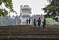


See also
editReferences
editWikimedia Commons has media related to Kozara.
- ^ a b "Topografska karta Prijedor 2-2".
- ^ "Kozara". Kozara National Park.
- ^ "Kozara Memorial". Memorial Museums.
 | This Bosnia and Herzegovina geography article is a stub. You can help Wikipedia by expanding it. |
🔥 Top keywords: Akademia e Shkencave e RPS te ShqiperiseAlexandria Ocasio-CortezBilderberg GroupCristiano RonaldoDong XiaowanMinecraftOperation GladioPrimal cutRiot FestStrictly Come Dancing (series 7)Main PageSpecial:SearchPage 3Wikipedia:Featured picturesHouse of the DragonUEFA Euro 2024Bryson DeChambeauJuneteenthInside Out 2Eid al-AdhaCleopatraDeaths in 2024Merrily We Roll Along (musical)Jonathan GroffJude Bellingham.xxx77th Tony AwardsBridgertonGary PlauchéKylian MbappéDaniel RadcliffeUEFA European Championship2024 ICC Men's T20 World CupUnit 731The Boys (TV series)Rory McIlroyN'Golo KantéUEFA Euro 2020YouTubeRomelu LukakuOpinion polling for the 2024 United Kingdom general electionThe Boys season 4Romania national football teamNicola CoughlanStereophonic (play)Gene WilderErin DarkeAntoine GriezmannProject 2025