In the mountaineering parlance of the Western United States, a fourteener (also spelled 14er) is a mountain peak with an elevation of at least 14,000 ft (4267 m). The 96 fourteeners in the United States are all west of the Mississippi River. Colorado has the most (53) of any single state; Alaska is second with 29. Many peak baggers try to climb all fourteeners in the contiguous United States, one particular state, or another region.

Qualification criteria
editThe summit of a mountain or hill may be measured in three principal ways:
- Topographic elevation is the height of the summit above a geodetic sea level.[1][2]
- Topographic prominence is how high the summit rises above its surroundings.[3][2]
- Topographic isolation (or radius of dominance) is how far the summit lies from its nearest point of equal elevation.[4]
Not all summits over 14,000 feet qualify as fourteeners.[5] Summits that qualify are those considered by mountaineers to be independent. Objective standards for independence include topographic prominence and isolation (distance from a higher summit), or a combination of the two. However, fourteener lists do not always use such objective rules consistently.[citation needed]
A rule commonly used by mountaineers in the contiguous United States is that a peak must have at least 300 ft (91 m) of prominence to qualify. By this rule, Colorado has 53 fourteeners, California has 12, and Washington has 2.[citation needed]
According to the Mountaineering Club of Alaska, the standard in Alaska uses a 500-foot (150 m) prominence rule rather than a 300-foot (91 m) rule.[6] By this rule, Alaska has at least 21 peaks over 14,000 ft (4,267 m) and its 12 highest peaks exceed 15,000 ft (4,572 m).[citation needed]
Fourteeners
editThe following table lists the 96 mountain peaks of the United States with at least 14,000 ft (4267 m) of topographic elevation and at least 300 ft (91.44 m) of topographic prominence]. Of these, 53 rise in Colorado, 29 in Alaska, 12 in California, and 2 in Washington (Liberty Cap is part of the crater atop Mt Rainier). The 22 highest fourteeners all rise in Alaska.


Topographic prominence
editThe table above uses a minimum topographic prominence criterion of 300 ft (91.44 m) and includes 96 peaks. The number of peaks included depends upon the minimum topographic prominence criterion. A criterion of 100 m (328.1 ft) includes 90 peaks, 500 ft (152.4 m) includes 77 peaks, 1,000 ft (304.8 m) includes 63 peaks, and 500 m (1,640 ft) includes 46 peaks.
The following U.S. summits have 14,000 ft of elevation, but have less than 300 ft of topographic prominence:
- Denali, Browne Tower, 14,530, Alaska: Prominence = 25–125 feet (7.6–38.1 m). Why this became included on some fourteener lists is unclear.
- Mount Cameron, 14,238, Colorado: Prominence = 118 feet.
- El Diente Peak, 14,159, Colorado: Prominence = 239 feet. On many fourteener lists.
- Point Success, 14,158, Washington: Prominence = 118 feet.
- Polemonium Peak, 14,080+, California: Prominence = 160–240 feet.
- Starlight Peak, 14,080, California: Prominence = 80–160 feet.
- North Conundrum Peak, 14,040+, Colorado: Prominence = 200–280 feet.
- North Eolus, 14,039, Colorado: Prominence = 159–199 feet.
- North Maroon Peak, 14,014, Colorado: Prominence = 234 feet. On many fourteener lists.
- Thunderbolt Peak, 14,003, California: Prominence = 223 feet.
- Sunlight Spire, 14,001, Colorado: Prominence = 195–235 feet.[230]
Gallery
edit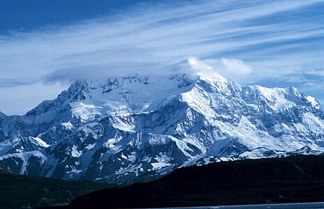 Mount Saint Elias, Alaska
 Mount Foraker, Alaska
 Mount Blackburn, Alaska
 Mount Sanford and Mount Wrangell, Alaska
 Mount Elbert, Colorado
 Mount Williamson, California
 White Mountain Peak, California
 Longs Peak, Colorado
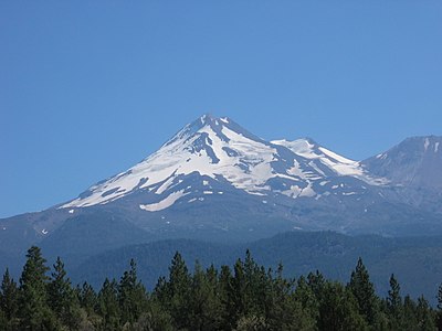 Mount Shasta, California
 Maroon Bells (Maroon Peak and North Maroon Peak), Colorado
 Pikes Peak, Colorado
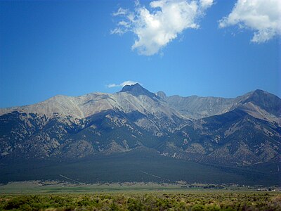 Blanca Peak, Colorado
 Wilson Peak, Colorado


a.jpg)


See also
edit


- List of mountain peaks of North America
- List of mountain peaks of Greenland
- List of mountain peaks of Canada
- List of mountain peaks of the Rocky Mountains
- List of mountain peaks of the United States
- List of the highest major summits of the United States
- List of the most prominent summits of the United States
- List of the most isolated major summits of the United States
- List of extreme summits of the United States
- List of mountain peaks of Alaska
- List of mountain peaks of California
- List of mountain peaks of Colorado
- List of mountain peaks of Hawaiʻi
- List of mountain peaks of Montana
- List of mountain peaks of Nevada
- List of mountain peaks of Utah
- List of mountain peaks of Washington (state)
- List of mountain peaks of Wyoming
- List of mountain peaks of México
- List of mountain peaks of Central America
- List of mountain peaks of the Caribbean
- United States of America
- Physical geography
- Eight-thousander, peak with at least 8,000 m. elevation
Notes
edit- ^ The summit of Denali is the highest point of the Alaska Range, the State of Alaska, the United States of America, and all of North America. Denali is the third-most topographically prominent and third-most topographically isolated summit on Earth after Mount Everest and Aconcagua.
- ^ Mount Saint Elias is the second-highest major summit of both Canada and the United States.
- ^ The summit of Mount Bona is the highest point of the northwest Saint Elias Mountains.
- ^ The summit of Mount Blackburn is the highest point of the Wrangell Mountains.
- ^ Mount Fairweather on the international border of Alaska is the highest point the Canadian Province of British Columbia.
- ^ The summit of Mount Whitney is the highest point of the Sierra Nevada, the State of California, and the contiguous United States.
- ^ The summit of Mount Elbert is the highest point of the Rocky Mountains and the U.S. State of Colorado.
- ^ Mount Massive is the second highest summit of the Rocky Mountains.
- ^ The elevation of Mount Massive includes an adjustment of +2.087 m (6.85 ft) from NGVD 29 to NAVD 88.
- ^ The summit of Mount Harvard is the highest point of the Collegiate Peaks.
- ^ The summit of Mount Rainier is the highest point of the Cascade Range and the U.S. State of Washington. Mount Rainier is the most prominent summit in the contiguous United States and the fourth-most prominent in North America.
- ^ The elevation of Mount Rainier includes an adjustment of +1.914 m (6.28 ft) from NGVD 29 to NAVD 88.
- ^ The elevation of Mount Williamson includes an adjustment of +1.807 m (5.93 ft) from NGVD 29 to NAVD 88.
- ^ The summit of Blanca Peak is the highest point of the Sangre de Cristo Mountains.
- ^ The elevation of Blanca Peak includes an adjustment of +1.755 m (5.76 ft) from NGVD 29 to NAVD 88.
- ^ The elevation of La Plata Peak includes an adjustment of +1.983 m (6.51 ft) from NGVD 29 to NAVD 88.
- ^ The summit of Uncompahgre Peak is the highest point of the San Juan Mountains.
- ^ The elevation of Crestone Peak includes an adjustment of +1.76 m (5.77 ft) from NGVD 29 to NAVD 88.
- ^ The summit of Mount Lincoln is the highest point of the Mosquito Range.
- ^ The summit of Castle Peak is the highest point of the Elk Mountains.
- ^ The summit of Grays Peak is the highest point of the Front Range and the Continental Divide of North America.
- ^ The summit of Mount Antero is the highest point of the southern Sawatch Range.
- ^ The summit elevation of Mount Blue Sky includes a vertical offset of +1.798 m (5.9 ft) from the station benchmark.
- ^ The summit of Longs Peak is the highest point of the northern Front Range.
- ^ The summit of Mount Wilson is the highest point of the San Miguel Mountains.
- ^ The elevation of Mount Wilson includes an adjustment of +1.899 m (6.23 ft) from NGVD 29 to NAVD 88.
- ^ The summit of White Mountain Peak is the highest point of the White Mountains.
- ^ The summit of North Palisade is the highest point of the Palisades.
- ^ The elevation of North Palisade includes an adjustment of +1.867 m (6.13 ft) from NGVD 29 to NAVD 88.
- ^ The elevation of Crestone Needle includes an adjustment of +1.763 m (5.78 ft) from NGVD 29 to NAVD 88.
- ^ The summit of Mount Shasta is the highest point of the southern Cascade Range.
- ^ The elevation of Kit Carson Mountain includes an adjustment of +1.773 m (5.82 ft) from NGVD 29 to NAVD 88.
- ^ The elevation of Mount Sill includes an adjustment of +1.888 m (6.19 ft) from NGVD 29 to NAVD 88.
- ^ The summit of Mount Sneffels is the highest point of the Sneffels Range.
- ^ The elevation of Capitol Peak includes an adjustment of +1.991 m (6.53 ft) from NGVD 29 to NAVD 88.
- ^ The elevation of Liberty Cap includes an adjustment of +1.758 m (5.77 ft) from NGVD 29 to NAVD 88.
- ^ Pikes Peak is the easternmost 14,000-foot (4267.2 m) summit of the United States. Pikes Peak was the inspiration for the lyrics of America the Beautiful.
- ^ The elevation of Mount Russell includes an adjustment of +1.869 m (6.13 ft) from NGVD 29 to NAVD 88.
- ^ The summit of Windom Peak is the highest point of the Needle Mountains and La Plata County, Colorado.
- ^ Mount Eolus may be higher than Windom Peak.
- ^ The elevation of Windom Peak includes an adjustment of +1.785 m (5.86 ft) from NGVD 29 to NAVD 88.
- ^ The elevation of Mount Eolus includes an adjustment of +1.756 m (5.76 ft) from NGVD 29 to NAVD 88.
- ^ The elevation of Challenger Point includes an adjustment of +1.752 m (5.75 ft) from NGVD 29 to NAVD 88.
- ^ The elevation of Humboldt Peak includes an adjustment of +1.79 m (5.87 ft) from NGVD 29 to NAVD 88.
- ^ The elevation of Sunlight Peak includes an adjustment of +1.804 m (5.92 ft) from NGVD 29 to NAVD 88.
- ^ The summit of Culebra Peak is the highest point of the Culebra Range.
- ^ The elevation of Culebra Peak includes an adjustment of +1.74 m (5.71 ft) from NGVD 29 to NAVD 88.
- ^ The elevation of Ellingwood Point includes an adjustment of +1.789 m (5.87 ft) from NGVD 29 to NAVD 88.
- ^ The elevation of Mount Lindsey includes an adjustment of +1.691 m (5.55 ft) from NGVD 29 to NAVD 88.
- ^ The elevation of Little Bear Peak includes an adjustment of +1.733 m (5.69 ft) from NGVD 29 to NAVD 88.
- ^ The elevation of Mount Sherman includes an adjustment of +2.029 m (6.66 ft) from NGVD 29 to NAVD 88.
- ^ The elevation of Redcloud Peak includes an adjustment of +2.015 m (6.61 ft) from NGVD 29 to NAVD 88.
- ^ The elevation of Mount Langley includes an adjustment of +1.76 m (5.77 ft) from NGVD 29 to NAVD 88.
- ^ The elevation of Mount Tyndall includes an adjustment of +1.835 m (6.02 ft) from NGVD 29 to NAVD 88.
- ^ The elevation of Wilson Peak includes an adjustment of +1.877 m (6.16 ft) from NGVD 29 to NAVD 88.
- ^ The summit of San Luis Peak is the highest point of the La Garita Mountains.
- ^ The elevation of Wetterhorn Peak includes an adjustment of +1.903 m (6.24 ft) from NGVD 29 to NAVD 88.
- ^ The elevation of Mount Muir includes an adjustment of +1.857 m (6.09 ft) from NGVD 29 to NAVD 88.
- ^ The elevation of Middle Palisade includes an adjustment of +1.835 m (6.02 ft) from NGVD 29 to NAVD 88.
- ^ The summit of Mount of the Holy Cross is the highest point of the northern Sawatch Range.
- ^ The summit elevation of Mount of the Holy Cross includes a vertical offset of +0.61 m (2 ft) from the station benchmark.
- ^ The elevation of Sunshine Peak includes an adjustment of +1.969 m (6.46 ft) from NGVD 29 to NAVD 88.
References
editExternal links
edit Definitions from Wiktionary
 Media from Commons
 News from Wikinews
 Quotations from Wikiquote
 Texts from Wikisource
 Textbooks from Wikibooks
 Resources from Wikiversity