Calaca, officially the City of Calaca (Filipino: Lungsod ng Calaca), is a component city in the province of Batangas, Philippines. According to the 2020 census, it has a population of 87,361 people.[5]
Calaca | |
|---|---|
| City of Calaca | |
 Street and City Hall in Calaca | |
 Seal | |
 Map of Batangas with Calaca highlighted | |
OpenStreetMap  | |
.svg) Calaca Location within the Philippines | |
| Coordinates: 13°55′48″N 120°48′47″E / 13.93°N 120.8131°E | |
| Country | Philippines |
| Region | Calabarzon |
| Province | Batangas |
| District | 1st district |
| Founded | May 10, 1835[1] |
| Cityhood | September 3, 2022 |
| Barangays | 40 (see Barangays) |
| Government | |
| • Type | Sangguniang Panlungsod |
| • Mayor | Sofronio Leonardo C. Ona Jr.[2] |
| • Vice Mayor | Jerry Raphael I. Katigbak |
| • Representative | Joseph Eric R. Buhain |
| • City Council | Members |
| • Electorate | 58,881 voters (2022) |
| Area | |
| • Total | 114.58 km2 (44.24 sq mi) |
| Elevation | 49 m (161 ft) |
| Highest elevation | 253 m (830 ft) |
| Lowest elevation | 0 m (0 ft) |
| Population (2020 census)[5] | |
| • Total | 87,361 |
| • Density | 760/km2 (2,000/sq mi) |
| • Households | 20,901 |
| Economy | |
| • Poverty incidence | 10.70 |
| • Revenue | ₱ 763.6 million (2020) |
| • Assets | ₱ 2,260 million (2020) |
| • Expenditure | ₱ 726.4 million (2020) |
| • Liabilities | ₱ 786.4 million (2020) |
| Service provider | |
| • Electricity | Batangas 1 Electric Cooperative (BATELEC 1) |
| Time zone | UTC+8 (PST) |
| ZIP code | 4212 |
| PSGC | |
| IDD : area code | +63 (0)43 |
| Native languages | Tagalog |
| Website | calaca |
Calaca is home to the lively Calacatchara festival (a portmanteau of Calaca and atchara (chutney).
Etymology edit
The name was taken from the roofs of the houses made of bamboos halves arranged over top of one another. One anecdote believes that: When it was still a sitio and long been called Calaca, three Spanish officials happened to pass by. They saw some carpenters making the roof of a house. They asked one of the carpenters about the name of the place. The carpenter, who did not know Spanish, believed that the Spaniards were asking what they were making and they answered, “calaca.” The Spaniards noted the name and since then, Calaca became the official name.[7]
History edit
Calaca was part of Balayan when it was used to be a barrio. On May 10, 1835, it was officially converted into a town. Don Rufino Punungbayan was the first Gobernadorcillo of the municipality during the year 1835–1836.
Cityhood edit
On March 11, 2020, House Bill No. 6598 was filed for the conversion of the municipality of Calaca into a component city in the province of Batangas.[8] Both the House of Representatives and the Senate passed the bill. On May 26, 2021, President Rodrigo Roa Duterte approved the bill through Republic Act No. 11544.[9] On August 19, 2021, COMELEC postponed the plebiscite which seeks to ratify the conversion of the municipality of Calaca into a city for the preparation of the 2022 elections.[10] On July 13, 2022, the election body sets the date of plebiscite on September 3, 2022.[11] By virtue of Republic Act No. 11544 after ratification of the law, Calaca becomes the fifth city in Batangas and the first in the province's 1st legislative district.[12][13][2][14]
| Choice | Votes | % |
|---|---|---|
 Yes Yes | 29,424 | 88.61 |
| No | 3,781 | 11.39 |
| Valid votes | 33,205 | 100% |
| Invalid or blank votes | 0 | 0% |
| Total votes | 33,205 | 100.00 |
| Registered voters/turnout | 58,881 | 56.39% |
| Source: Press statement from the COMELEC via Twitter; news article from Manila Bulletin | ||
Geography edit
According to the Philippine Statistics Authority, the city has a land area of 114.58 square kilometres (44.24 sq mi) [15] constituting 3.67% of the 3,119.75-square-kilometre- (1,204.54 sq mi) total area of Batangas.
Calaca is 38 kilometres (24 mi) from Batangas City and 116 kilometres (72 mi) from Manila.
Barangays edit
Calaca is politically subdivided into 40 barangays.[16]. Each barangay consists of puroks and some have sitios.
As of June 30, 2021, there are five barangays that are considered urban (highlighted in bold).[17]
| PSGC | Barangay | Population | ±% p.a. | |||
|---|---|---|---|---|---|---|
| 2020[5] | 2010[18] | |||||
| 041007001 | Bagong Tubig | 2.8% | 2,434 | 2,083 | 1.57% | |
| 041007002 | Baclas | 1.9% | 1,688 | 1,574 | 0.70% | |
| 041007003 | Balimbing | 0.6% | 494 | 456 | 0.80% | |
| 041007004 | Bambang | 1.6% | 1,415 | 1,239 | 1.34% | |
| 041007006 | Barangay 1 (Poblacion) | 2.2% | 1,903 | 1,839 | 0.34% | |
| 041007007 | Barangay 2 (Poblacion) | 0.9% | 827 | 729 | 1.27% | |
| 041007008 | Barangay 3 (Poblacion) | 0.3% | 278 | 279 | −0.04% | |
| 041007009 | Barangay 4 (Poblacion) | 1.2% | 1,031 | 908 | 1.28% | |
| 041007010 | Barangay 5 (Poblacion) | 1.3% | 1,096 | 1,004 | 0.88% | |
| 041007011 | Barangay 6 (Poblacion) | 0.9% | 762 | 742 | 0.27% | |
| 041007012 | Bisaya | 1.2% | 1,016 | 861 | 1.67% | |
| 041007013 | Cahil | 4.3% | 3,742 | 2,929 | 2.48% | |
| 041007014 | Caluangan | 2.1% | 1,863 | 1,699 | 0.93% | |
| 041007015 | Calantas | 3.6% | 3,128 | 2,784 | 1.17% | |
| 041007016 | Camastilisan | 4.7% | 4,147 | 3,425 | 1.93% | |
| 041007017 | Coral ni Lopez (Sugod) | 2.2% | 1,921 | 1,695 | 1.26% | |
| 041007018 | Coral ni Bacal | 1.6% | 1,389 | 1,145 | 1.95% | |
| 041007019 | Dacanlao | 7.1% | 6,177 | 5,243 | 1.65% | |
| 041007020 | Dila | 1.9% | 1,624 | 1,504 | 0.77% | |
| 041007021 | Loma | 1.5% | 1,346 | 1,112 | 1.93% | |
| 041007022 | Lumbang Calzada | 3.2% | 2,820 | 2,329 | 1.93% | |
| 041007023 | Lumbang na Bata | 2.1% | 1,873 | 1,769 | 0.57% | |
| 041007024 | Lumbang na Matanda | 2.9% | 2,549 | 1,944 | 2.75% | |
| 041007025 | Madalunot | 2.2% | 1,927 | 1,675 | 1.41% | |
| 041007027 | Makina | 1.5% | 1,301 | 1,094 | 1.75% | |
| 041007028 | Matipok | 2.1% | 1,830 | 1,515 | 1.91% | |
| 041007030 | Munting Coral | 0.4% | 387 | 328 | 1.67% | |
| 041007031 | Niyugan | 1.6% | 1,404 | 1,185 | 1.71% | |
| 041007032 | Pantay | 6.5% | 5,654 | 4,517 | 2.27% | |
| 041007033 | Puting Bato West | 3.8% | 3,291 | 2,892 | 1.30% | |
| 041007034 | Puting Kahoy | 1.5% | 1,310 | 1,179 | 1.06% | |
| 041007035 | Puting Bato East | 2.5% | 2,145 | 2,001 | 0.70% | |
| 041007036 | Quisumbing | 2.5% | 2,193 | 1,824 | 1.86% | |
| 041007037 | Salong | 5.5% | 4,766 | 4,130 | 1.44% | |
| 041007038 | San Rafael | 1.1% | 965 | 661 | 3.86% | |
| 041007039 | Sinisian | 2.3% | 2,025 | 1,764 | 1.39% | |
| 041007041 | Taklang Anak | 1.4% | 1,190 | 980 | 1.96% | |
| 041007042 | Talisay | 2.3% | 1,985 | 1,935 | 0.26% | |
| 041007043 | Tamayo | 1.8% | 1,590 | 1,435 | 1.03% | |
| 041007044 | Timbain | 2.7% | 2,373 | 2,114 | 1.16% | |
| Total | 87,361 | 70,521 | 2.16% | |||
Climate edit
| Climate data for Calaca City, Batangas | |||||||||||||
|---|---|---|---|---|---|---|---|---|---|---|---|---|---|
| Month | Jan | Feb | Mar | Apr | May | Jun | Jul | Aug | Sep | Oct | Nov | Dec | Year |
| Mean daily maximum °C (°F) | 29 (84) | 30 (86) | 31 (88) | 33 (91) | 32 (90) | 30 (86) | 29 (84) | 29 (84) | 29 (84) | 29 (84) | 29 (84) | 29 (84) | 30 (86) |
| Mean daily minimum °C (°F) | 20 (68) | 20 (68) | 21 (70) | 22 (72) | 24 (75) | 24 (75) | 24 (75) | 24 (75) | 24 (75) | 23 (73) | 22 (72) | 21 (70) | 22 (72) |
| Average precipitation mm (inches) | 11 (0.4) | 13 (0.5) | 14 (0.6) | 32 (1.3) | 101 (4.0) | 142 (5.6) | 208 (8.2) | 187 (7.4) | 175 (6.9) | 131 (5.2) | 68 (2.7) | 39 (1.5) | 1,121 (44.3) |
| Average rainy days | 5.2 | 5.0 | 7.4 | 11.5 | 19.8 | 23.5 | 27.0 | 25.9 | 25.2 | 23.2 | 15.5 | 8.3 | 197.5 |
| Source: Meteoblue (Use with caution: this is modeled/calculated data, not measured locally.)[19] | |||||||||||||
Demographics edit
| Year | Pop. | ±% p.a. |
|---|---|---|
| 1903 | 5,838 | — |
| 1918 | 9,310 | +3.16% |
| 1939 | 10,671 | +0.65% |
| 1948 | 13,551 | +2.69% |
| 1960 | 18,667 | +2.70% |
| 1970 | 27,780 | +4.05% |
| 1975 | 31,705 | +2.69% |
| 1980 | 36,508 | +2.86% |
| 1990 | 45,377 | +2.20% |
| 1995 | 51,459 | +2.38% |
| 2000 | 58,489 | +2.78% |
| 2007 | 64,966 | +1.46% |
| 2010 | 70,521 | +3.03% |
| 2015 | 81,859 | +2.88% |
| 2020 | 87,361 | +1.29% |
| Source: Philippine Statistics Authority[20][18][21][22] | ||
In the 2020 census, Calaca had a population of 87,361.[5] The population density was 760 inhabitants per square kilometre (2,000/sq mi).
Economy edit
Calaca is currently identified by the Philippine Statistics Agency as a 1st class municipal economic zone.[23] The Philippine Statistics Agency as of September 2022 had not made a determination of the income classification on the city scale for Calaca based on the previous four years of revenue.[24]
Poverty Incidence of Calaca
5 10 15 20 25 30 2006 28.10 2009 17.84 2012 19.95 2015 17.36 2018 10.29 2021 10.70 Source: Philippine Statistics Authority[25][26][27][28][29][30][31][32] |
Gallery edit
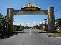 Welcome arch from Lemery
 City hall
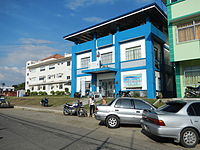 Police station
 Public market
 Saint Raphael the Archangel Parish Church


