Payl:Turkmenistan location map.svg

Size of this PNG preview of this SVG file: 800 x 568 ka mga piksel. Uban pang mga resoluyon: 320 x 227 ka mga piksel | 640 x 454 ka mga piksel | 1,024 x 727 ka mga piksel | 1,280 x 909 ka mga piksel | 2,560 x 1,817 ka mga piksel | 1,796 x 1,275 ka mga piksel.
Tibuok resolusyon (SVG nga payl, nominally 1,796 × 1,275 pixels, size sa payl: 277 KB)
Mubong sugid:
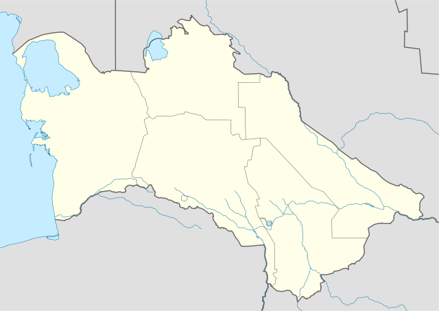
| Deskripsyon | Deutsch: Positionskarte von Turkmenistan Quadratische Plattkarte, N-S-Streckung 120 %. Geographische Begrenzung der Karte:
English: Location map of Turkmenistan Equirectangular projection, N/S stretching 120 %. Geographic limits of the map:
|
| Petsa | |
| Gigikanan | own work, using
|
| Tagsulat | NordNordWest |
 | This map has been made or improved in the German Kartenwerkstatt (Map Lab). You can propose maps to improve as well. |
Pagtugot
I, the copyright holder of this work, hereby publish it under the following licenses:
 | Gitugot ang pagkopya, pag-apud-apod o/ug pag-usab ning maong dokumento ubos sa mga termino sa GNU Free Documentation License, Version 1.2 o mas bag-ong bersiyon nga gimantala sa Free Software Foundation; nga walay Invariant Sections, walay Front-Cover Texts, ug walay Back-Cover Texts. Ang kopya sa lisensiya gilakip sa bahin nga giulohang GNU Free Documentation License. |
This file is licensed under the Creative Commons Attribution-Share Alike 3.0 Unported license.
- Libre ka:
- sa pagsabwag – sa pagkopya, pag-apod-apod ug pagsabwag sa hinimo
- sa pag-remix – sa pag-adap sa binuhat
- Ubos sa mosunod nga mga kondisyon:
- atribusyon – Kinahanglan nimo nga hatagan ang angay nga kredito, maghatag usa ka link sa lisensya, ug ipakita kung adunay mga pagbag-o. Mahimo nimo kini buhaton sa bisan unsang makatarunganon nga paagi, apan dili sa bisan unsang paagi nga nagsugyot nga gi-endorso ka sa licensor o ang imong paggamit.
- share parehas – Kung imong gi-remix, gibag-o, o gibase sa materyal, kinahanglan nimo nga iapod-apod ang imong mga kontribusyon sa ilawom sa parehas o katugma nga lisensya sama sa orihinal.
You may select the license of your choice.
Kaagi sa payl
I-klik ang petsa/oras aron makit-an ang hulagway sa payl niadtong panahona.
| Petsa/Takna | Thumbnail | Mga dimensyon | Tiggamit | Komento | |
|---|---|---|---|---|---|
| kasamtangan | 17:29, 27 Nobiyembre 2009 | | 1,796 × 1,275 (277 KB) | NordNordWest | corr |
| 19:10, 24 Oktubre 2008 |  | 1,796 × 1,177 (277 KB) | NordNordWest | {{Information |Description= {{de|Positionskarte von Turkmenistan}} Quadratische Plattkarte, N-S-Streckung 120 %. Geographische Begrenzung der Karte: * N: 43.2° N * S: 34.9° N * W: 52.0° O * O: 67.2° O {{en|Location map of [[:en:Tu |
Mga paggamit sa payl
More than 100 pages use this file.The following list shows the first 100 pages that use this file only.A full list is available.
- Abadan
- Akhtay
- Anau
- Balka Ivanovskaya
- Balka Krutaya
- Bam
- Barkhan
- Chaacha
- Chak
- Chardzha
- Chingurak Kotal
- Chink Kaplankyr
- Darvaza
- Daryā-ye Morghāb
- Divana (pagklaro)
- Egri
- Farab
- Gora Ak-Dzhar
- Gora Akdag
- Gora Chadzhi
- Gora Dozornaya
- Gora Inzhenernaya
- Gora Kamennaya
- Gora Kara-Tyube
- Gora Karabet
- Gora Kazan
- Gora Krasnaya
- Gora Kurgan
- Gora Kyzylkaya
- Gora Lagernaya
- Gora Lysaya
- Gora Piramida
- Gora Shapka
- Gora Stolovaya
- Gora Storozhevaya
- Gora Turkmenskaya
- Gorodskoy Kanal
- Gory Aktau
- Gory Kara-Kyr
- Gory Stolovyye
- Kaka (pagklaro)
- Kalinin
- Kalininsk
- Kanal Tsentral’nyy
- Karamanly
- Karaoy
- Kashan
- Kel’tegey
- Kese
- Khrebet Kamenistyy
- Kirovskiy Rayon
- Krasavchik
- Kushk
- Kushka
- Leninsk
- Leninskiy Rayon
- Loshchina Agashlinskaya Shchel’
- Mamay
- Mari
- Meire
- Murgab
- Murgabskiy Rayon
- Murgap
- Murghāb
- Mys Kazak
- Mys Peschanyy
- Oktyabr'skiy Rayon
- Oktyabr’skiy Rayon
- Ozero Shor-Kul’
- Pereval Alam
- Pereval Arvaz
- Pereval Vorota
- Pereval Zagara
- Peski Akkum
- Peski Kyzylkum
- Proletarskiy Rayon
- Rodnik Kara-Bulak
- Rodnik Karaagach
- Rodnik Kuduk
- Rūd-e Golrān
- Sarakhs
- Sayat (pagklaro)
- Serakhs
- Seydi
- Shan
- Sharah
- Solenaya
- Solënaya
- Sovetskiy Rayon
- Stalino
- Stalinskiy Rayon
- Takhta
- Tejen
- Tel’manskiy Rayon
- Tersakan
- Vodokhranilishche Erenkhauz
- Гора Кызылкая
- Гора Лысая
- Гора Столовая
- Хребет Каменистый
View more links to this file.
Global nga paggamit sa payl
Kining ubang wiki naggamit ning maong payl:
- Paggamit sa an.wikipedia.org
- Paggamit sa ar.wikipedia.org
- Paggamit sa av.wikipedia.org
- Paggamit sa az.wikipedia.org
- Aşqabad
- Mərv
- Arçman
- Türkmənbaşı
- Şablon:Yer xəritəsi Türkmənistan
- Xarəzm
- Türkmənabad
- Daşoğuz
- Türkmənbaşı Ruhu məscidi
- Köhnə Ürgənc
- Əbivərd
- Türkmənistan şəhərləri
- Marı
- Bayramalı
- Şadlıq
- Yolötən
- Sərhədabad (Türkmənistan)
- Balkanabad
- Qumdağ
- Bərəkət (Türkmənistan)
- Qızılarbat
- Xəzər (Türkmənistan)
- Kerki
- Maqdanlı
- Seydi
- Qazocaq
- Sakar
- Qaraboğazgöl
- Türkmənbaşı körfəzi
- Şimali Çələkən körfəzi
- Türkmən körfəzi
- Cənubi Çələkən körfəzi
- Uzunada körfəzi
- Balxan körfəzi
- Baherden
- Qaraboğaz
- Türkmənbaşı sarayı
- Türkmənistandakı ümumdünya irsi obyektlərinin siyahısı
- Uzboy
- Aşqabad Beynəlxalq Hava Limanı
- Muncuqlutəpə yaşayış yeri (Türkmənistan)
- Anau
- Gökdepe
- Paggamit sa ba.wikipedia.org
View more global usage of this file.
🔥 Top keywords: Unang PanidPorn hubEspesyal:PangitaIkaduhang Gubat KalibotanonWikipedia:Mga pagpasabotWikipedyaEspesyal:Bag-ongGiusabWikipedia:Mahitungod sa WikipedyaRodrigo DuterteCerro El Cono (bukid sa Peru)Wikipedia:Maayong pag-abot, higala!Wikipedia:TubaanPornograpiyaEspesyal:AkongHisgotGajraj Bahadur NagarQáqaqContactGumagamit:LsjbotWikipedia:Mga panghitaboNaked BoyKategoriya:Amerikanong karton nga pelikulaFutai-damuPanuhotWikipedia:Talaan sa sulodNobiyembre 8Cerro El ConoRosaryoTabang:Mga sulod1200Akto Sa PaghinulsolPornhubSkålåniPixarKategoriya:Mga pelikula sa PixarKategoriya:Mga pelikula sa Walt Disney PicturesDaucus montanusShanghai Pudong International AirportPelosiaRepublika Srpska