Payl:Bermuda location map.svg

Size of this PNG preview of this SVG file: 800 x 545 ka mga piksel. Uban pang mga resoluyon: 320 x 218 ka mga piksel | 640 x 436 ka mga piksel | 1,024 x 698 ka mga piksel | 1,280 x 872 ka mga piksel | 2,560 x 1,744 ka mga piksel | 1,311 x 893 ka mga piksel.
Tibuok resolusyon (SVG nga payl, nominally 1,311 × 893 pixels, size sa payl: 58 KB)
Mubong sugid:
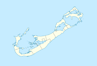
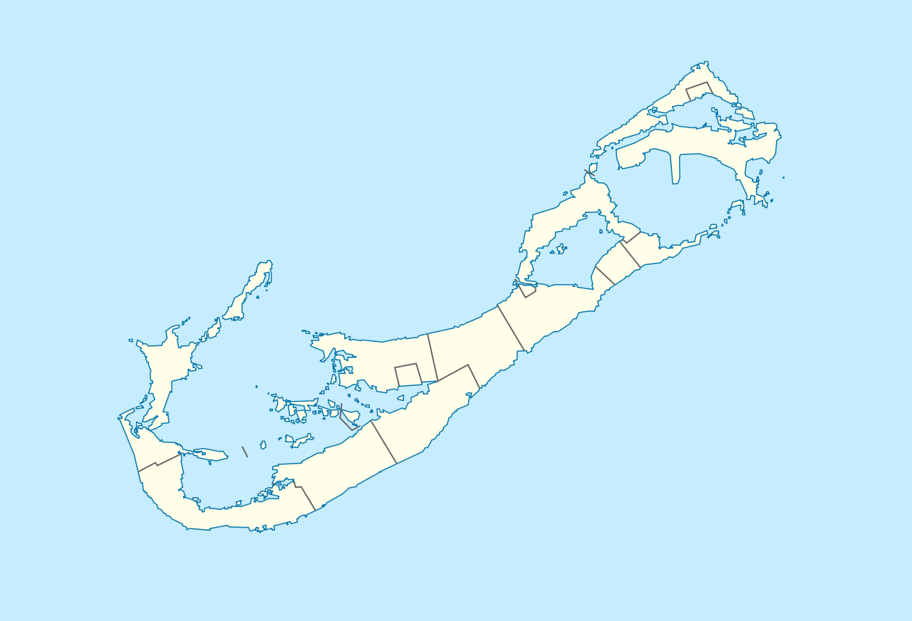
| Deskripsyon | Deutsch: Positionskarte von Bermuda Geographische Begrenzung der Karte:
English: Location map of Bermuda Geographic limits of the map:
| ||||||||||||
| Petsa | |||||||||||||
| Gigikanan | Kaugalingong trabaho | ||||||||||||
| Tagsulat | NordNordWest | ||||||||||||
| Pagtugot (Paggamit pag-usab niini nga file) |
|
 | This map has been made or improved in the German Kartenwerkstatt (Map Lab). You can propose maps to improve as well. |
| Annotations | This image is annotated: View the annotations at Commons |
Kaagi sa payl
I-klik ang petsa/oras aron makit-an ang hulagway sa payl niadtong panahona.
| Petsa/Takna | Thumbnail | Mga dimensyon | Tiggamit | Komento | |
|---|---|---|---|---|---|
| kasamtangan | 16:29, 19 Disyembre 2009 | | 1,311 × 893 (58 KB) | NordNordWest | == {{int:filedesc}} == {{Information |Description= {{de|Positionskarte von Bermuda}} Geographische Begrenzung der Karte: * N: 32.41° N * S: 32.22° N * W: 64.93° W * O: 64.6° W {{en|Location map of Bermuda}} Geographic l |
Mga paggamit sa payl
More than 100 pages use this file.The following list shows the first 100 pages that use this file only.A full list is available.
- Bay Island
- Bird Island
- Bird Rock
- Black Rock
- Boat Rock
- Burgess Point
- Burrows Hill
- Camber
- Castle Island
- Castle Point
- Cat Island
- Cathedral Rocks
- Cave Island
- Cedar Hill
- Church Bay
- Cock Rocks
- Cockle Point
- Cooper Island
- Cove Point
- Crawl Point
- Crow Island
- Current Island
- Dyer Island
- East Point
- Elizabeth Island
- Ferry Point
- Flora Point
- Freeport
- Goat Island
- Goose Island
- Grape Bay
- Grape Bay (luuk sa Bermuda)
- Grassy Bay
- Great Bay
- Great Head
- Green Bay
- Hamilton
- Hamilton Island
- High Point
- Horseshoe Bay
- Horseshoe Island
- Hunt Island
- Little Head
- Long Bay
- Long Island
- Long Point
- Long Rock
- Magazine Island
- Main Island
- Mangrove Bay
- Middle Beach
- Middle Island
- Middleton Bay
- Mill Point
- Mosquito Hill
- Mount Hill
- Mullet Bay
- Nelly Island
- Nelson Bay
- Nonsuch Bay
- North Channel
- North Point
- One Tree Island
- Outer Island
- Palm Island
- Partridge Island
- Pembroke
- Pigeon Rocks
- Port Royal Bay
- Rabbit Island
- Red Bay
- Red Hole
- Regatta Island
- Reid Island
- Rocky Bay
- Rose Hill
- Rushy Island
- Saint George
- Soldier Point
- Somerset (pagklaro)
- South Channel
- Spanish Point
- Spectacle Island
- Split Rock
- Stag Rocks
- Stokes Point
- Sugarloaf Hill
- Taylor Point
- The Lagoon
- The Narrows
- The Peak
- Town Hill
- Turtle Island
- Warwick
- Watch Hill
- Watling Island
- Whale Island
- White Island
- White Point
- White Shoal
View more links to this file.
Global nga paggamit sa payl
Kining ubang wiki naggamit ning maong payl:
- Paggamit sa af.wikipedia.org
- Paggamit sa an.wikipedia.org
- Paggamit sa ar.wikipedia.org
- Paggamit sa ast.wikipedia.org
- Paggamit sa az.wikipedia.org
- Paggamit sa ba.wikipedia.org
- Paggamit sa be-tarask.wikipedia.org
- Paggamit sa be.wikipedia.org
- Paggamit sa bg.wikipedia.org
- Paggamit sa bn.wikipedia.org
- Paggamit sa bs.wikipedia.org
- Paggamit sa ckb.wikipedia.org
- Paggamit sa cs.wikipedia.org
- Paggamit sa da.wikipedia.org
- Paggamit sa de.wikipedia.org
- Hamilton (Bermuda)
- Saint George’s (Bermuda)
- Grand Bermuda
- Somerset Island (Bermuda)
- Boaz Island
- Watford Island
- Ireland Island North
- Ireland Island South
- Sandys Parish
- Southampton Parish
- Warwick Parish
- Paget Parish
- Devonshire Parish
- Saint George’s Island (Bermuda)
- Saint David’s Island (Bermuda)
- Pembroke Parish
- Smith’s Parish
- Hamilton Parish
View more global usage of this file.
🔥 Top keywords: Unang PanidPorn hubKategoriya:RomaniyaKorobelaGoogleIkaduhang Gubat KalibotanonWikipedia:Mga pagpasabotEspesyal:Bag-ongGiusabWikipedia:TubaanEspesyal:PangitaWikipedia:Mahitungod sa WikipedyaGajraj Bahadur NagarPornograpiyaWikipedia:Mga panghitaboEspesyal:AkongHisgotTabang:Mga sulodWikipedia:Maayong pag-abot, higala!Wikipedia:Talaan sa sulodWikipedyaQáqaqRosaryoWikipedia:Katungod sa pagpatikFutai-damuContactPornhubAkto Sa PaghinulsolPanuhotTraci LordsLysimachia punctataCalubian, LeytePilipinasEnero 1Wikipedya:TabangKot AdduGumagamit:LsjbotWikipedia:Piniling artikulo640Wikimedia FoundationEutonina indicans