.jpg)
.jpg&action=edit&redlink=1)

Size of this preview: 800 × 542 pixels. Other resolutions: 320 × 217 pixels | 640 × 434 pixels | 1,024 × 694 pixels | 1,200 × 813 pixels.
Original file (1,200 × 813 pixels, file size: 424 KB, MIME type: image/jpeg)
| This is a file from the Wikimedia Commons. Information from its description page there is shown below. Commons is a freely licensed media file repository. You can help. |
.jpg)
Summary
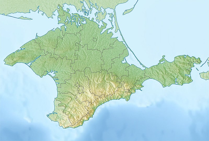
| Description | Русский: Физическая карта Крыма Равноугольная проекция, стандартная параллель — 45°15′с.ш. Параметры шаблона (координаты краёв): English: Physical map of the Crimea Conformal projection, standard parallels — 45°15's.W. Template parameters (coordinates of the edges):
|
| Date | |
| Source | Relief map of Crimea.jpg |
| Author | original map (see authors of Relief map of Crimea.jpg), derivative work: Dinamik |
Licensing
I, the copyright holder of this work, hereby publish it under the following license:
| I, the copyright holder of this work, release this work into the public domain. This applies worldwide. In some countries this may not be legally possible; if so: I grant anyone the right to use this work for any purpose, without any conditions, unless such conditions are required by law. |
File history
Click on a date/time to view the file as it appeared at that time.
| Date/Time | Thumbnail | Dimensions | User | Comment | |
|---|---|---|---|---|---|
| current | 21:43, 18 May 2018 | | 1,200 × 813 (424 KB) | Janitoalevic | Better quality |
| 11:42, 12 May 2014 |  | 1,200 × 813 (234 KB) | Dinamik | == {{int:filedesc}} == {{Information |Description = {{ru|1=Физическая карта Крыма<br>Равноугольная проекция, стандартная параллель — 45°15′с.ш.<br>Параметры шаблона (к... |
File usage
More than 100 pages use this file.The following list shows the first 100 pages that use this file only.A full list is available.
.jpg)
- 1927 Crimean earthquakes
- Ai-Petri
- Alushta
- Aqtas Lake
- Arabat Fortress
- Arabat Spit
- Baherove (air base)
- Bakhchysarai Cave Monastery
- Baydar Nature Reserve
- Canğul
- Cape Aya
- Cape Fiolent
- Cape Fonar
- Charming Harbor National Nature Park
- Chonhar
- Chonhar Peninsula
- Chonhar Strait
- Chornomorske
- Chufut-Kale
- Chushka Spit
- Crimea
- Crimean Mountain karst
- Crimean Nature Reserve
- Demir-Kapu
- Demirci yayla
- Dhzurla
- Djur-Djur
- Donuzlav
- Feodosia Gulf
- Grand Canyon (Crimea)
- Gulf of Yalta
- Henicheska Hirka
- Heracles Peninsula
- Holovkinskoho waterfall
- Inkerman
- Inkerman Cave Monastery
- Kachyk lake
- Kalamita Bay
- Kara Dag Mountain
- Karadag Nature Reserve
- Karkinit Bay
- Karkinitska and Dzharylgatska Bays
- Karpivka, Crimea
- Kazantyp Nature Reserve
- Kerch (fortress)
- Kerch Airport
- Kerch Bay
- Kerch Peninsula
- Kerch Strait
- Koyashskoye Salt Lake
- Krasnoperekopsk
- Lavanda, Crimea
- Lithuanian Peninsula
- Maiak, Chornomorske Raion
- Mangup
- Mehmed III Giray
- Novofedorivka
- Novosilske, Crimea
- Nymphaion (Crimea)
- Olenivka, Chornomorske Raion
- Opuk (mountain)
- Opuk Nature Reserve
- Pantikapaion
- Partenit
- Perchem
- Perekop
- Qarabiy yayla
- Roman-Kosh
- Russo-Turkish War (1735–1739)
- Saky
- Saky (air base)
- Scythian Neapolis
- Semydviria
- Sevastopol International Airport
- Shchaslyvtseve
- Simferopol International Airport
- Staryi Krym
- Strilkove
- Sudak
- Sudak Bay
- Swan Islands Nature Reserve
- Syvash
- Syvash, Kherson Oblast
- Tarkhankut Peninsula
- Tobechytske Lake
- Tuzla Spit
- Uchan-su (waterfall)
- Uzunlarske Lake
- Vuzka Bay
- Yalta Mountain-Forest Nature Reserve
- Yevpatoria
- Yevpatoria Bay
- Yevpatoria RT-70 radio telescope
- Yuke-Tepe
- Zeytin-Kosh
- User:Benjamin Trovato/sandbox
- User:Mercussek/sandbox
- User:Twas Now/Siege of Caffa
- User:Ty654/List of earthquakes from 1920-1929 exceeding magnitude 6+
- Module:Location map/data/Crimea
View more links to this file.
Global file usage
The following other wikis use this file:
- Usage on ast.wikipedia.org
- Usage on azb.wikipedia.org
- Usage on az.wikipedia.org
- Usage on ba.wikipedia.org
- Usage on bn.wikipedia.org
- Usage on bs.wikipedia.org
- Usage on ca.wikipedia.org
- Usage on ceb.wikipedia.org
- Usage on da.wikipedia.org
- Usage on el.wikipedia.org
- Usage on es.wikipedia.org
- Estrecho de Kerch
- Quersoneso (ciudad)
- Istmo de Perekop
- Neápolis escita
- Ai-Petri
- Río Almá (Crimea)
- Río Chorna (Crimea)
- Península de Kerch
- Bahía de Karkinit
- Bahía de Arabat
- Cabo Kazantip
- Isla Tuzla
- Cascada de Uchan-su
- Puerto Krym
- Kara Dag
- Plantilla:Mapa de localización de Crimea
- Faro Yenikalski
- Cueva de Mármol (Crimea)
- Cueva Viálova
- Monte Koshka
- Valle de Baydar
- Península de Heracles
- Faro de Tarjankut
- Puente de Crimea
- Crimea
- Declaración de Independencia de Crimea y Sebastopol
- Bahía de Feodosia
- Bahía de Sudak
- Bahía de Kalamita
- Bahía de Kerch
- Bahía de Yalta
- Bahía de Eupatoria
View more global usage of this file.
.jpg)
Metadata
🔥 Top keywords: Akademia e Shkencave e RPS te ShqiperiseAlexandria Ocasio-CortezBilderberg GroupCristiano RonaldoDong XiaowanMinecraftOperation GladioPrimal cutRiot FestStrictly Come Dancing (series 7)Main PageSpecial:SearchWikipedia:Featured picturesList of European Cup and UEFA Champions League finalsCarlo AncelottiUEFA Champions League2024 Indian general electionJude BellinghamBorussia DortmundToni KroosReal Madrid CF2019 Indian general election2024 ICC Men's T20 World CupCleopatraRobert PicktonDonald TrumpDeaths in 20242024 South African general electionEdin Terzić (footballer)UFC 302Karim AdeyemiResults of the 2019 Indian general electionFuriosa: A Mad Max SagaYouTubeEminemDani Carvajal2024 UEFA Champions League finalMarco ReusVinícius JúniorCivil War (film)The First OmenGodzilla Minus OneICC Men's T20 World CupEmre CanKepler's SupernovaEric (miniseries)Jennifer LopezLenny KravitzNeatsville, Kentucky