Size of this preview: 800 × 600 pixels. Other resolutions: 320 × 240 pixels | 640 × 480 pixels | 1,024 × 768 pixels | 1,280 × 960 pixels | 2,560 × 1,920 pixels.
Original file (2,560 × 1,920 pixels, file size: 2.23 MB, MIME type: image/jpeg)
| This is a file from the Wikimedia Commons. Information from its description page there is shown below. Commons is a freely licensed media file repository. You can help. |
Summary
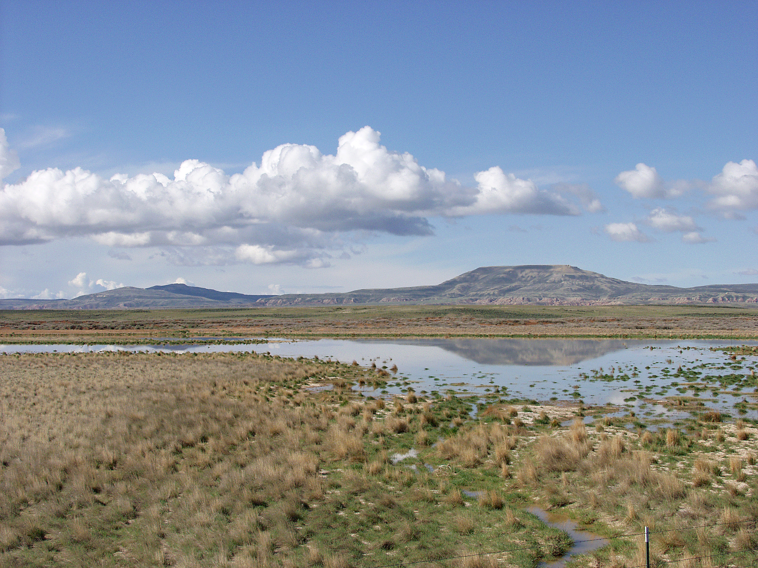
| Description | English: Melting snowpack is the primary source for surface water in Wyoming, such as this emphemeral wetland in the Muddy Creek Watershed of the Red Desert. This stretch of rangeland is typical of the vast expanses of publicly owned rangeland that aerial remote sensing is particularly well-adapted to. |
| Date | Unknown date |
| Source | http://www.ars.usda.gov/is/graphics/photos/feb06/d423-1.htm |
| Author | US Department of Agriculture. Sam Cox |
| Permission (Reusing this file) | US Federal Government work |
Licensing
| This image is in the public domain because it contains materials that originally came from the Agricultural Research Service, the research agency of the United States Department of Agriculture. |
File history
Click on a date/time to view the file as it appeared at that time.
| Date/Time | Thumbnail | Dimensions | User | Comment | |
|---|---|---|---|---|---|
| current | 17:05, 21 April 2009 | | 2,560 × 1,920 (2.23 MB) | Fishdecoy | {{Information |Description={{en|1=This stretch of rangeland in the Muddy Creek Watershed in Wyoming’s Red Desert is typical of the vast expanses of publicly owned rangeland that aerial remote sensing is particularly well-adapted to.}} |Source=http://www |
File usage
The following pages on the English Wikipedia use this file (pages on other projects are not listed):
Global file usage
The following other wikis use this file:
- Usage on ar.wikipedia.org
- Usage on arz.wikipedia.org
- Usage on ca.wikipedia.org
- Usage on ceb.wikipedia.org
- Usage on cs.wikipedia.org
- Usage on fa.wikipedia.org
- Usage on fr.wikipedia.org
- Usage on it.wikipedia.org
- Usage on ka.wikipedia.org
- Usage on lt.wikipedia.org
- Usage on vi.wikipedia.org
- Usage on www.wikidata.org
Metadata
🔥 Top keywords: Akademia e Shkencave e RPS te ShqiperiseAlexandria Ocasio-CortezBilderberg GroupCristiano RonaldoDong XiaowanMinecraftOperation GladioPrimal cutRiot FestStrictly Come Dancing (series 7)Main PageSpecial:SearchUEFA Euro 2024Wikipedia:Featured picturesInside Out 2Callum Styles.xxxCleopatraDonald SutherlandZaheer IqbalHouse of the DragonDeaths in 20242024 Copa América2024 ICC Men's T20 World CupUEFA European ChampionshipCopa AméricaLyndon DykesJessica AlbaBilly IdolSonakshi SinhaYouTubeSherri Papini kidnapping hoaxTom KimSha'Carri RichardsonThe BikeridersSabrina CarpenterThe Boys (TV series)Cristiano RonaldoJeff KentJ. Robert OppenheimerJacob FatuChappell RoanChé AdamsProject 2025Christian PulisicTaylor SwiftMaharaja (2024 film)The Boys season 4Bridgerton