Alitagtag, officially the Municipality of Alitagtag (Tagalog: Bayan ng Alitagtag), is a 4th class municipality in the province of Batangas, Philippines. According to the 2020 census, it has a population of 26,819 people.[3]
Alitagtag | |
|---|---|
| Municipality of Alitagtag | |
 Sign of Alitagtag | |
 Seal | |
 Map of Batangas with Alitagtag highlighted | |
OpenStreetMap  | |
.svg) Alitagtag Location within the Philippines | |
| Coordinates: 13°51′54″N 121°00′23″E / 13.865047°N 121.006319°E | |
| Country | Philippines |
| Region | Calabarzon |
| Province | Batangas |
| District | 3rd district |
| Founded | January 1, 1910 |
| Barangays | 19 (see Barangays) |
| Government | |
| • Type | Sangguniang Bayan |
| • Mayor | Edilberto G. Ponggos |
| • Vice Mayor | Manuel E. Abrigo |
| • Representative | Ma. Theresa V. Collantes |
| • Municipal Council | Members |
| • Electorate | 19,091 voters (2022) |
| Area | |
| • Total | 24.76 km2 (9.56 sq mi) |
| Elevation | 161 m (528 ft) |
| Highest elevation | 875 m (2,871 ft) |
| Lowest elevation | 5 m (16 ft) |
| Population (2020 census)[3] | |
| • Total | 26,819 |
| • Density | 1,100/km2 (2,800/sq mi) |
| • Households | 6,873 |
| Economy | |
| • Income class | 4th municipal income class |
| • Poverty incidence | 9.95 |
| • Revenue | ₱ 99.61 million (2020) |
| • Assets | ₱ 257.3 million (2020) |
| • Expenditure | ₱ 96.8 million (2020) |
| • Liabilities | ₱ 32.8 million (2020) |
| Service provider | |
| • Electricity | Batangas 2 Electric Cooperative (BATELEC 2) |
| Time zone | UTC+8 (PST) |
| ZIP code | 4205 |
| PSGC | |
| IDD : area code | +63 (0)43 |
| Native languages | Tagalog |
Etymology
editAlitagtag derived its name from the Tagalog word alinagnag, which means "a small distinct light."[5][6]
History
editMuch of Alitagtag was once part of Bauan. On August 10, 1908, the resolution by the electorate of barrios Alitagtag, Balagbag, Dalipit, Munlawin, and Muzon was transmitted to the Provincial Committee, who would approve it in three months' time. Batangas Governor Galicano Apacible later endorsed it to the Civil Commission for a hearing that would be held on January 2, 1909.[7]
The aforementioned barrios were separated from Bauan to constitute the new independent municipality of Alitagtag by virtue of Executive Order No. 43 dated May 7, 1909. The order took effect on January 1, 1910.[8]
In 1957, the following barrios were created: Pingas, composed of sitios Pingas and Corral; Tadlak, composed of sitios Tadlak and Malukan; and Sambi composed of the sitio of Sambi.[9]
Geography
editAccording to the Philippine Statistics Authority, the municipality has a land area of 24.76 square kilometers (9.56 sq mi) [10] constituting 0.79% of the 3,119.75-square-kilometer (1,204.54 sq mi) total area of Batangas.
It is bordered on the north by Taal Lake, east by Cuenca and San Jose, west by Santa Teresita and San Luis, and south by Bauan and San Pascual.
Barangays
editAlitagtag is politically subdivided into 19 barangays.[11] Each barangay consists of puroks and some have sitios.
| PSGC | Barangay | Population | ±% p.a. | |||
|---|---|---|---|---|---|---|
| 2020[3] | 2010[12] | |||||
| 041002001 | Balagbag | 3.2% | 861 | 650 | 2.85% | |
| 041002002 | Concepcion | 2.3% | 618 | 463 | 2.93% | |
| 041002003 | Concordia | 3.5% | 932 | 852 | 0.90% | |
| 041002004 | Dalipit East | 4.4% | 1,192 | 1,134 | 0.50% | |
| 041002005 | Dalipit West | 3.5% | 931 | 965 | −0.36% | |
| 041002006 | Dominador East | 5.3% | 1,417 | 928 | 4.32% | |
| 041002007 | Dominador West | 4.2% | 1,131 | 1,069 | 0.57% | |
| 041002008 | Munlawin | 5.2% | 1,394 | 1,142 | 2.01% | |
| 041002009 | Muzon Primero | 9.4% | 2,524 | 2,167 | 1.54% | |
| 041002010 | Muzon Segundo | 8.6% | 2,294 | 2,119 | 0.80% | |
| 041002011 | Pinagkurusan | 4.3% | 1,148 | 1,311 | −1.32% | |
| 041002012 | Ping-As | 5.9% | 1,595 | 1,215 | 2.76% | |
| 041002013 | Poblacion East | 5.4% | 1,456 | 1,297 | 1.16% | |
| 041002014 | Poblacion West | 9.7% | 2,595 | 2,304 | 1.20% | |
| 041002015 | Salvador Agito | 2.9% | 785 | 619 | 2.40% | |
| 041002016 | San Jose | 9.1% | 2,441 | 2,225 | 0.93% | |
| 041002017 | San Juan | 2.8% | 761 | 637 | 1.79% | |
| 041002018 | Santa Cruz | 5.0% | 1,351 | 1,286 | 0.49% | |
| 041002019 | Tadlac | 5.2% | 1,393 | 1,266 | 0.96% | |
| Total | 26,819 | 23,649 | 1.27% | |||
Climate
edit| Climate data for Alitagtag, Batangas | |||||||||||||
|---|---|---|---|---|---|---|---|---|---|---|---|---|---|
| Month | Jan | Feb | Mar | Apr | May | Jun | Jul | Aug | Sep | Oct | Nov | Dec | Year |
| Mean daily maximum °C (°F) | 27 (81) | 29 (84) | 30 (86) | 32 (90) | 30 (86) | 29 (84) | 28 (82) | 27 (81) | 27 (81) | 28 (82) | 28 (82) | 27 (81) | 29 (83) |
| Mean daily minimum °C (°F) | 19 (66) | 18 (64) | 19 (66) | 21 (70) | 23 (73) | 23 (73) | 23 (73) | 23 (73) | 23 (73) | 22 (72) | 20 (68) | 19 (66) | 21 (70) |
| Average precipitation mm (inches) | 11 (0.4) | 13 (0.5) | 14 (0.6) | 32 (1.3) | 101 (4.0) | 142 (5.6) | 208 (8.2) | 187 (7.4) | 175 (6.9) | 131 (5.2) | 68 (2.7) | 39 (1.5) | 1,121 (44.3) |
| Average rainy days | 5.2 | 5.0 | 7.4 | 11.5 | 19.8 | 23.5 | 27.0 | 25.9 | 25.2 | 23.2 | 15.5 | 8.3 | 197.5 |
| Source: Meteoblue [13] (Use with caution: this is modeled/calculated data, not measured locally.) | |||||||||||||
Demographics
edit| Year | Pop. | ±% p.a. |
|---|---|---|
| 1918 | 6,978 | — |
| 1939 | 8,067 | +0.69% |
| 1948 | 9,597 | +1.95% |
| 1960 | 9,967 | +0.32% |
| 1970 | 12,822 | +2.55% |
| 1975 | 12,243 | −0.92% |
| 1980 | 14,500 | +3.44% |
| 1990 | 16,016 | +1.00% |
| 1995 | 18,639 | +2.88% |
| 2000 | 20,192 | +1.73% |
| 2007 | 22,794 | +1.69% |
| 2010 | 23,649 | +1.35% |
| 2015 | 25,300 | +1.29% |
| 2020 | 26,819 | +1.15% |
| Source: Philippine Statistics Authority[14][12][15][16] | ||
In the 2020 census, Alitagtag had a population of 26,819.[3] The population density was 1,100 inhabitants per square kilometer (2,800/sq mi).
Economy
edit
Poverty incidence of Alitagtag
5 10 15 20 2006 7.50 2009 8.64 2012 6.49 2015 5.97 2018 16.00 2021 9.95 Source: Philippine Statistics Authority[17][18][19][20][21][22][23][24] |
Culture
editThe town is notable for being the original location where a replica of the True Cross was erected in the early Spanish colonial period. Known as the Holy Cross of Alitagtag or Mahal na Poong Santa Cruz, the image which was supposedly hewn from the post of a fallen house made of anubing hardwood, is venerated in surrounding towns for its reputedly auspicious powers.
The sublî dance, now popular throughout the province and beyond, is the most widely recognised ritual associated with the Catholic devotion to the Holy Cross of Alitagtag.
Gallery
edit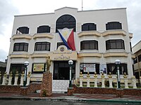 Municipal hall
 Park
Park Multipurpose sports complex
 Invencion de la Santa Cruz Parish Church


